Pays de Grignan – L’Enclave des Papes

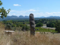
This easy route takes you on a tour of the Enclave des Papes, where you’ll pass through fields of lavender and vineyards and can visit the village of Grillon. Scenic paths will take you to a viewpoint overlooking Valréas, then you’ll reach the banks of the Lez where you’ll cross a ford. If the river is in flood, an alternative route is available. You’ll reach Grignan through the vineyards, with a view of the château!

Details

n°1214167
Creation:
Last update:
Last review:
  • Mountain biking
    Activity: Mountain biking
  • ↔
    Distance: 17.35 mi
  • ◔
    Duration according to the author: 3 hrs 
  • ▲
    Difficulty: Moderate

  • ⚐
    Back to start: Yes
  • ↗
    Ascent: + 476 ft
  • ↘
    Descent: - 479 ft

  • ▲
    Highest point: 837 ft
  • ▼
    Lowest point: 505 ft
  • ⚐ Country: France
  • ⚐
    Area: Dauphiné
  • ⚐ City: Grignan (26230)
  • ⚑
    Start/End: N 44.419062° / E 4.904928°
  • ❏
    IGN map(s): Ref. 3039ET

  • ◶
    Type of surface: Not specified
  • ⇧
    Bike carrying: Not specified
  • ▲
    Difficulty: Not specified
  • Hour-by-hour weather

Description of the route

Mountain bike route no. 3
(S/E) From the village hall (Espace Sévigné) in Grignan. Cross the village via the D4, follow signpost No. 3 and head for the junction with the D541.

(1) Head straight on towards the swimming pool and turn left onto a lovely path to reach ‘Les Blaches’.

(2) Underneath a power line, take the stony path down to the left and follow it to the road.

(3) Turn left and head for Colonzelle at the ‘La Croix’ signpost (alt. 180m), then in the village turn right at the ‘Colonzelle’ signpost (alt. 180m). Continue straight on.

(4) After crossing the Aulière, continue along a path to join a small road.

(5) Turn right at the ‘Authèze Sud’ signpost (alt. 163m) and follow a path through fields of lavender to the ‘Les Garrigues’ signpost (alt. 173m). At the road, turn right.

(6) Turn right towards the stone hut to reach Grillon; at the Alençon signpost (alt. 181m), turn right, and further on take a path leading to truffle fields and vineyards.

(7) Turn left, then right onto a wide path through the vineyards to reach the old Valréas road. At the roundabout, head towards the La Font de l’Orme signpost (alt. 213m) – Watch out for cars! – then continue straight on.

(8) At the ‘Montmartel Sud’ signpost (alt. 220m), turn right to go round the electricity substation; there’s a view of Valréas. Continue along a small road,

(9) Turn left at the ‘Montmartel Nord’ signpost (alt. 225m), then right onto a lovely path with a short ford. Further on, head uphill to a farm.

(10) On the left, take a very enjoyable single track through the woodland, then head down to the right to the ‘Les Serrières’ signpost (alt. 212m)

(11) Turn left and follow a track to the D64. Watch out for cars!

(12) Continue straight on to the Loisonville marker (alt. 189m) and turn right onto a small road to reach the Les Linardes marker (alt. 186m). Turn left at the La Grande Fontaine marker (alt. 190m), and further on, after passing a farm, you’ll reach the banks of the Lez.

(13) Cross the ford – __be careful!_ Otherwise, in the event of high water, go back 700m to the Les Linardes marker (alt. 186m) and follow route ‘3bis’. After the ford, continue along the path skirting the fields and follow signpost no. 3, which takes you through the vineyards to join the D541.

(14) Stay on the pavement and follow signpost no. 3 to reach the junction you passed on the way out.

(1) Carry on straight ahead, then turn left to return to the road. Turn right to return to the starting point (S/E)

Waypoints

  1. S/E : mi 0 - alt. 620 ft - Espace Sévigné
  2. 1 : mi 0.52 - alt. 610 ft - Crossroads of the circular loop
  3. 2 : mi 1.85 - alt. 627 ft - Les Blaches
  4. 3 : mi 2.64 - alt. 509 ft - D471
  5. 4 : mi 3.51 - alt. 512 ft - Crossing l’Aulière
  6. 5 : mi 4.07 - alt. 538 ft - Authèze Sud
  7. 6 : mi 5.53 - alt. 581 ft - Les Guarrigues signpost (alt. 173m)
  8. 7 : mi 7.66 - alt. 633 ft - Junction of 2 paths
  9. 8 : mi 9.49 - alt. 725 ft - Montmartel South signpost (alt. 220m)
  10. 9 : mi 10.17 - alt. 741 ft - Montmartel South signpost
  11. 10 : mi 11.49 - alt. 797 ft - Farm
  12. 11 : mi 12.38 - alt. 696 ft - Les Serrières signpost (alt. 212m)
  13. 12 : mi 13.49 - alt. 630 ft - Crossing the D64
  14. 13 : mi 14.45 - alt. 620 ft - Gué-sur-le-Lez
  15. 14 : mi 16.38 - alt. 617 ft - Reaching the D541
  16. S/E : mi 17.35 - alt. 620 ft - Espace Sévigné

Notes

We strongly recommend that you take the IGN map referred to on these pages with you. Mountain bikers must be self-sufficient; professional guides are available if required. Emergency numbers: 18 or 112
Enquiries at the Pays de Grignan – Enclave des Papes Tourist Office: 04 75 46 56 75 (Grignan) and 04 90 35 04 71 (Valréas) / info@tourisme-paysdegrignan.com /
Pays de Grignan Tourist Office
Valréas Tourist Office

Reviews and comments

4.7 / 5
Based on 1 review

Reliability of the description
5 / 5
Ease of following the route
5 / 5
Route interest
4 / 5
Titifb05
Titifb05

Overall rating : 4.7 / 5

Date of your route : Jun 30, 2025
Reliability of the description : ★★★★★ Very good
Ease of following the route : ★★★★★ Very good
Route interest : ★★★★☆ Good
Very busy route : No

Nice

Machine-translated

Other walks in the area

For more walks, use our search engine .

The GPS track and description are the property of this route's author. Please do not copy them without permission.