


Ben Lomond
For more info visit https://gillianswalks.com/2016/09/10/ben-lomond/
Details
Creation:
Last update:
-
 Activity: Walking
-
 Distance: 7.65 mi
-
 Average duration: 6h 10
-
 Difficulty: Difficult
-
-
 Back to start: Yes
-
 Ascent: + 3,025 ft
-
 Descent: - 3,025 ft
-
-
 Highest point: 3,084 ft
-
 Lowest point: 59 ft
-
 Country:
United Kingdom
-

-
 City:
Stirling
-
 Start/End: N 56.1525° / W 4.642429°
-


 Hour-by-hour weather


Waypoints
- S/E : mi 0 - alt. 59 ft
- S/E : mi 7.65 - alt. 59 ft
Other walks in the area
Ben Lomond - Ptarmigan
 Visorando Member7.18 mi
+3,091 ft
-3,081 ft
6h 00
Difficult
 Departure from Stirling
Circular walk to Ben Lomond summit. The first part to Ben Lomond summit is very touristic but the section going down is less as most people go up and down Ben Lomond using the same path. View over Loch Lomond is incredible.
From Rowardenann to Inverarnan
 14.04 mi
+1,355 ft
-1,388 ft
7h 40
Difficult
Departure from Stirling
The third stage of the WHW involves walking up the shores of Loch Lomond. You begin with a steady climb through a beautiful forest, offering superb views of the loch, whilst passing waterfalls cascading down from Ben Lomond. Once back at the loch’s edge, you follow the shore for a long stretch – sometimes closer, sometimes further away – along paths that rise and fall like a rollercoaster and wind their way between the rocks. A short climb through beautiful scenery and a descent to Inverarnan bring this long stage to a close.
Beinn Dubh from Luss
7.18 mi
+2,188 ft
-2,175 ft
5h 10
 Moderate
Departure from Argyll and Bute
Dog friendly circular walk to Beinn Dubh summit from the village of Luss. Great views over Loch Lomond.
Luss Heritage Trail
 Tourism professional
 1.43 mi
+72 ft
-72 ft
0h 45
 Easy
Departure from Argyll and Bute
An easy walk around the pretty conservation village of Luss, famous for having been the setting for the successful TV soap ‘High Road’. This walk encompasses it’s sandy beach, the Luss Water and a quiet woodland containing remnants of a former slate quarry.
Beinn Dubh
 6.78 mi
+2,224 ft
-2,218 ft
5h 05
Difficult
Departure from Argyll and Bute
A magnificent hike offering stunning views of Loch Lomond and panoramic vistas from the summit. This hike is not suitable for beginners due to the long and steep climb. There is no shade along the route. Be sure to wear sturdy footwear as the summit is muddy in places and rocky in others.
Cashel Forest
 3.56 mi
+869 ft
-869 ft
2h 25
Easy
Departure from Stirling
Dog friendly circular walk in Cashel Forest offering amazing view over loch Lomond. This walk follows the longer waymarked path in the forest.
Amongst the Arrochar Alps at Glen Loin
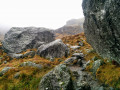 9.96 mi
+2,234 ft
-2,215 ft
6h 30
Difficult
Departure from Argyll and Bute
A challenging high-level loop beneath the Arrochar Alps, beginning and ending at Succoth car park. On a clear day enjoy fantastic close-up views of the surrounding mountains, including The Cobbler, Beinn Narnain and Beinn Ime, returning via Glen Loin.
Beinn Narnain and the Cobbler
6.78 mi
+3,816 ft
-3,802 ft
6h 25
Difficult
Departure from Argyll and Bute
Touristic walk to Beinn Narnain and the Cobbler. The Cobbler summit has a very distinctive shape and is classified as a Corbett and Marilyn summit. Beinn Narnain is classified as a Munro and Marilyn summit. This is a circular walk starting from Succoth car park. There are some scrambling to reach the summit of Beinn Narnain and the Cobbler.
For more walks, use our search engine .
The GPS track and description are the property of this route's author. Please do not copy them without permission.

