


23rd Oct - Day 49 - Masts/Roman Camp To Abington
Details
Creation:
Last update:
–
–
-
 Activity: Walking
 -
 Distance: 8.26 mi
 -
 Average duration: 3h 50
 -
 Difficulty: Not specified
 -
-
 Back to start: No
 -
 Ascent: + 33 ft
 -
 Descent: - 197 ft
 -
-
 Highest point: 968 ft
 -
 Lowest point: 755 ft
-
 Country:
United Kingdom
Country:
United Kingdom
-
 City:
South Lanarkshire
City:
South Lanarkshire -
 Start: N 55.428138° / W 3.618195°
 -
 End: N 55.507663° / W 3.694807°
 -


 Hour-by-hour weather


Waypoints
- S : mi 0 - alt. 948 ft
- 1 : mi 3.11 - alt. 866 ft - Turn right
- 2 : mi 3.12 - alt. 863 ft - Turn left onto A702
- 3 : mi 3.31 - alt. 889 ft - Turn right onto Carlisle Road
- 4 : mi 4.14 - alt. 863 ft - Keep right onto Camps Road
- 5 : mi 4.15 - alt. 853 ft - Turn right onto Camps Road
- 6 : mi 4.35 - alt. 827 ft - Turn sharp left
- 7 : mi 6.71 - alt. 820 ft - Turn left onto Station Road
- 8 : mi 7.1 - alt. 807 ft - Turn sharp right onto Carlisle Road, A702
- 9 : mi 7.19 - alt. 801 ft - Turn left onto Carlisle Road
- 10 : mi 7.19 - alt. 801 ft - Turn sharp left onto Carlisle Road, A702
- 11 : mi 7.97 - alt. 781 ft - Keep right onto Carlisle Road, A702
- 12 : mi 8 - alt. 787 ft - At roundabout, take exit 3
- 13 : mi 8.06 - alt. 794 ft - Keep right
- 14 : mi 8.1 - alt. 791 ft - Keep right
- 15 : mi 8.13 - alt. 784 ft - Keep left
- 16 : mi 8.16 - alt. 781 ft - Keep left
- 17 : mi 8.19 - alt. 781 ft - Turn left
- 18 : mi 8.19 - alt. 784 ft - Turn right
- 19 : mi 8.21 - alt. 784 ft - Turn left
- 20 : mi 8.21 - alt. 784 ft - Turn right
- E : mi 8.26 - alt. 787 ft
Other walks in the area
Remains of Morton Castle and Morton Loch
 Association / Club / Walk leader
 0.67 mi
+75 ft
-112 ft
0h 20
0.67 mi
+75 ft
-112 ft
0h 20
 Easy
Departure from Dumfries and Galloway
Easy
Departure from Dumfries and Galloway
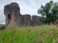
This is a quick wander to visit Morton Castle. It is a nice family walk to visit the ruins and enjoy views of the countryside.
Drumlanrig Castle and stream
 1.39 mi
+112 ft
-115 ft
0h 45
Easy
Departure from Dumfries and Galloway
1.39 mi
+112 ft
-115 ft
0h 45
Easy
Departure from Dumfries and Galloway
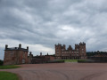
This short and easy stroll starts from the beautiful Drumlanrig Castle and then brings you into the woodlands and along a stream to get another view of the castle and its garden.
Grey Mares Tail Waterfall, Moffat
 Tourism professional
 2.82 mi
+935 ft
-932 ft
2h 05
2.82 mi
+935 ft
-932 ft
2h 05
 Moderate
Departure from Dumfries and Galloway
Moderate
Departure from Dumfries and Galloway
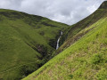
A hike up past the spectacular Gray Mare's Tail waterfall to the remote and tranquil Loch Skeen
Tinto Hill
 4.22 mi
+1,572 ft
-1,572 ft
3h 20
4.22 mi
+1,572 ft
-1,572 ft
3h 20
 Difficult
Departure from South Lanarkshire
Difficult
Departure from South Lanarkshire
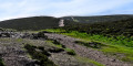
A good one if you are new to hill walking thanks to the well-trodden footpath from start to finish. Lovely views of Lanarkshire and beyond on a clear day! Tinto summit is at 711m / 2332ft so a serious hill walk.
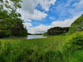
Lanark Loch
 1.18 mi
+30 ft
-30 ft
0h 35
Easy
Departure from South Lanarkshire
1.18 mi
+30 ft
-30 ft
0h 35
Easy
Departure from South Lanarkshire
This short walk and flat walk is ideal on a warm day. There is a great playground and the area is accessible with pushchairs and prams if you avoid the detour into the woods. If you have ever been to Western Canada, well it feels like being there.
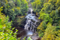
The Falls of Clyde, New Lanark
 3.68 mi
+410 ft
-423 ft
2h 05
Moderate
Departure from South Lanarkshire
3.68 mi
+410 ft
-423 ft
2h 05
Moderate
Departure from South Lanarkshire
Best experienced after a period of sustained rainfall, this section of the River Clyde is pretty spectacular. Starting in the historical village of New Lanark, the track forms the last section of the Clyde Walkway and is basically a woodland walk with viewpoints to the waterfalls along the river, the most photographed of these being Corra Linn which plunges down 26m over the rocks!
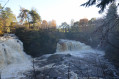
Falls of Clyde
 7.00 mi
+751 ft
-761 ft
3h 50
Moderate
Departure from South Lanarkshire
7.00 mi
+751 ft
-761 ft
3h 50
Moderate
Departure from South Lanarkshire
Starting in the historic village of New Lanark, follow the Clyde Walkway through the woods, stopping at several viewpoints to see the spectacular waterfalls along the river. The return route brings you down the opposite bank of the river and into Kirkfieldbank, then through Castlebank Park.
For more walks, use our search engine .
The GPS track and description are the property of this route's author. Please do not copy them without permission.

