Country:
 City:
City:


Start : New Lanark World Heritage Site car park. (ML11 9DB) Grid ref. NS 88105 42432
(S/E) From the main car park for the New Lanark World Heritage Site, follow a footpath leading downhill past an information board.
At the bottom of the hill turn left (South-East) to reach New Lanark Road. You will start to see badger signs saying “Follow me to the Falls of Clyde”.
(1) Turn left (South-East) along New Lanark Road for 100m, past the war memorial and a red phone box and then turn right (South-West), through some gates and down some steps then across a footbridge, arriving in front of the entrance to the cafe.
(2) Turn left (South-East), passing a picnic area. When you reach Robert Owen's School keep left at a fork and follow the path along past an office building.
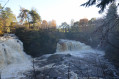
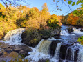
(3) Go through a gap in the wall and into the woods. Choose the paths closest to the River Clyde, following the boardwalk and stopping off at several viewpoints along the way to admire the waterfalls.
(4) After approx 700m you will arrive at the buildings and pipes which form Corra Linn Substation. Keep right (South) at a fork to head back into the woods and up some steps.
(5) Continue to follow the trails closest to the River Clyde, gently uphill for the next 1.5km to reach Bonnington Linn Weir. Along the way you will experience several sets of steps and a number of viewpoints just off the path, including the most popular one overlooking the spectacular Corra Linn waterfall.
(6) Cross the bridge at Bonnington Linn Weir then turn right (South-West).
Continue to follow the trails closest to the River Clyde, gently downhill for the next 4.5km. There are several viewpoints along the way.
(7) You will emerge onto Kirkfield Road in the residential area of Kirkfieldbank. Turn right (North-West).
(8) Walk along Kirkfield Road to a bridge over the River Clyde. Turn right (North-East) to cross the bridge.
(9) At the other side of the bridge turn right (East) to go through a gate next to a house (looks like you are going down someone's driveway).
Follow this track along the river and through some trees. After a steep uphill section you will emerge onto St Patrick's Road.
(10) Follow this single track road South-East for 380m to a park entrance. Note the wooden finger posts for "Clyde Walkway". Turn right (South) to enter Castlebank Park.
(11) After a short 90m, turn right (South-West) onto a woodland footpath signposted "Clyde Walkway New Lanark". The footpath zig zags down a steep hill to the river.
(12) At the bottom of the hill follow the trail along the river a short distance and keep right at a fork to cross the Braxfield Burn.
The trail then follows the course of the River Clyde into New Lanark.
When you reach New Lanark Road turn right (South-East) and walk along to the war memorial.
Turn left here and retrace your steps back uphill to the main car park (S/E)
 Tourism professional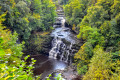

 Association / Club / Walk leader
 Easy
Easy 
 Difficult
  Visorando Member