


Le pas des Barres est muni de câbles.
Tour des 10 plus hauts sommets de Chartreuse - J4

Jour 4 du Tour des 10 plus hauts sommets de Chartreuse.
St-Pierre d'Entremont, Granier (Nord), Pinet, Cirque de St-Même.
This walk is part of a multi-day hike: Tour des 10 plus hauts sommets de Chartreuse
Details
Creation:
Last update:
–
–
-
 Activity: Walking
 -
 Distance: 15.94 mi
 -
 Average duration: 12h 15
 -
 Difficulty: Very difficult
 -
-
 Back to start: No
 -
 Ascent: + 5,669 ft
 -
 Descent: - 5,003 ft
 -
-
 Highest point: 6,342 ft
 -
 Lowest point: 2,096 ft
-
 Country:
France
Country:
France
-
 Areas: Alps, Chartreuse
 -
 City:
Saint-Pierre-d'Entremont (73670)
City:
Saint-Pierre-d'Entremont (73670) -
 Start: N 45.413087° / E 5.854267°
 -
 End: N 45.399283° / E 5.891387°
 -
 IGN map(s): Ref. 3333OT, 3333OTR
 -


 Hour-by-hour weather
Description of the walk
Waypoints
- S : mi 0 - alt. 2,133 ft - St-Pierre d'Entremont
- 1 : mi 3.43 - alt. 2,759 ft - Entremont-le-Vieux
- 2 : mi 4.81 - alt. 3,652 ft - La Plagne
- 3 : mi 5.17 - alt. 3,973 ft - Granges du Priz
- 4 : mi 7.55 - alt. 6,339 ft - Mont Granier
- 5 : mi 9.24 - alt. 5,381 ft - Pas des Barres
- 6 : mi 10.21 - alt. 5,030 ft - Col de l'Alpette
- 7 : mi 12.01 - alt. 6,125 ft - Sommet du Pinet ou le Truc (1867 m)
- E : mi 15.94 - alt. 2,818 ft - Cirque de St-Même
This route passes through a protected area, which may be subject to special regulations:
Other walks in the area
The Cirque de Saint-Même waterfall
 Visorando Member
 6.06 mi
+1,430 ft
-1,424 ft
4h 00
6.06 mi
+1,430 ft
-1,424 ft
4h 00
 Moderate
Departure from Saint-Pierre-d'Entremont (Isère)
Moderate
Departure from Saint-Pierre-d'Entremont (Isère)
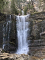
From Saint-Pierre-d'Entremont, this beautiful walk leads to the source of the Guiers-Vif, follows the course of the torrent, passes through hamlets and reveals the large clearing of the Cirque de Saint-Même.
The Cirque de Saint-Même is a very popular spot, attracting families in search of fresh air in the summer months. Hikers will find a little more freshness and tranquillity as they climb towards the Cascade du Guiers-Vif.
Route du Château, Randocroquis
 Tourist office
 3.87 mi
+1,217 ft
-1,204 ft
2h 50
Moderate
Departure from Saint-Pierre-d'Entremont (Isère)
3.87 mi
+1,217 ft
-1,204 ft
2h 50
Moderate
Departure from Saint-Pierre-d'Entremont (Isère)
This circular walk exploring Château de Montbel is also a Randocroquis® route offering introductory art workshops: drawing techniques, contrasts, perspective and landscapes.
Chemin des Mules from Saint-Pierre-d'Entremont
 3.72 mi
+584 ft
-597 ft
2h 15
3.72 mi
+584 ft
-597 ft
2h 15
 Easy
Departure from Saint-Pierre-d'Entremont (Isère)
Easy
Departure from Saint-Pierre-d'Entremont (Isère)
This route winds its way between the two churches of Saint-Pierre-d'Entremont before slipping into the Cozon valley. It follows an ancient path, a haven of greenery and freshness where it is pleasant to walk with the family on hot summer days.
The summit and the Roche Veyrand circuit
 8.34 mi
+3,156 ft
-3,150 ft
6h 35
8.34 mi
+3,156 ft
-3,150 ft
6h 35
 Difficult
Departure from Saint-Pierre-d'Entremont (Savoie) (Savoie)
Difficult
Departure from Saint-Pierre-d'Entremont (Savoie) (Savoie)
Starting from Saint-Pierre-d’Entremont, the climb to the summit of Roche Veyrand is steady and at times steep, with sections secured by cables where you’ll need to use your hands, but there are no technical difficulties or vertiginous sections. The rest of the route is a pleasant walk, mainly through woodland, which takes you all the way round Roche Veyrand via the Col de la Cluse, then down into the Corbel valley before climbing back up via the Pas de la Coche to return to the starting point. Given the nature of the ascent, this walk is not recommended for novice walkers (IBP = 97).
Circular Saint-Pierre-d’Entremont loop, via the bottom of the Cirque de Saint-Même
9.14 mi
+1,804 ft
-1,781 ft
5h 45
Moderate
Departure from Saint-Pierre-d'Entremont (Savoie) (Savoie)
A circular route around Saint-Pierre-d’Entremont via the Cirque de Saint-Même, returning via the Torrent du Cozon gorges. The views are magnificent all along the way, and you reach the cirque on foot, rather than by car, to see the first waterfall. The route is marked and well signposted with numerous signs.
Roche Veyrand, circular from Saint-Pierre-d'Entremont
 4.92 mi
+2,612 ft
-2,592 ft
4h 30
Difficult
Departure from Saint-Pierre-d'Entremont (Savoie) (Savoie)
4.92 mi
+2,612 ft
-2,592 ft
4h 30
Difficult
Departure from Saint-Pierre-d'Entremont (Savoie) (Savoie)
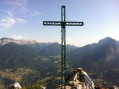
Roche Veyrand is a peak that proudly dominates the two Saint-Pierre-d'Entremont villages. Its steep slopes have made it possible to equip a Via Ferrata. This route is a classic in the Entremonts: it climbs directly up a steep path close to the equipped cliff, then descends via a wide forest detour that takes you through several hamlets of Saint-Pierre-d'Entremont (Savoie).
Le Pinet via the Fouda Blanc strap
 7.07 mi
+3,753 ft
-3,760 ft
6 hrs
7.07 mi
+3,753 ft
-3,760 ft
6 hrs
 Extremely difficult
Departure from Saint-Pierre-d'Entremont (Savoie) (Savoie)
Extremely difficult
Departure from Saint-Pierre-d'Entremont (Savoie) (Savoie)
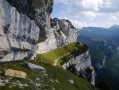
Here is the guidebook for the longest ledge in Chartreuse and, in my opinion, one of the most beautiful. It is a loop circuit that forms a figure 8. The west, slightly north-west orientation of this ledge leads me to recommend that you set off at the end of the morning and in this direction so that you can enjoy the most beautiful landscapes at the end of the afternoon.
A much more complete description can be found in Pascal Sombardier's book "Les Randonnées du Vertige" (Vertigo Hikes).
The sangles of Fouda Blanc and Le Pinet and finally the Grotte à l'Échelle
 7.22 mi
+3,986 ft
-3,960 ft
7 hrs
Extremely difficult
Departure from Saint-Pierre-d'Entremont (Savoie) (Savoie)
7.22 mi
+3,986 ft
-3,960 ft
7 hrs
Extremely difficult
Departure from Saint-Pierre-d'Entremont (Savoie) (Savoie)
Please note that this exposed route is not suitable for people who are prone to vertigo and have no experience of aerial crossings and climbing steps. It should not be attempted in wet weather due to the risk of slipping.This circular hike crosses the very aerial sangles of Fouda Blanc and Le Pinet, which, at over 3 km, is the longest in the Chartreuse. The Fouda Blanc sangle is slightly less exposed and busier than the Pinet. The latter is narrower, often grassy, slippery in wet weather, and has a few unstable earthy passages that must be crossed with caution. Access to this crossing is via the Varvats trail at Pas de l'Échelle. At the end of the ridges, you reach the summit of Pinet, also known as Truc, then the ridge trail joins Pas de Fouda Blanc, which you descend before crossing the Grotte à l'Échelle. The descent down a scree slope and then through the woods takes you back to the return path.GPX track required.
For more walks, use our search engine .
The GPS track and description are the property of this route's author. Please do not copy them without permission.

