


Patrixdemex

 Visorando Member
 Premium user
 - Location: Meximieux (01800)
- Gender: man
Sign up:
Published route(s)
 Bigues trail
 6.07 mi
 +348 ft
 -371 ft
 3h 05
3h 05
 Easy
Easy
 Departure from Parmilieu (Isère)
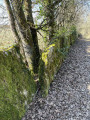
A little path that smells of hazelnuts... This pleasant, easy trail takes you through the charming little village of Parmilieu, a land of stone, quarries and traditional stone houses.
A circular from Cuvery to Catray
 6.04 mi
+715 ft
-705 ft
3h 25
Easy
Departure from Châtillon-en-Michaille (Ain)
6.04 mi
+715 ft
-705 ft
3h 25
Easy
Departure from Châtillon-en-Michaille (Ain)
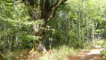
This is a lovely little route that takes us through Catray, home to a welcoming inn, before winding our way across the northern part of the Retord plateau along relatively quiet paths. With very little elevation gain, this route is straightforward despite being at altitudes above 1,000 metres. It can also be tackled on snowshoes.Views of Mont Blanc, weather permitting.
From Vaux-Févroux to the Croix de Bramefan circular
 7.73 mi
+1,791 ft
-1,781 ft
5h 05
7.73 mi
+1,791 ft
-1,781 ft
5h 05
 Moderate
Departure from Vaux-en-Bugey (Ain)
Moderate
Departure from Vaux-en-Bugey (Ain)
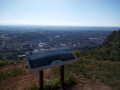
There are many ways to get to the Croix de Bramefan. This route is unique in that it first takes you along the ridge north of Vaux and, after crossing the Buizin stream, returns via the Bramefan ridge. Almost the entire route is through woodland. The "medium" rating for this hike is justified by the fact that the start of the route is all uphill and there are numerous crossroads that could lead you astray.
Loop around Saint-Éloi
 4.74 mi
+302 ft
-292 ft
2h 25
Easy
Departure from Saint-Éloi (Ain)
4.74 mi
+302 ft
-292 ft
2h 25
Easy
Departure from Saint-Éloi (Ain)
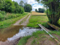
This easy circuit around the commune of Saint-Éloi in the Ain department will give you a glimpse of the Dombes region.
It also offers plenty of geocaching opportunities for enthusiasts.
 The Cottey Valley circular tour from Meximieux
16.87 mi
+577 ft
-577 ft
2 hrs
 Difficult
Departure from Meximieux (Ain)
Difficult
Departure from Meximieux (Ain)
This 30 km mountain bike route starts in Meximieux and takes you on a circular route through the very pleasant Cottey Valley. This mixed trail/road route presents two challenges: the gradient of the path and its unstable, stony surface. There is little elevation gain overall. The return journey through the maize fields is sometimes a bit damp, as farmers like to water the crops.
Circular around Lhuis, between Milieu and Ansolin
 9.13 mi
+1,444 ft
-1,460 ft
5h 25
Moderate
Departure from Lhuis (Ain)
9.13 mi
+1,444 ft
-1,460 ft
5h 25
Moderate
Departure from Lhuis (Ain)
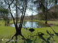
This 15 km circular route around Lhuis will take you along an old tramway, overlooking a beautiful pond, following typical streams, observing a resurgence and crossing a scree slope. Several viewpoints over the Rhône and its valley, the Creys nuclear power plant and the Tentanet mountain make this hike very attractive.
Circular route between Conand and Arandas, Mortier cross and Cra viewpoint
 6.40 mi
+1,463 ft
-1,444 ft
4h 15
Difficult
Departure from Conand (Ain)
6.40 mi
+1,463 ft
-1,444 ft
4h 15
Difficult
Departure from Conand (Ain)
This circular walk takes you deep into the mountainous Bugey region, which is often easy going but can be very rugged in places. The final descent of this walk is very difficult and is only suitable for experienced walkers who are not afraid of heights. It is recommended that you use GPS for the end of the walk, from Arandas.
La Roche de l'Église via Souclin
 8.34 mi
+2,005 ft
-1,998 ft
5h 35
Moderate
Departure from Saint-Sorlin-en-Bugey (Ain)
8.34 mi
+2,005 ft
-1,998 ft
5h 35
Moderate
Departure from Saint-Sorlin-en-Bugey (Ain)
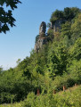
A very pleasant trail from Saint-Sorlin-en-Bugey leads first to the old village of Souclin and then to the Roche de l'Église, which overlooks it. This hike will appeal to lovers of old stones: old villages and paths often lined with timeless stone walls. This route has few paved roads and offers many panoramic views of the Rhône between Bouvesse and Vertrieu, the north of the Isère and, in good weather, even Lyon.
Chanduraz and La Roche Percée from Béon
 7.60 mi
+3,369 ft
-3,392 ft
6h 25
Difficult
Departure from Béon (Ain)
7.60 mi
+3,369 ft
-3,392 ft
6h 25
Difficult
Departure from Béon (Ain)
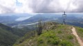
This is a challenging route that will take you to Chanduraz, a remarkable viewpoint over Lake Bourget, the Rhône and the entire panorama around Culoz, passing through La Roche Percée. However, you will have to tackle a climb of over 1,000 metres, which is as difficult going up as it is coming down, to earn it.
The view from Panissières
 9.42 mi
+1,230 ft
-1,227 ft
5h 25
Moderate
Departure from Panissières (Loire)
9.42 mi
+1,230 ft
-1,227 ft
5h 25
Moderate
Departure from Panissières (Loire)
An easy hike offering beautiful panoramic views of the Monts du Lyonnais. The route alternates between woodland, hamlets and farmland.
Around Pérouges
 5.72 mi
+427 ft
-427 ft
3h 00
Moderate
Departure from Pérouges (Ain)
5.72 mi
+427 ft
-427 ft
3h 00
Moderate
Departure from Pérouges (Ain)
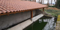
This loop will take you out of the medieval town to discover the varied landscape of the region, with woods, crops, a few old houses and panoramic views. The 9 km route is easy to follow and well marked in orange.
Tour of Cleyzieu via the Falconnière balcony
 4.61 mi
+925 ft
-902 ft
2h 55
Moderate
Departure from Cleyzieu (Ain)
4.61 mi
+925 ft
-902 ft
2h 55
Moderate
Departure from Cleyzieu (Ain)
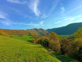
Cleyzieu is a charming village in the Bugey region. This easy hike offers several viewpoints. It passes through both woodland and open areas.
Lac des Blanchets and Roc du Diable from Belle Plagne
 3.50 mi
+1,266 ft
-1,273 ft
2h 45
Moderate
Departure from Mâcot-la-Plagne (Savoie)
3.50 mi
+1,266 ft
-1,273 ft
2h 45
Moderate
Departure from Mâcot-la-Plagne (Savoie)
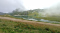
This half-day hike is easy for most of the route but presents some difficulty during the (optional) ascent of the Roc du Diable. The rest of the route is mostly on paths prepared for mountain machinery, so there are no particular difficulties. There is a beautiful panoramic view from the top of the Roc du Diable (2,426 m). This hike is not signposted, so it is recommended that you use the app for certain sections.
Mont Saint-Jacques and Tête des l'Arpettes from Belle Plagne
 4.16 mi
+1,450 ft
-1,470 ft
3h 10
Moderate
Departure from Mâcot-la-Plagne (Savoie)
4.16 mi
+1,450 ft
-1,470 ft
3h 10
Moderate
Departure from Mâcot-la-Plagne (Savoie)
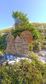
This hike is not technically difficult and can be completed in half a day. It offers beautiful views, including two lookout points. The trails are sometimes difficult to see, so a GPS device may be useful, although the terrain is clear and the waypoints are visible from a distance at all times.You will pass through mountain pastures where cows may be present in season.
Château Richard viewpoint from Nances
 4.85 mi
+1,627 ft
-1,614 ft
3h 40
Moderate
Departure from Nances (Savoie)
4.85 mi
+1,627 ft
-1,614 ft
3h 40
Moderate
Departure from Nances (Savoie)
This walk will take you to a viewpoint overlooking Lake Aiguebelette and the surrounding mountains, particularly the Chartreuse range. The route runs mainly through woodland and is easy to navigate, apart from one section – which can be avoided but is quite fun – involving ladders.