


Julien2209

 Visorando Member
 Premium user
 - Gender: man
Sign up:
Published route(s)
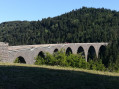
 From the Recoumène Viaduct to the Meyzous Plateau
 5.23 mi
 +502 ft
 -502 ft
 2h 50
2h 50
 Easy
Easy
 Departure from Le Monastier-sur-Gazeille (Haute-Loire)
This hike takes you to the Recoumène viaduct, the village of Monastier-sur-Gazeille and the Meyzous plateau.
The most beautiful part is the crossing of the Meyzous plateau amid meadows and dry stone walls.
Throughout the route, you can admire different views of the Recoumène bridge and the Devès, Meygal and Mézenc mountain ranges.
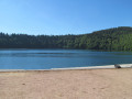
The lakes of Montcineyre, Bourdouze and Estivadoux from Lac Pavin
 11.70 mi
+1,814 ft
-1,804 ft
7h 00
11.70 mi
+1,814 ft
-1,804 ft
7h 00
 Difficult
Departure from Besse-et-Saint-Anastaise (Puy-de-Dôme)
Difficult
Departure from Besse-et-Saint-Anastaise (Puy-de-Dôme)
This hike takes you to four volcanic lakes: Lac Pavin, which is 92 metres deep and 700 to 800 metres in diameter; Lac de Montcineyre, formerly owned by the Michelin family; Lac de Bourdouze, which is partially covered by peat bog; and finally Lac de l'Estivadoux, which is almost completely dry.
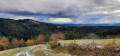
The Champrivat Valley from the Champagnac-Le-Vieux lake
 5.73 mi
+856 ft
-876 ft
3h 25
5.73 mi
+856 ft
-876 ft
3h 25
 Moderate
Departure from Champagnac-le-Vieux (Haute-Loire)
Moderate
Departure from Champagnac-le-Vieux (Haute-Loire)
This walk offers you the chance to discover several viewpoints over the Sancy and Cézallier massifs and the Allier Valley.
From the banks of the Senouire to the Allier
 11.81 mi
+1,270 ft
-1,270 ft
6h 30
Difficult
Departure from Lavaudieu (Haute-Loire)
11.81 mi
+1,270 ft
-1,270 ft
6h 30
Difficult
Departure from Lavaudieu (Haute-Loire)
Lavaudieu, listed as one of the "Most Beautiful Villages in France", will be the starting point for your hike.
During the first part of the hike, you can admire beautiful views of the Cézallier, the Massif du Sancy and the Puy de Dôme. During the second part, you will follow the Allier gorges on a balcony trail. During the last part, you can discover a magnificent chapel and pastoral meadows.
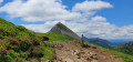
Le Puy Griou via Bec d'Aigle and Téton de Vénus
 8.56 mi
+2,707 ft
-2,677 ft
6h 15
Difficult
Departure from Laveissière (Cantal)
8.56 mi
+2,707 ft
-2,677 ft
6h 15
Difficult
Departure from Laveissière (Cantal)
Fond d'Alagnon will be the starting point for your hike. Follow the ridge towards Puy Griou, passing by Bec de l'Aigle and Téton de Vénus. Along the way, you will enjoy numerous views of Plomb Cantal, Puy Mary, Peyre Arse and many other peaks.
The Lac de Servières from the Lac de Guéry
 9.53 mi
+1,683 ft
-1,683 ft
5h 50
Moderate
Departure from Orcival (Puy-de-Dôme)
9.53 mi
+1,683 ft
-1,683 ft
5h 50
Moderate
Departure from Orcival (Puy-de-Dôme)
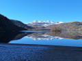
The Lac de Guéry, of volcanic origin, is the starting point for this hike. At 1244 m, it is the highest lake in Auvergne. Along the way, you'll follow the ridge to the Lac de Servières.
⚠️Please note that the route of the GR® 30 has been modified since 2022, and several sections have been changed and no longer correspond with the IGN maps.