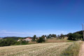
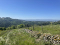
The Champrivat Valley from the Champagnac-Le-Vieux lake

This walk offers you the chance to discover several viewpoints over the Sancy and Cézallier massifs and the Allier Valley.

Details

4419423
Creation:
Last update:
Last review:
  • Walking
    Activity: Walking
  • ↔
    Distance: 5.73 mi
  • ◔
    Average duration: 3h 25 
  • ▲
    Difficulty: Moderate

  • ⚐
    Back to start: Yes
  • ↗
    Ascent: + 856 ft
  • ↘
    Descent: - 876 ft

  • ▲
    Highest point: 2,995 ft
  • ▼
    Lowest point: 2,260 ft

Photos

Description of the walk

Start from the car park at the Champagnac-Le-Vieux lake.

(S/E) From the car park, head for the D5 road and turn right onto it, heading west. After 50 m, join the small path by crossing the ditch and follow the orange markings. At the next junction, ignore a path on the right.

(1) Cross the D5 road with care and continue along the small tree-lined path. At the junction, turn right and do not head towards the village of Taix. Cross the D5 road again and continue along the wide stone path for about 1 km towards the north-west.

(2) Pass the Durbiat wash house on your right and enter the village via the tarmac road. At the exit, in a left-hand bend, leave the tarmac road and continue along a dirt track to the right.

(3) At the crossroads, turn left and after about 250 m ignore a path branching off to the right as well as the orange markings.

(4) Join the tarmac road, veer left until you reach the D5 road and turn right towards the south-east.
At the bend, leave the D5 road, veer left towards Dreins and continue to the village, following the yellowPR® markings.

(5) In the village, turn left, continue for 50 m and turn right onto the path leading down towards the valley. After about 200 m, at the junction of several paths, leave the yellowPR® markings on your right. Continue along the main path on the left towards the Yellow Cross.

(6) At the T-junction, continue straight ahead, staying on the main path; ignore the path branching off to the right and any subsequent ones.

(7) At the road, turn right and after a few metres, turn left onto the path heading south-east. Stay on the path for about 1.3 km, passing the Ravins du Rouge and the Ravin de la Bechade. Ignore the paths branching off to the left.

(8) Turn left onto the path heading south-east without joining the D588 road. Continue along the path; at the next junction, go straight on and head towards the village of Champagnac-Le-Vieux.

(9) Continue along the tarmac road; at the junction, veer left until you reach the D588. Turn left onto this road heading north and stay on the road for about 500 m.

(10) Leave the D588 on your right and continue on the D893. After a few dozen metres, turn left onto the small tarmac road towards Les Cluzelles. At the next crossroads, you will see the lake at Champagnac-Le-Vieux. Turn right to reach the car park (S/E).


Waypoints

  1. S/E : mi 0 - alt. 2,799 ft - Champagnac-Le-Vieux lake car park
  2. 1 : mi 0.36 - alt. 2,900 ft - D5 road
  3. 2 : mi 1.09 - alt. 2,982 ft - Durbiat wash house
  4. 3 : mi 1.37 - alt. 2,956 ft - Crossroads
  5. 4 : mi 1.92 - alt. 2,851 ft - Route de Blanchet
  6. 5 : mi 2.35 - alt. 2,818 ft - Dreins
  7. 6 : mi 2.84 - alt. 2,477 ft - T-junction
  8. 7 : mi 3.01 - alt. 2,277 ft - Tarmac road
  9. 8 : mi 3.87 - alt. 2,543 ft - Near the D588
  10. 9 : mi 4.85 - alt. 2,927 ft - Tarmac road
  11. 10 : mi 5.22 - alt. 2,874 ft - Junction of the D 583 and D 893
  12. S/E : mi 5.73 - alt. 2,799 ft - Champagnac-Le-Vieux lake car park

Always be cautious and plan ahead when you're outdoors. Visorando and the author of this route cannot be held responsible for any accidents occurring on this route.

The GR® and PR® markings are the intellectual property of the Fédération Française de Randonnée Pédestre.

Reviews and comments

4.5 / 5
Based on 5 reviews

Reliability of the description
4.6 / 5
Ease of following the route
4.6 / 5
Route interest
4.2 / 5
franck_35
franck_35

Overall rating : 4.3 / 5

Date of your route : May 19, 2025
Reliability of the description : ★★★★☆ Good
Ease of following the route : ★★★★★ Very good
Route interest : ★★★★☆ Good
Very busy route : No

A lovely walk that alternates between woodland, footpaths and country lanes, offering beautiful views of the surrounding mountains.
No particular difficulty.
It’s lovely to do in the spring sunshine; the forest and meadows are magnificent.
We completed the route in 2½ hours.

Machine-translated

Geraldine D
Geraldine D

Overall rating : 4.3 / 5

Date of your route : Jan 28, 2024
Reliability of the description : ★★★★★ Very good
Ease of following the route : ★★★★★ Very good
Route interest : ★★★☆☆ Average
Very busy route : No

Lots of sections through the forest (love it or hate it). A steep descent around the 4-kilometre mark, which can be tricky in wet weather.
I wasn’t particularly impressed by this route, but that’s just my personal opinion. In any case, it’s perfectly signposted, not very busy, and the distance is perfect for a winter’s afternoon.

Thanks to Julien for suggesting this walk, which is a great way to explore the area around Champagnac-le-Vieux.

Machine-translated

christelle113
christelle113
• Edited:

Overall rating : 5 / 5

Date of your route : Aug 03, 2023
Reliability of the description : ★★★★★ Very good
Ease of following the route : ★★★★★ Very good
Route interest : ★★★★★ Very good
Very busy route : No

Hello,
A lovely walk, with clear directions.
Thank you for sharing

Machine-translated

REDONDIE ARLETTE
REDONDIE ARLETTE

Overall rating : 5 / 5

Date of your route : Feb 07, 2021
Reliability of the description : ★★★★★ Very good
Ease of following the route : ★★★★★ Very good
Route interest : ★★★★★ Very good
Very busy route : No

Thanks, Julien. We did the walk again – it was very well described – and we enjoyed some magnificent views,
and lovely climbs from the tarmac road up to the entrance to Champagnac-Le-Vieux. This walk must be lovely to do in spring; we’ll plan it again

Machine-translated

Julien2209
Julien2209
• Edited:

Hello Arlette,

It’s true that the description didn’t match the reality on the ground.
I’ve made several corrections to make the description clearer regarding the descent.

Julien

Machine-translated

Julien2209
Julien2209

In response to Arlette's message:
''We went on the hike on 31 January 2021, but couldn’t finish it because at Dreins, following the yellow markings, there’s a cross on the left during the descent, leading down a long slope through the woods, and our beacon beeped to warn us not to go down. We took the yellow markings to the right and it started beeping again, so we turned back and headed back to the lake.
On 7 February, we will do this hike again to find the correct route and finish the hike.”

I have made several corrections to the description regarding the descent after Dreins. Thank you for bringing this issue to our attention; however, the GPX track is correct and matches the route of the hike.

Julien

Machine-translated

REDONDIE ARLETTE
REDONDIE ARLETTE

Overall rating : 3.7 / 5

Date of your route : Feb 02, 2021
Reliability of the description : ★★★★☆ Good
Ease of following the route : ★★★☆☆ Average
Route interest : ★★★★☆ Good
Very busy route : No

We went on the hike on 31 January 2021, but weren’t able to finish it because, in Dreins, whilst following the yellow markings, there’s a cross on the left during the descent, leading down a long slope through the woods, and our GPS beeped to warn us not to go down there. We took the yellow route to the right, and it started beeping again, so we turned back and headed back to the lake.
On 7 February, we will do this hike again to find the correct route and finish the hike.

Machine-translated

Other walks in the area

For more walks, use our search engine .

The GPS track and description are the property of this route's author. Please do not copy them without permission.