


jmfsr

 Visorando Member
 Premium user
 - Location: Castetnau-Camblong (64190)
- Gender: man
Sign up:
Published route(s)
 The heights of Jungholtz
 6.49 mi
 +1,417 ft
 -1,411 ft
 4h 15
4h 15
 Moderate
 Departure from Jungholtz (Haut-Rhin)
The hike starts in Jungholtz and crosses the communal forest of Guebwiller to take you to the Col de Peternit. Hike between the Guebwiller and Rimbach valleys, among conifers and deciduous trees.
The hike can also be done by mountain bike.
The southern trenches of Hartmannswillerkopf
 4.28 mi
+1,532 ft
-1,529 ft
3h 20
Moderate
Departure from Wattwiller (Haut-Rhin)
4.28 mi
+1,532 ft
-1,529 ft
3h 20
Moderate
Departure from Wattwiller (Haut-Rhin)
The Hartmannswillerkopf (Viel Armand in French) was the scene of fierce fighting throughout 1915. Losses amounted to 50,000 dead, evenly divided between the two sides. This hike pays tribute to these soldiers by following part of their trenches. It begins with the ascent of the massif, following the German fortified trenches to the summit where the necropolis is located. The return route descends via the French side, the "Chemin des Dames".
The northern trenches of Hartmannswillerkopf
 5.74 mi
+1,959 ft
-1,952 ft
4h 20
Moderate
Departure from Soultz-Haut-Rhin (Haut-Rhin)
5.74 mi
+1,959 ft
-1,952 ft
4h 20
Moderate
Departure from Soultz-Haut-Rhin (Haut-Rhin)
The Hartmannswillerkopf (HWK, Viel Armand in French) was the scene of fierce fighting throughout 1915. Like the "South Trenches of the HWK" hike, this hike pays tribute to the combatants by following part of their trenches and shelters. It begins with an ascent of the northern slope of the massif and the German side to the summit, followed by a descent via the French side before passing by the Sicurani Chapel.
The Zeller Canteen
 7.79 mi
+1,594 ft
-1,588 ft
5h 00
7.79 mi
+1,594 ft
-1,588 ft
5h 00
 Easy
Departure from Hartmannswiller (Haut-Rhin)
Easy
Departure from Hartmannswiller (Haut-Rhin)
Like the "South and North Trenches of Hartmannswillerkopf" hikes, this hike pays tribute to the soldiers of theFirst World War.
This hike follows the German supply routes that fed the front.
The Zeller canteen was the location of the German army's Sector II headquarters in 1914. Around this canteen, the pioneer village included a bookshop, dentist, hairdresser, kitchen, photographer and a chapel.
Warning. Friday 12 May 2023. From (9) to (10), dangerous to approach, the owners of the Ollwiller estate almost let the dogs loose. Be very careful, do not approach the estate.
Awaiting modification...
 Illwald
 16.70 mi
+20 ft
-20 ft
3 hrs
Easy
Departure from Illhaeusern (Haut-Rhin)
16.70 mi
+20 ft
-20 ft
3 hrs
Easy
Departure from Illhaeusern (Haut-Rhin)
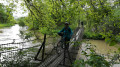
The Illwald is France’s largest voluntary nature reserve. Covering 2,000 hectares, this area consists mainly of vast meadows, forests and rivers. Water shapes these environments, whilst the flora and fauna enhance them. The forest is home to some 110 plant species and 210 types of fungi. However, the Illwald owes its fame in particular to the fallow deer, introduced in 1854. The population currently numbers over 300 individuals.
Take a short detour to visit the medieval village of Guémar.
A section appears to be off-limits to cyclists; please check the signs
Hohrodberg - Linge, World War I battlefield
 8.75 mi
+1,627 ft
-1,624 ft
5h 25
Moderate
Departure from Hohrod (Haut-Rhin)
8.75 mi
+1,627 ft
-1,624 ft
5h 25
Moderate
Departure from Hohrod (Haut-Rhin)
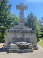
The Linge region was the scene of bloody battles in 1914 and 1915. It is the remains and traces still very much visible on the ground that you will discover as you follow this route. On this section of the Linge-Barrenkopf front, barely 2 km long, one of the bloodiest battles of the Great War in the Vosges took place between 20 July and 16 October 1915. It claimed the lives of more than17,000 young French and German soldiers.
The First World War bunker trail at Burnhaupt-le-Bas
 5.41 mi
+59 ft
-59 ft
2h 30
Easy
Departure from Burnhaupt-le-Bas (Haut-Rhin)
5.41 mi
+59 ft
-59 ft
2h 30
Easy
Departure from Burnhaupt-le-Bas (Haut-Rhin)
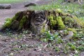
Along this trail of bunkers, explore fortifications dating back to the First World War, built by the German army. After the fighting in the summer and autumn of 1914, the Haute-Alsace front stabilised on along the line of Cernay-Dannemarie. The commune of Burnhaupt-le-Bas remains on the German side. In December 1914 and January 1915, the French offensive in this sector regularly broke the German lines at the cost of many lives.
The Kilometre Zero Trail - World War I
 4.93 mi
+289 ft
-295 ft
2h 30
Easy
Departure from Pfetterhouse (Haut-Rhin)
4.93 mi
+289 ft
-295 ft
2h 30
Easy
Departure from Pfetterhouse (Haut-Rhin)
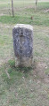
Kilometre Zero is the starting point of the front line established during theFirst World War. It is located on the current French-Swiss border, at a place called Le Largin. The Kilometre Zero trail explores three sections of the front line, the first kilometres of the French and German fronts, and the Swiss front at Le Largin, established along the border opposite the no man's land where boundary marker No. 111, considered the zero point of the Great War front line, is located.
Haulenwald circuit (First World War)
 3.24 mi
+381 ft
-381 ft
1h 50
Easy
Departure from Illfurth (Haut-Rhin)
3.24 mi
+381 ft
-381 ft
1h 50
Easy
Departure from Illfurth (Haut-Rhin)
The fighting of the First World War raged in the Sundgau region from August 1914 onwards. The French blew up the Dannemarie viaduct and the front stabilised and extended from the Vosges to the Swiss border. The front line ran a few kilometres from Illfurth, near Heidwiller. During this tour, you will discover several bunkers that served a variety of purposes, including ammunition depots, observation posts and artillery emplacements, as well as several casemates.