


griffmonster

 Visorando Member
 Premium user
About
The ethos for the Griffmonster Walks site is to share information with fellow walkers and hikers to assist in planning their own routes
Sign up:
Published route(s)
 The Monastery of Prophet Elias (Pefkos Cross)

 1.92 mi
 +335 ft
 -335 ft
 1h 10
1h 10
 Easy
Easy
 Departure from Greece
Sitting high above Pefkos is a tiny monastery of Prophet Elias adjacent to the huge cross which stands guard above the village shining like a beacon in the night. This walk provides a simple circular route to reach this 12th century chapel. There is quite a climb for the final ascent but nothing that an average fit person can achieve and the views from here are well worth the effort exerted. From the centre of Pefkos the route takes a track up the hill behind the village onto a road, then uses the public steps left to the monastery.
From Trimley to Languard Fort via Felixstowe Ferry
 9.77 mi
+92 ft
-161 ft
4h 35
9.77 mi
+92 ft
-161 ft
4h 35
 Moderate
Departure from Trimley St Martin (Suffolk)
Moderate
Departure from Trimley St Martin (Suffolk)
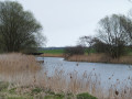
This walk navigates from the village of Trimley down to Kings Fleet and along the banks of the River Deben to Felixstowe Ferry, the setting of an old Black Shuck tale from many years ago which is a feature to this walk. A coastal walk follows, along the seafront of Felixstowe through to the where the River Orwell meets the sea, a strategic point of defence against attacking enemies attempting to sail up the estuary. Key to that defence is Languard Fort which has stood here for many centuries and has played key parts in the world wars of the 20th centuries. A fascinating place to visit with a certain eeriness within its confines.
Alton Water Reservoir
 7.64 mi
+36 ft
-39 ft
3h 35
Moderate
Departure from Stutton (Suffolk)
7.64 mi
+36 ft
-39 ft
3h 35
Moderate
Departure from Stutton (Suffolk)
Located on the Shotley peninsular, the Alton Water Reservoir provides an easy walk around its water. A self contained circular route that needs little in the way of maps. Just keep the water on your right and keep walking! The mixed variety of landscapes of open meadow, woods and even the hills on the northern side of the reservoir provide a constant changing scenery throughout the walk. In all this is a great walk with some pleasing panoramas and ever changing views of the reservoir.
An Amble up the Deben Estuary
 12.90 mi
+144 ft
-194 ft
6h 05
12.90 mi
+144 ft
-194 ft
6h 05
 Difficult
Departure from Felixstowe (Suffolk)
Difficult
Departure from Felixstowe (Suffolk)
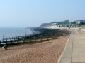
A walk along the River Deben in Suffolk, starting at Felixstowe and ending in Martlesham. The lovely walk along the Deben estuary. Although parts are inaccessible due to breaches of the flood banks, the mix of riverside paths, country lanes and footpaths provides an ideal mix of landscapes to keep any walker fascinated. The May bush pub offers a perfect place to take a rest and refreshment, its riverside location unbeatable.
Deben Estuary - Melton to Bawdsey
 16.62 mi
+259 ft
-233 ft
7h 50
Difficult
Departure from Melton (Suffolk)
16.62 mi
+259 ft
-233 ft
7h 50
Difficult
Departure from Melton (Suffolk)
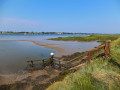
A river side walk along the Deben Estuary in Suffolk between the villages of Melton and Bawdsey. This walk follows river side footpaths with spectacular views across the estuary. Unfortunately at Ramsholt there is no public access and one needs to divert through to the village of Alderton with a road walk for the last few miles to Bawdsey. A ferry crossing an a short walk into Felixstowe provides public transport access back to Melton
Foxhall and Brookhill Wood
 2.98 mi
+43 ft
-43 ft
1h 25
Easy
Departure from Foxhall (Suffolk)
2.98 mi
+43 ft
-43 ft
1h 25
Easy
Departure from Foxhall (Suffolk)
Short circular walk around heaths and woodlands of Foxhall, Ipswich. A pleasant stroll around the heaths and woodlands around Foxhall, to the east of Ipswich. The walk is short but nonetheless a pleasant way to while a way an hour or two. Natural woodland, babbling stream and if you look very carefully you may even see what remains of Foxhalls All Saints Church
Fynn Valley
 16.21 mi
+197 ft
-167 ft
7h 40
Difficult
Departure from Woodbridge (Suffolk)
16.21 mi
+197 ft
-167 ft
7h 40
Difficult
Departure from Woodbridge (Suffolk)
A walk along the Suffolk Fynn Valley between Woodbridge and Witnesham, with a return route via Grundisburgh and Hasketon.The walk follows the the banks of the Deben around to Martlesham Creek where it meets the River Fynn. The path then follows the rivers course through Little Bealings, Playford and Tuddenham St Martin through to Witnesham. Waymarkers point out the route throughout this section. The return is on footpaths across fields to Grundisburgh, then using further footpaths to Hasketon and finally back to Woodbridge
The Fynn Valley Walk is an official waymarked route following the course of the River Fynn from Witnesham to Martlesham then continuing through to Woodbridge along the banks of the River Deben. For this walk, the Fynn Valley route is walked in reverse then public footpaths are used across the fields to Grundisburgh and Hasketon and back down into Woodbridge to make a circular walk.
Gipping Valley Way - Needham Market to Ipswich
 11.98 mi
+46 ft
-105 ft
5h 35
Moderate
Departure from Needham Market (Suffolk)
11.98 mi
+46 ft
-105 ft
5h 35
Moderate
Departure from Needham Market (Suffolk)
A walk following Suffolk's River Gipping between Needham Market and Ipswich.
A riverside walk tracing the route of the River Gipping as it heads through Suffolk to join the tidal waters of the Orwell at Ipswich. A gentle ambling route that twists and turns through the countryside which presents a perfect summers walk.
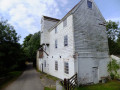
This is a good walk for summer when the sun is shining and the gentle Gipping River trickles its way through the Suffolk countryside. There are old mills, there are little bridges and old locks which are no more than weirs these days presenting an interesting journey. It is a stereotypical English rural landscape. Admittedly the main A14 is never too far away so there is always the distant moan of traffic but it is easy to forget about this, even more so, I would guess, if one is a townie and used to such noises.
Stour and Orwell - Felixstowe to Ipswich
 17.09 mi
+381 ft
-404 ft
8h 10
Difficult
Departure from Felixstowe (Suffolk)
17.09 mi
+381 ft
-404 ft
8h 10
Difficult
Departure from Felixstowe (Suffolk)
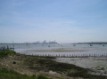
This walk goes along the banks of the Orwell River in Suffolk starting at Felixstowe and ending in the centre of Ipswich. The Stour and Orwell path is an extension to the southern end of the Suffolk Coast Path and follows the coast along the estuaries of the Orwell and the Stour.
The start of the walk is characterised by the earthen river defences along which the footpath navigates. From Levington Creek an alternative route is used to pay a visit to the 13th century Ship Inn before proceeding through Broke Hall Woods to rejoin the official route through to Ipswich.
Suffolk Coast Path - Snape to Felixstowe
 20.54 mi
+115 ft
-69 ft
9h 35
Difficult
Departure from Tunstall (Suffolk)
20.54 mi
+115 ft
-69 ft
9h 35
Difficult
Departure from Tunstall (Suffolk)
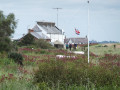
A walk along the Suffolk Coast Path between Snape and FelixstoweThis is the most remote section of the Suffolk Coast Path and follows the Butley River down to Shingle Street and then continues along the coast to the ferry at Bawdsey. There is an eerie sense of foreboding when walking this section. The solitude. The windswept landscape. The distant silhouettes of the Orfordness Pagodas. The lonely river. One can walk virtually the entire distance without seeing a soul and the only company is the decaying remains of WWII defences and the looming martello towers from Napoleonic times.⚠️Make sure you check the ferry timetables before you start the walk
The Fonnereau Way to Ipswich
 11.45 mi
+197 ft
-157 ft
5h 25
Moderate
Departure from Woodbridge (Suffolk)
11.45 mi
+197 ft
-157 ft
5h 25
Moderate
Departure from Woodbridge (Suffolk)
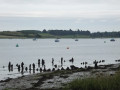
A walk between Woodbridge and Ipswich incorporating sections from the Fonnereau Way, the Sandlings and the Fynn Valley Way.
This walk links the railway stations of Woodbridge, Westerfield and Ipswich with scenic views along the estuary at Woodbridge and the Fynn Valley before entering Ipswich from the west through the historic parkland known as Christchurch park which dates from the 12th century which includes many historic features and a mansion that is open to the public.
The Sandlings - Martlesham to Rushmere Heath
 4.81 mi
+49 ft
-36 ft
2h 15
Easy
Departure from Martlesham (Suffolk)
4.81 mi
+49 ft
-36 ft
2h 15
Easy
Departure from Martlesham (Suffolk)
A walk across heathland from Martlesham to Rushmere Heath on the eastern fringes of Ipswich
Like most modern towns, Ipswich is suffering from a seemingly endless amount of urban sprawl that envelops the traditional villages that once surrounded it. However, this walk follows heathland that is hidden behind the housing estates all the way from Martlesham through to Rushmere Heath and Ipswich Hospital.
Gipping Valley River Path - Stowmarket to Needham Market
 5.25 mi
+7 ft
-66 ft
2h 25
Easy
Departure from Stowmarket (Suffolk)
5.25 mi
+7 ft
-66 ft
2h 25
Easy
Departure from Stowmarket (Suffolk)
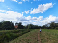
An easy walk following Suffolk's River Gipping between Stowmarket and Needham Market.
The river Gipping forms the source to the mighty Orwell River. At Stowmarket it is no more than a babbling stream that winds its way through the Suffolk countryside. The path keeps to the riverside throughout with no difficult obstacles other than styles, making a pleasant stroll between these two places. With some fantastic pubs at either end it makes a good little pub crawl.
A Country Amble between Leiston and Saxmundham
 4.84 mi
+56 ft
-59 ft
2h 15
Easy
Departure from Leiston (Suffolk)
4.84 mi
+56 ft
-59 ft
2h 15
Easy
Departure from Leiston (Suffolk)
A walk across the Coastal Suffolk landscape between Leiston and Saxmundham.
This walk searches out footpaths to connect the neighbouring towns of Leiston and Suffolk. Although there is no direct route, the paths chosen are certainly more conducive to the walker than the busy road route. With the churches of Leiston and Knodishall on the route, plus the mysterious Harris's Pit in the parish of Sternfield there is enough to interest the avid rambler. Sternfield also has the notoriety of being the village from which the last woman to be burnt at the stake in England came.
A Spooky Suffolk to Potsford Gibbet
 6.13 mi
+138 ft
-115 ft
2h 55
Easy
Departure from Wickham Market (Suffolk)
6.13 mi
+138 ft
-115 ft
2h 55
Easy
Departure from Wickham Market (Suffolk)
A circular walk around Wickham Market in Suffolk to take in the spooky sights of Potsford Gibbet.
Jonah Snell was reputedly the last man to be 'hung in chains' at Potsford Gibbet in 1699 as decreed by the cracked plaque that is affixed to the decaying post which is all that remains of the gibbet. His ghost is said to haunt the area and the hill up to the location of the Gibbet is still locally known as Dragarse Hill after he was dragged by his arse up the hill to the Gibbet for his part in the grizzly murders carried out at Letheringham Mill.
A Trek Around Sole Bay
 23.79 mi
+256 ft
-266 ft
11h 10
Difficult
Departure from Leiston (Suffolk)
23.79 mi
+256 ft
-266 ft
11h 10
Difficult
Departure from Leiston (Suffolk)
A circular walk between Sizewell and Southwold along the Suffolk Coast Path and Sandlings Walk.
Due to the limitations of public transport, it is difficult to create linear walks along the Suffolk Coast Path between Sizewell and Southwold.
The walk follows the Suffolk Coast Path up to Dunwich Heath where a newly designated footpath along the roadside will join back with the Suffolk Coast Path at Greyfriars Woods and leads to Dunwich. Keep with the Coast Path through Dunwich and across the marshes to Walberswick where the river Blyth can be crossed using the ferry to continue into Southwold along the Suffolk Coast Path. Return is straight down the coast to Dunwich then head across the heath through to Eastbridge and Leiston following the Sandlings Walk.
⚠️The Walberswick Ferry only runs at weekends during some weeks of the year and one should check the service prior to walking. There is an alternative route.
Around the Churches of Knodishall and Friston
 10.18 mi
+144 ft
-138 ft
4h 50
Moderate
Departure from Leiston (Suffolk)
10.18 mi
+144 ft
-138 ft
4h 50
Moderate
Departure from Leiston (Suffolk)
A circular walk around the Suffolk villages of Knodishall and Friston.
An easy ramble across the Suffolk countryside, with the highlight being the hidden ruins of St Peters Church in the old parish of Buxlow, now a part of Knodishall. There's some fascinating history on this walk along paths that are off the beaten track but nonetheless well-maintained.
Around Suffolk's Minsmere Bird Reserve
 10.01 mi
+79 ft
-102 ft
4h 40
Moderate
Departure from Leiston (Suffolk)
10.01 mi
+79 ft
-102 ft
4h 40
Moderate
Departure from Leiston (Suffolk)
A circular walk through the Suffolk Coastal Area of Outstanding Natural Beauty taking in Sizewell and the Minsmere Bird Reserve.
One does not have to have an enthusiasm for ornithology to enjoy this walk. The natural surroundings of marshland and heathland are enough to inspire everyone and there is a lot of associated history along this route which dates back to the 12th century when Leiston Abbey once occupied an island in the marshes. Note that charges apply to the Minsmere section.
Through the Garden of Suffolk
 13.13 mi
+167 ft
-167 ft
6h 10
Difficult
Departure from Saxmundham (Suffolk)
13.13 mi
+167 ft
-167 ft
6h 10
Difficult
Departure from Saxmundham (Suffolk)
A walk between Saxmundham and Darsham along the East Suffolk Line Walk.
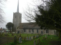
It is Yoxford that gives us the name of this walk which is part of the East Suffolk Line Walks and this specific ramble extends the line walk to return to Leiston where a regular bus service connects the two ends. Yoxford sits on the banks of the River Yox surrounded by three country house parks; Sibton Park that contains large well stocked fishing lake; Grove Park situated in the village; and Rookery Park on the Leiston road. This has earned Yoxford the name of the 'Garden of Suffolk'. The whole route of this walk is a pleasant amble through the rural fields of Suffolk with a return journey through the pretty country lanes following the Minsmere river through to Middleton, Theberton and finally Leiston.
Through the The Vale of Slaughden
 3.71 mi
+16 ft
-16 ft
1h 45
Easy
Departure from Aldeburgh (Suffolk)
3.71 mi
+16 ft
-16 ft
1h 45
Easy
Departure from Aldeburgh (Suffolk)
An exhilarating walk along the defence banks of Suffolk's River Alde estuary beginning and ending at Slaughden Quay. The walk traces the defence banks that following the River Alde inland, returning via the footpath on the southern edge of Aldeburgh.
Once known as the Vale of Slaughden, the area below Aldeburgh presents a big open landscape across the marsh with the wide estuary waters of the River Alde as it meanders alongside the coast. Once upon a time Slaughden was a bustling fishing village but in present day it is all under the waves and a narrow spit of shingle is all that divides the North Sea from the gentle waters of the river.
Through the Woods on Kenton and Goose Hills
 6.77 mi
+72 ft
-72 ft
3h 10
Moderate
Departure from Leiston (Suffolk)
6.77 mi
+72 ft
-72 ft
3h 10
Moderate
Departure from Leiston (Suffolk)
An easy circular walk through the woodland around Sizewell on the Suffolk Coast. Simple walk with many alternatives using the myriad tracks and paths through Kenton Hill woodland.
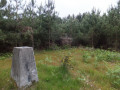
Suffolk is not best known for its hills and Kenton Hill and Goose Hill probably would not be regarded as hills but for their name. However, this wooded area offers an ever changing scenery throughout the year with the mixture of conifer and broad leafed trees, flora and fauna and a variety of wildlife. There is also a viewing platform overlooking the Minsmere marshes
The Dunwich Leper Chapel
 14.18 mi
+167 ft
-190 ft
6h 40
Difficult
Departure from Leiston (Suffolk)
14.18 mi
+167 ft
-190 ft
6h 40
Difficult
Departure from Leiston (Suffolk)
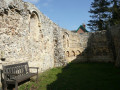
A circular walk between Leiston to Dunwich using the Suffolk Coast Path from Sizewell to Dunwich with a visit to the ruins of the 12th-century Leper Chapel. The return uses the footpath via Mount Pleasant to get onto the Sandlings Path across Dunwich Heath to return back to Leiston.
Alde Valley - Sweffling to Badingham
 9.30 mi
+210 ft
-210 ft
4h 30
Moderate
Departure from Swefling (Suffolk)
9.30 mi
+210 ft
-210 ft
4h 30
Moderate
Departure from Swefling (Suffolk)
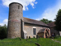
A circular walk through the quintessential Suffolk countryside following the River Alde, following country lanes with a few footpaths along the Alde Valley. This is typical Suffolk countryside where one can take a lazy stroll. There are pubs to visit, three to be precise and all named the White Horse, along with three churches that are not named the White Horse!
Bromeswell Village
 1.92 mi
+30 ft
-89 ft
0h 55
Easy
Departure from Bromeswell (Suffolk)
1.92 mi
+30 ft
-89 ft
0h 55
Easy
Departure from Bromeswell (Suffolk)
A very easy walk around the Suffolk Village of Bromeswell. The Sandlings Path avoids the busy road between Melton and the footpath across the Heathland to Rendlesham Forest by navigating around the quiet village of Bromeswell. Although only a short distance, it is worth taking ones time to explore this quiet village with its typically East Anglian church of St Edmund.
Captains Wood, Sudbourne
 2.29 mi
+46 ft
-46 ft
1h 05
Easy
Departure from Sudbourne (Suffolk)
2.29 mi
+46 ft
-46 ft
1h 05
Easy
Departure from Sudbourne (Suffolk)
A walk around the ancient woodland of Captains Wood just outside the hamlet of Sudbourne
This is a hidden gem of a walk close to the Suffolk Coast in woodland which is currently under the management of the Suffolk Wildlife Trust. The ancient woodland is full of life, colour and a natural wildness that is a pleasure to behold. A waymarked path provides easy access around the wood so one cannot get lost. Just take ones time and take it all in.
Deben Valley from Wickham Market to Woodbridge
 7.68 mi
+105 ft
-213 ft
3h 35
Moderate
Departure from Wickham Market (Suffolk)
7.68 mi
+105 ft
-213 ft
3h 35
Moderate
Departure from Wickham Market (Suffolk)
A walk along the Deben Valley in Suffolk from Wickham Market to Woodbridge following the route of the East Suffolk Line Walks along the Deben Valley. An easy and simple walk with the highlight of the village of Ufford which boasts its very own microbrewery and ancient church. The walk ends with an amble along the popular riverside path between Melton and Woodbridge.
Exploring the Suffolk Coast and Heaths AONB around Aldeburgh
 12.86 mi
+108 ft
-105 ft
6h 00
Difficult
Departure from Leiston (Suffolk)
12.86 mi
+108 ft
-105 ft
6h 00
Difficult
Departure from Leiston (Suffolk)
A walk between Aldringham and Aldeburgh through the Suffolk Coastal Area of Outstanding Natural Beauty. (AONB) There is a variety of differing scenery along this route, gentle hills around Aldringham, boardwalks across the marshes at The Fens, a walk along the old Aldeburgh railway and an estuary walk along river defences of the Alde. With such treasures as the pretty little church at Aldringham, tucked away in the trees and away from civilisation and the magnificent church of St Peter and St Paul at Aldeburgh, there is plenty to see and explore.
In Search of Leiston's Ancient Pagan Sites, the Procession Rayles & Gallows
7.00 mi
+52 ft
-56 ft
3h 15
Moderate
Departure from Leiston (Suffolk)
A walk following the western parish boundary of Leiston in Suffolk, as described in a document from the middle-ages.
This walk attempts to follow the instructions of a perambulation around the western side of the Leiston Parish boundary that was undertaken in the year AD1620. Leiston's history is renowned for its Abbey and the Garret's works, but this walk also discovers the site of a possible ancient pre-Christian shrine or temple, the location of the Leiston gallows and the procession route taken by those attending this gruesome public spectacle.
In Search of the ruins of Leiston Abbey
 9.33 mi
+85 ft
-98 ft
4h 20
Moderate
Departure from Leiston (Suffolk)
9.33 mi
+85 ft
-98 ft
4h 20
Moderate
Departure from Leiston (Suffolk)
A circular walk around Leiston and Eastbridge in Suffolk. Leiston Abbey was originally founded in the late 12th century by Ranulf de Glanville. The original building was constructed on an island in the Minsmere marshes. Two centuries later, due to the inhospitable conditions on the marsh and constant flooding the Abbey was moved inland, lock stock and stone to a site close to Leiston. Despite a great fire in 1367 and much demolition following the dissolution of the monasteries there still remains some impressive ruins. There is still a remnant of the old Abbey, with the former chapel building sitting in its island position above the marsh, decaying into the landscape and containing a WWII pill box. This walk visits both sites making a well worthwhile walk.
Saxmundham to Rendham
 6.65 mi
+171 ft
-167 ft
3h 10
Moderate
Departure from Saxmundham (Suffolk)
6.65 mi
+171 ft
-167 ft
3h 10
Moderate
Departure from Saxmundham (Suffolk)
Circular Walk between Saxmundham and the village of Rendham, across the Suffolk countryside with a worthy stop off at the White Horse pub at Rendham. Woodland, open fields, babbling brooks make this typical of this part of Suffolk. And there is history too, with the Roman bronze head being discovered in the river at Rendham back in 1907. How did it get there?
Saxmundham, Kelsale and Carlton
 4.11 mi
+148 ft
-138 ft
2h 00
Easy
Departure from Saxmundham (Suffolk)
4.11 mi
+148 ft
-138 ft
2h 00
Easy
Departure from Saxmundham (Suffolk)
A walk around Saxmundham, Kelsale and Carlton. Using footpaths an country lanes, this short walk provides some fine views, historic churches and even a ghostly tale of an apparition of phantom dancers. A worthy candidate for an afternoons exploration of this hidden corner of East Suffolk.
Suffolk Coast Path - Orford to Butley Ferry
 6.48 mi
+30 ft
-30 ft
3h 00
Moderate
Departure from Orford (Suffolk)
6.48 mi
+30 ft
-30 ft
3h 00
Moderate
Departure from Orford (Suffolk)
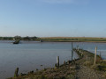
A Suffolk circular walk along the banks of the Ore and Butley rivers between Orford and the Butley Ferry river crossing at Gedgrave.
The Suffolk Coast Path Orford Loop has two routes back onto the main trail, the first returns from Orford up to Chillesford but an alternative is to follow the lane from Orford to Gedrgrave and down to Butley Ferry. Although this crossing only operates from April to October, a pleasant and easy circular walk can be made from Orford returning along the top of the river defences.
Tales of Sundials, Witchcraft and Ghostly happenings in Saxmundham
 1.98 mi
+23 ft
-26 ft
0h 55
Easy
Departure from Saxmundham (Suffolk)
1.98 mi
+23 ft
-26 ft
0h 55
Easy
Departure from Saxmundham (Suffolk)
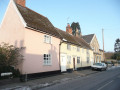
A circular walk around the Suffolk town of Saxmundham using the Town Trail that can be added onto the East Suffolk Line Walks or to while away a couple of hours on a lazy afternoon, including searching out the unique tombstone sundial in St Johns churchyard, and finding the haunted Monks Cottages.
The Alde Valley - Leiston to Wickham Market
 13.98 mi
+259 ft
-190 ft
6h 40
Difficult
Departure from Leiston (Suffolk)
13.98 mi
+259 ft
-190 ft
6h 40
Difficult
Departure from Leiston (Suffolk)
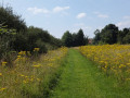
A walk along the East Suffolk Line Path between Leiston and Wickham Market
Although the official route for the East Suffolk Line Path links the stations at Saxmundham and Campsea Ashe, this provides an alternative route using the local bus service to link the two ends. Highlights along the route include the picturesque Beversham Mill and the legendary Blaxhall Stone which is said to progressively grow in size.
The Orford Loop, Tales of Castles and Mermen
 15.91 mi
+167 ft
-190 ft
7h 30
Difficult
Departure from Orford (Suffolk)
15.91 mi
+167 ft
-190 ft
7h 30
Difficult
Departure from Orford (Suffolk)
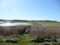
A walk around the Orford Loop section of the Suffolk Coast Path. The main Suffolk Coast Path cuts through Tunstall Forest from Iken Cliff to Chillesford. However, more recently, a path has been added which allows access to Orford by following the Alde estuary. This then cuts back across Gedgrave marshes and Sudbourne Hall to return to the main path at Chillesford.
Tracks and lanes to Glemham
 22.07 mi
+371 ft
-361 ft
10h 30
Difficult
Departure from Leiston (Suffolk)
22.07 mi
+371 ft
-361 ft
10h 30
Difficult
Departure from Leiston (Suffolk)
A route that can be either walked or cycled through the Suffolk countryside around Snape, Blaxhall and Glenham. It goes through the Suffolk countryside using a mixture of lanes, tracks, bridleways and little used country roads. This can be either walked or cycled and provides a full days outing taking in the picturesque villages of Snape, Blaxhall, Little Glemham, Great Glemham and Benhall which these days is split into two with the A12 separating Benhall Low Street from Benhall Green. Along the route is the Parham Airfield Museum, although this is only open on Sundays between April to October.
Ufford Heritage Trail
 3.19 mi
+180 ft
-180 ft
1h 35
Easy
Departure from Ufford (Suffolk)
3.19 mi
+180 ft
-180 ft
1h 35
Easy
Departure from Ufford (Suffolk)
A walk around the village of Ufford.
Ufford is rich in heritage and well worth exploring. The Heritage Trail was created in 2006 and leads the walker around the historic features of the village including the village stocks, water meadows and the many listed buildings. The Highlight of the trail has to be the church which has an unusual dedication to St Mary of the Assumption and contains the second largest font cover in England which is a sight to behold.
Eye to Hoxne
 10.02 mi
+102 ft
-102 ft
4h 40
Moderate
Departure from Eye (Suffolk)
10.02 mi
+102 ft
-102 ft
4h 40
Moderate
Departure from Eye (Suffolk)
A walk around the Suffolk villages of Eye and Hoxne.
Hoxne is said to be where St Edmund was Martyred by the Viking invaders in the 9th century. The village is full of reminders of the gruesome event including the cross which marks the place of the oak tree his assailants tied him to, beat him, fired arrows at and eventually beheaded and the bridge he reputedly hid trying to escape his captors.
Suffolks Mystery Brampton Standing Stone
 13.14 mi
+213 ft
-266 ft
6h 15
Difficult
Departure from Halesworth (Suffolk)
13.14 mi
+213 ft
-266 ft
6h 15
Difficult
Departure from Halesworth (Suffolk)
A walk between Halesworth and Beccles along the East Suffolk Line Path.
This waymarked route links the railway stations at Halesworth, Brampton and Beccles. Taking the train between these towns will provide an interesting glimpse of what is in store along the walk, including the rather curious Belle Grove Farm looking as if it is out of some fantasy movie and the mysterious Brampton Standing Stone just south of Brampton Station.
Angles Way - Earsham to Beccles
 11.92 mi
+171 ft
-180 ft
5h 40
Moderate
Departure from Earsham (Norfolk)
11.92 mi
+171 ft
-180 ft
5h 40
Moderate
Departure from Earsham (Norfolk)
A walk along the Angles Way between Earsham and Beccles heading up the hills that overlook Outney Common. This is a really rewarding start to an easy ramble that continues across the Waveney Valley to Mettingham before continuing down the Waveney Valley. Although Geldeston is on the opposite side of the river to The Angles Way the excursion across the Shipmeadow marshes is well worth the effort to visit the unique Geldeston Locks Inn.
Down the Blyth Valley in Pursuit of Black Shuck
 18.03 mi
+243 ft
-236 ft
8h 30
Difficult
Departure from Halesworth (Suffolk)
18.03 mi
+243 ft
-236 ft
8h 30
Difficult
Departure from Halesworth (Suffolk)
A walk down the Blyth Valley in Suffolk from Halesworth to Blythburgh, then across the heaths and commons to Leiston. It was the legendary hell hound that supposedly came this way in 1577 and terrified parishioners of Blythbrugh church after doing a similar job at Bungay.
East Suffolk Line - The Yox Blyth
 9.53 mi
+194 ft
-187 ft
4h 35
Moderate
Departure from Halesworth (Suffolk)
9.53 mi
+194 ft
-187 ft
4h 35
Moderate
Departure from Halesworth (Suffolk)
A walk along the East Suffolk Line Trail between Halesworth and Darsham. Great views are to be had along the Blyth valley before footpaths head over to the Yox valley. The village of Bramfield is at the half way point where is an old pub for refreshments as well as a distinctive church with a detached tower and a fine example of a Crinkle Crankle Wall, not to mention the legendary Bramfield Oak.
In search of the lost Suffolk village of Hethern
 4.87 mi
+128 ft
-112 ft
2h 20
Easy
Departure from Dunwich (England)
4.87 mi
+128 ft
-112 ft
2h 20
Easy
Departure from Dunwich (England)
A walk through Dunwich forest to the medieval site of the lost village of Hethern.
Dunwich forest is always a good place to walk and find peace amid the fora, fauna and wildlife. There are information boards that provide details of this ever changing world of nature but there is nothing about its history. Little is known of the medieval village of Hethern or the landmarks of Stonehill Bridge and Stonehill Castle which are recorded in the 15th century Westleton Extents. This document records that they stood aside a now lost road directly linking Dunwich to Blythburgh and which cut across the marshes.
Leiston to Walberswick
 21.56 mi
+187 ft
-180 ft
10h 05
Difficult
Departure from Leiston (Suffolk)
21.56 mi
+187 ft
-180 ft
10h 05
Difficult
Departure from Leiston (Suffolk)
A circular walk between Leiston and Walberswick incorporating sections of the Suffolk Coast Path and Sandlings Walk. It uses the beach at low tide to get from Sizewell to Walberswick, returning through Dunwich forest. Walberswick is said to be the most haunted place in Britain though one would not think it from its relaxed and laid back character, famous for its crabbing pastimes.
Leiston to Westwood Marsh
 18.20 mi
+207 ft
-226 ft
8h 35
Difficult
Departure from Leiston (Suffolk)
18.20 mi
+207 ft
-226 ft
8h 35
Difficult
Departure from Leiston (Suffolk)
A walk encompassing the Westwood Marshes footpath into a circular route from Leiston.
The Westwood Marshes footpath is little gem of a path that links the Newdelight Walks with the Suffolk Coast Path through the Westwood marshes. The route for this walk uses this path as the ultimate destination from Leiston but shorter alternatives to include this path are also detailed.
Norfolk/Suffolk Coast - Gorleston to Kessingland
 12.89 mi
+115 ft
-112 ft
6h 00
Difficult
Departure from Great Yarmouth (Norfolk)
12.89 mi
+115 ft
-112 ft
6h 00
Difficult
Departure from Great Yarmouth (Norfolk)
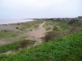
A coastal walk between Gorleston and Kessingland crossing the border from Norfolk to Suffolk.
This mighty fine walk takes the avid rambler to the most easterly point of the British Isles, Ness Point that is located in front of Lowestoft. The point is marked with a large circular ground compass with distances and direction to well known landmarks around the globe. The route uses cliff top paths, proms and beaches and makes for a great days walking.
Southwold
 5.98 mi
+75 ft
-69 ft
2h 50
Easy
Departure from Southwold (Suffolk)
5.98 mi
+75 ft
-69 ft
2h 50
Easy
Departure from Southwold (Suffolk)
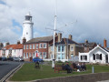
A circular walk around Southwold which navigates from Southwold Harbour around the northern part of the Blyth estuary known as Buss Creek, returning via the seafront to the harbour. One cannot miss out on a wander around the pier to take in the amazing sights of the quirky The Under the Pier show, the creation of Tim Hunkin and typical British eccentricity at its best.
Southwold to Blythburgh along the former Southwold Railway
3.79 mi
+66 ft
-66 ft
1h 50
Easy
Departure from Southwold (Suffolk)
A linear walk along the former trackbed of the Southwold Railway to Blythburgh.
The Southwold Railway was a narrow gauge line that linked Halesworth and Southwold. This closed in 1929 but the track bed is still in existence to Blythburgh and makes an excellent walk. The White Hart pub offers a place for refreshment before returning along the same route. Outstanding views across the Blyth estuary and easy walking across heath and woodland make this a well worthwhile excursion.
Southwold to Covehithe
 10.44 mi
+148 ft
-148 ft
4h 55
Moderate
Departure from Southwold (Suffolk)
10.44 mi
+148 ft
-148 ft
4h 55
Moderate
Departure from Southwold (Suffolk)
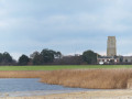
A walk along the beach route of the Suffolk Coast Path to the tiny hamlet of Covehithe with its impressive ruins of St Andrews church. Return is along the inland route of the Coast Path. This walk is dependant upon tides and consultation of tide times is vital in order to negotiate the beach route.
Suffolk Coast Path - Lowestoft to Southwold Beach Route
11.18 mi
+23 ft
-23 ft
5h 10
Moderate
Departure from Lowestoft (Suffolk)
The Suffolk Coast Path runs between Lowestoft and Southwold but due to coastal erosion has been diverted inland which results in some road walking, including along the main A12 between Pakefield and Kessingland. An alternative route is to follow the coast as it is possible to walk the entire distance along the beach providing one times the walk to coincide with low tide. This section is worth making the effort to walk, just to view the trees that are slowly being taken by the sea at Benacre and Covehithe broads where the distance between the broad and the sea is a mere sandy section of beach.
⚠️ Check the tide timetable before attempting this walk.