gazet

 Visorando Member
 Premium user
 - Location: Viuz-la-Chiésaz (74540)
- Website: http://loprazcondus.canalblog.com/
Sign up:
Published route(s)
 Circular route on Sapenay Mountain
 2.83 mi
 +840 ft
 -817 ft
 2 hrs
2 hrs
 Easy
Easy
 Departure from Cessens (Savoie)
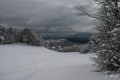
This is an unmarked and little-used route that is best taken in the middle of winter if you want to have enough snow, as the altitude remains modest (between 800 and 950 metres). The views of Lake Bourget are magnificent.
In summer, it is possible to follow a marked route called "le tour de la montagne du Sapenay" (the Sapenay mountain tour), which does not, however, take the section directly overlooking the lake.
 The Seven Fountains Loop in Montmin
 4.40 mi
+817 ft
-823 ft
2h 45
Easy
Departure from Montmin (Haute-Savoie)
4.40 mi
+817 ft
-823 ft
2h 45
Easy
Departure from Montmin (Haute-Savoie)
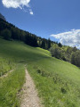
This loop trail runs through the suspended valley of Montmin and takes you to the monument of the Seven Fountains (1642), a Christian building with a very unusual design.
Circuit around the Col de la Cochette and the Altar of the Priest in Arith
 7.54 mi
+2,415 ft
-2,405 ft
5h 35
7.54 mi
+2,415 ft
-2,405 ft
5h 35
 Moderate
Departure from Arith (Savoie)
Moderate
Departure from Arith (Savoie)
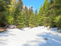
This circular route allows you to explore the north-eastern tip of the Revard Plateau. The gentle, undulating terrain offers views of the Bauges massif and Lake Bourget, and, at the highest point, a wider vista of the Alpine arc and Mont Blanc.A short detour to the Autel du Curé will take you in the footsteps of the Reign of Terror in Savoie.
Combe Fort and Pointe de la Fougère
 5.96 mi
+2,838 ft
-2,841 ft
5h 15
Moderate
Departure from Jarsy (Savoie)
5.96 mi
+2,838 ft
-2,841 ft
5h 15
Moderate
Departure from Jarsy (Savoie)
A hike through a wild area in the heart of the Bauges Massif, offering magnificent views of Pécloz, Arcalod and Orgeval. From Pointe de la Fougère, you can see the Isère Valley, the Beaufortain and Mont Blanc. Chamois and mouflons are abundant in this area.
Lake Lessy and Aiguille Verte from Le Petit-Bornand
 8.19 mi
+2,628 ft
-2,618 ft
6h 05
8.19 mi
+2,628 ft
-2,618 ft
6h 05
 Difficult
Departure from Le Petit-Bornand-les-Glières (Haute-Savoie)
Difficult
Departure from Le Petit-Bornand-les-Glières (Haute-Savoie)
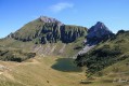
A hike that will take you to Lac de Lessy, then to the Aiguille Verte du Chinaillon. The terrain is varied: mountain pastures, forests, scree, sharp limestone pavements, etc. The landscape is equally varied, culminating in the summit, which offers a 360° panorama of the Bornes, Aravis and Mont Blanc massifs. The area is also ideal for encountering the many ibexes that inhabit the massif.
Pointe de Chaurionde
 8.83 mi
+4,094 ft
-4,072 ft
7h 35
Difficult
Departure from École (Savoie)
8.83 mi
+4,094 ft
-4,072 ft
7h 35
Difficult
Departure from École (Savoie)
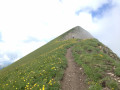
This hike will take you to the Pointe de Chaurionde via the Col du Haut du Four and the south-west ridge. Don't miss the chamois that inhabit the slopes. At the summit, you can admire Lake Annecy and Mont Blanc. You will cross the Vallon d'Orgeval (the valley of bears), which has now become a peaceful valley home to Tarine and Abondance cows and marmots.In June, the flora is magnificent and varied.
Chaurionde means "round summit".
(6) Access to the summit (or descent) via the Chalet de Coutarse is now prohibited (ZR zone of the PNR).
Le Lanfonnet and Roche Murraz
 3.45 mi
+1,959 ft
-1,978 ft
3h 20
Moderate
Departure from Talloires (Haute-Savoie)
3.45 mi
+1,959 ft
-1,978 ft
3h 20
Moderate
Departure from Talloires (Haute-Savoie)
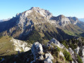
Less travelled than its prestigious neighbour (La Tournette), the summit of Lanfonnet offers a pleasant and less demanding alternative, with a smaller elevation gain. The view of Lake Annecy is spectacular.
The Moriond loop from Pralognan-la-Vanoise
 4.91 mi
+2,110 ft
-2,110 ft
4h 05
Moderate
Departure from Pralognan-la-Vanoise (Savoie)
4.91 mi
+2,110 ft
-2,110 ft
4h 05
Moderate
Departure from Pralognan-la-Vanoise (Savoie)
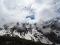
Le Moriond is a small peak located on the Aiguille de la Vanoise ridge. This summit is an easily accessible viewpoint from Pralognan, offering views of the Aiguille de la Vanoise and the Grande Casse. Marmots are never far away.
Etymology of Moriond: round mountain. Seen from Pralognan, this name is entirely justified!
Tête Noire, Tête Ronde and Tête de l'Arpettaz
 7.06 mi
+2,139 ft
-2,136 ft
5h 05
Moderate
Departure from Thorens-Glières (Haute-Savoie)
7.06 mi
+2,139 ft
-2,136 ft
5h 05
Moderate
Departure from Thorens-Glières (Haute-Savoie)
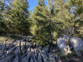
Tête Noire, Tête Ronde and Tête de l'Arpettaz: three peaks overlooking the southern end of the Glières Plateau. The hike takes you through a fairly wild and unfrequented part of the peaks surrounding the famous historic plateau. Magnificent 360° view.
Sulens Mountain via the Sentier du Facteur
 5.28 mi
+2,028 ft
-2,014 ft
4h 10
Moderate
Departure from Les Clefs (Haute-Savoie)
5.28 mi
+2,028 ft
-2,014 ft
4h 10
Moderate
Departure from Les Clefs (Haute-Savoie)
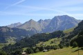
This is an unusual route to the summit of Sulens, which takes you up the steep grassy face of the east slope.
This trail is not "yet" marked on IGN maps... but is clearly visible on IGN Satellite.
A good reason to use it before it becomes too well-travelled...
At the summit: panoramic view of the Aravis mountain range, the Mont Blanc massif...