


francoisandre

 Association / Club / Walk leader
 VIP
VIP Premium user
Sign up:
Published route(s)
 Beauce or Hurepoix
 8.74 mi
 +243 ft
 -259 ft
 4h 15
4h 15
 Moderate
 Departure from Les Granges-le-Roi (Essonne)
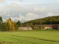
40 km from Paris, an unexpected valley. It marks the transition from the Beauceron plateau to the Paris Basin: this is the Hurepoix.
Chemin Charles Péguy: Palaiseau - Saint-Cyr-sous-Dourdan
 18.90 mi
+794 ft
-804 ft
7 hrs
18.90 mi
+794 ft
-804 ft
7 hrs
 Very difficult
Departure from Palaiseau (Essonne)
Very difficult
Departure from Palaiseau (Essonne)
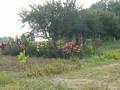
First of the four sections of the Charles Péguy Trail: Palaiseau-Chartres, via Dourdan.
It closely follows in the footsteps of the poet Charles Péguy, who made two pilgrimages in 1912 and 1913, each lasting four days there and back.
Chemin Charles Péguy: Saint-Cyr-sous-Dourdan - Ablis
 16.19 mi
+482 ft
-236 ft
7h 50
16.19 mi
+482 ft
-236 ft
7h 50
 Difficult
Departure from Saint-Cyr-sous-Dourdan (Essonne)
Difficult
Departure from Saint-Cyr-sous-Dourdan (Essonne)
This route is the second of four sections of the Charles Péguy Trail: Lozère (Palaiseau) - Chartres via Dourdan. It follows in the footsteps of the poet Charles Péguy, who celebrated his two pilgrimages (made in 1912 and 1913, each lasting four days there and back) in a poem that remains famous to this day. This is the transition stage: from the valleys and rolling hills of Hurepoix to the Beauce plateau.
Chemin Péguy: Pont-sous-Gallardon - Chartres
 14.10 mi
+266 ft
-177 ft
6h 45
Difficult
Departure from Bailleau-Armenonville (Eure-et-Loir)
14.10 mi
+266 ft
-177 ft
6h 45
Difficult
Departure from Bailleau-Armenonville (Eure-et-Loir)
The last section, from Pont sous Gallardon to Chartres, is the highlight of the route. The Beauce plain appears flat, but its many undulations reveal and conceal the spires and nave of the cathedral in turn.
The Chemin Charles Péguy was created by the Amitié Charles Péguy with the cooperation of all the municipalities crossed and the support of the Eure-et-Loir Departmental Council.
Ablis - Pont-sous-Gallardon
 9.58 mi
+236 ft
-341 ft
4h 35
Moderate
Departure from Ablis (Yvelines)
9.58 mi
+236 ft
-341 ft
4h 35
Moderate
Departure from Ablis (Yvelines)
This route is the third of the four sections of the Chemin Charles Péguy. It follows in the footsteps of the poet Charles Péguy, who made two pilgrimages to Chartres (in 1912 and 1913, each lasting four days there and back), celebrated in a poem that has gone down in history.
The route alternates between the landscapes of the Beauce region and other, more hilly and charming landscapes that you might not expect.
Chemin Charles Péguy: overview
58.91 mi
+1,775 ft
-1,549 ft
3 days
Difficult
Departure from Palaiseau (Essonne)
This marked route follows as closely as possible the path taken by Charles Péguy in 1912 and then 1913 from his home in Lozère (Palaiseau) to Chartres, via Dourdan.
The walking route is 94 kilometres long and is marked with blue and white signposts.
The trail was created by the Amitié Charles Péguy association. It received support from the Eure-et-Loir General Council. Visorando was responsible for its first publication on the Internet.
Chemin Charles Péguy: Alternative route via Forges-les-Bains
 4.03 mi
+210 ft
-302 ft
2h 00
4.03 mi
+210 ft
-302 ft
2h 00
 Not specified
Departure from Limours (Essonne)
Not specified
Departure from Limours (Essonne)
An alternative route to the first section of the Chemin Charles Péguy. It bypasses Limours and instead showcases the Hurepoix region. Discover the beautiful village of Forges-les-Bains and a route through stunning countryside.