


aicragellebasi

 Visorando Member
 Premium user
 - Location: Breuillet (17920|17113)
- Gender: woman
- Website: http://www.isabellegarcia.com
Sign up:
Published route(s)
 Elche Palm Grove Trail

 5.90 mi
 +66 ft
 -69 ft
 2h 45
2h 45
 Easy
Easy
 Departure from Elx / Elche (Alacant / Alicante)
A walk accessible to all, between the city and the palm grove. Ideal for discovering Elche and its horticultural heritage (listed by UNESCO). This route follows the PR®-CV 439, the official path of the Valencian Community, but with a different starting point for accessibility and easier parking.
Sierra de Santa Pola
 8.94 mi
+643 ft
-630 ft
4h 40
Easy
Departure from Elx / Elche (Alacant / Alicante)
8.94 mi
+643 ft
-630 ft
4h 40
Easy
Departure from Elx / Elche (Alacant / Alicante)
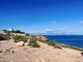
This circular will take you along the coast, below the mountains. The return journey is higher up (144 metres above sea level), passing by the Torre de las Escaletes and the Santa Pola lighthouse, which offer spectacular views of Santa Pola and Alicante. The route is easy and relatively flat. The only slight difficulty is the climb to the Torre de las Escaletes. However, this is equipped with ramps and stairs. And once you reach the top, you won't regret it! The Sierra de Santa Pola is a fossil reef and a protected site, which also houses remains from the Civil War that you will come across along the way.
Circular around Fontcalent
 7.63 mi
+522 ft
-522 ft
4h 00
7.63 mi
+522 ft
-522 ft
4h 00
 Moderate
Departure from Alacant / Alicante
Moderate
Departure from Alacant / Alicante
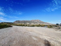
This hike takes you around the Serra de Fontcalent, allowing you to see it from all angles, but from below! It's an easy alternative to climbing to the summit, which is 700 metres high. Ideal for hikers who don't want to or can't climb. Admittedly, the view will not be the same. But this circular still offers some beautiful views: between the industrial and agricultural areas, you will see the major roads and railways. In short, life around Fontcalent.
Tour of the Santa Pola salt flats
 15.61 mi
+56 ft
-59 ft
7h 15
15.61 mi
+56 ft
-59 ft
7h 15
 Difficult
Departure from Santa Pola (Alacant / Alicante)
Difficult
Departure from Santa Pola (Alacant / Alicante)
This hike takes you around the Santa Pola salt flats. As the site is in operation, it is not possible to cross it. You will therefore need to skirt around it by following the GR®232. It is a long walk, but easy as there are no hills. There are long straight stretches, sometimes several kilometres long, but the landscape will quickly make you forget the monotony. In places, the paths may be damp or even slightly flooded, depending on the season.
Important note: at (17), you will need to take off your shoes to cross the Río Vinolopo for a few metres. So if you don't like water or are afraid of it, it is best to avoid this hike as you will have no other choice. But don't let that put you off: the salt flats are part of a wild nature reserve that is home to extraordinary flora and fauna.
Climb up to the Ermita de Santa Barbara in Jijona
 1.54 mi
+259 ft
-259 ft
0h 55
Easy
Departure from Xixona / Jijona (Alacant / Alicante)
1.54 mi
+259 ft
-259 ft
0h 55
Easy
Departure from Xixona / Jijona (Alacant / Alicante)
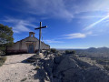
A little way from the historic centre and tourist routes, this short walk will show you the town of Jijona from a different angle through the eyes of the Ermita de Santa Barbara, a small 15th-century chapel, forgotten by all, perched on a hill of the same name. From its summit, you will not only have an unusual view of Jijona and its castle, but also of Alicante and the entire surrounding valley. Although there is a slight incline, this walk is relatively easy and accessible to all.
Pla del Totxar
 7.84 mi
+774 ft
-771 ft
4h 15
Moderate
Departure from Sant Vicent del Raspeig / San Vicente del Raspeig (Alacant / Alicante)
7.84 mi
+774 ft
-771 ft
4h 15
Moderate
Departure from Sant Vicent del Raspeig / San Vicente del Raspeig (Alacant / Alicante)
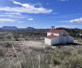
A circular loop that branches off onto the last (and most beautiful) section of the PR®-CV 282, a marked trail that follows the route of the old "Cañada Real", a network of transhumance routes dating back to the time of King Alfonso X el Sabio. You will set off from the Ermita de Nuestra Señora del Carmen to cross small inhabited areas with modest country houses before starting a circular route through the mountains where you can enjoy beautiful views of the coast. Half of the walk is on small, quiet asphalt roads and the other half on a very accessible path with gentle slopes. You won't even notice the 275 m elevation gain. It is also possible to bypass two crossing points, which shortens the walk to 10 km.
Tibi Dam from Sabinar
 9.04 mi
+1,788 ft
-1,781 ft
5h 45
Moderate
Departure from Sant Vicent del Raspeig / San Vicente del Raspeig (Alacant / Alicante)
9.04 mi
+1,788 ft
-1,781 ft
5h 45
Moderate
Departure from Sant Vicent del Raspeig / San Vicente del Raspeig (Alacant / Alicante)
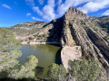
This is a hilly hike that takes you to the Tibi Dam, one of the oldest dams in Europe (1580) still in operation, via a circular route through the surrounding hills. The route offers beautiful views of the coast at the start and finish, but overall, it is more typical of the "Sierra Alicantina" landscape. The route goes up and down quite a bit, but the slopes are not very steep or very long. It is therefore a relatively accessible hike for people with a minimum level of fitness.