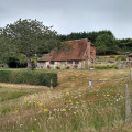
2023-11-23 T'ales From The Riverbank & Red Lion
Description
Start the plot by indicating the starting point. If you know the exact car parking situation, please explain how to park.
If we can access the starting point with public transports, please explain the lines to use and share any useful informations.
(S) From here, describe the instructions to follow from the starting point.
Add waypoints by clicking on the map.
The plot has to end by the location where the walk finishes. If it is a loop please write (S/E) at the end of the description. If it is a one way route write (E).
Waypoints
- S/E : km 0 - alt. 4 m
- 1 : km 0 - alt. 4 m - A prompt 09:50 a.m. start from Adur Rec CP (approx postcode BN43 5LT, grid ref TQ210049)
Free car park with loos. - 9:50 a.m. start
- 2 : km 4.01 - alt. 5 m - Mid-morning break, loos by car park, coffee van option, and chance to visit the WW1 Memorial Trench.
[Ideally one walks around the outside of the Fort to see it better, but alas it can be closed off for shingle defence / relocation works] - Mid-morning break
- 3 : km 4.47 - alt. 4 m - Sea erosion has caused a section of path to fall away, so currently need to detour via the Harbour Way road, rather than take the riverside path behind the sailing club. - Path closed Nov 2023
- 4 : km 8.43 - alt. 3 m - Red Lion PH
- 5 : km 10.23 - alt. 2 m - A short spur from the riverbank to see the Brighton City (Shoreham) Airport's art deco terminal building, and a view across the airfield.
The Hummingbird Cafe could be an optional coffee stop, with loos also available. - Art deco terminal
- S/E : km 11.29 - alt. 4 m
Useful Information
Always stay careful and alert while following a route. Visorando and the author of this walk cannot be held responsible in the event of an accident during this route.


