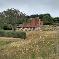
This West Sussex walk explores the South Downs to the north of Burpham village. Using a mixture of tracks and field paths the route offers some fine views and includes a section of the South Downs Way.
(D/A) The start is the car park (grid ref. TQ039089) adjacent to the village hall in Burpham village. Exit the car park onto the lane and bear left. Go left into the churchyard, bearing right to pass along the side of the church (which will be on your left). Exit the church yard via a stile and follow the signed path across a field with the boundary on your right to reach a lane (grid ref. TQ042092). Turn left along the lane with improving views to the Arun valley on your left.
(1) Continue past Peppering High Barn keeping straight ahead and ignoring the signed footpath on the right. This track leads you easily uphill to reach a fork in the track. Fork right, with the wood on your left. After about 100 metres, turn left through the wood on a narrow path to reach a track (grid ref. TQ044110). Go straight across following a clear path northwards with the field boundary on your right. Reaching a track keep straight ahead following a track as it descends into a valley. Stay on the track as it climbs steadily uphill to reach the South Downs Way (grid ref. TQ038124).
(2) Turn right along the South Downs Way. After a short way you can leave the enclosed path and cross a stile on your left and walk through the field adjacent to the path. Doing this provides unobstructed views north across the Weald and also along the South Downs in both directions. Continuing in westerly direction the path climbs gently onto Rackham Hill after which you need to return to the main path before crossing Springhead Hill. Descending from the latter, the path descends to a complex junction of paths and a road (grid ref. TQ070124).
(3) Turn sharp right here and follow the signed bridleway in a southwest direction. At the next path junction (grid ref. TQ061110) continue straight ahead. Soon the path goes right and shortly after reaches a junction of bridleways (grid ref. TQ060109). Turn left here and continue for about 300 metres south. Go through an opening and turn right to follow a path with the hedge on your right. This leads downhill into a large meadow where it is better to stay high on the right hand side and continue along the boundary to reach a grassy track that descends across the slope. This leads into an enclosed lane (grid ref. TQ048092). Go past the water treatment facility and a large house on your left to reach a lane (grid ref. TQ043090). Turn right and walk up the lane bearing left after a short way. Follow this lane past the hotel to a t-junction. Turn right and then left past the pub to the car park (D/A).
Waypoints :
D/A : km 0 - alt. 6m - Car park in Burpham village
1 : km 1.43 - alt. 56m - Peppering High Barn, continue
2 : km 4.31 - alt. 101m - Turn right
3 : km 7.5 - alt. 169m - Turn sharp right
D/A : km 12.65 - alt. 8m
This West Sussex walk explores the South Downs to the north of Burpham village. Using a mixture of tracks and field paths the route offers some fine views. In the early stages of the walk the view south and west over the Arun valley includes Arundel Castle in its lofty position above the river. As the countryside changes with the deep valleys on the southern flank of Amberley Mount. Turning east on the South Downs Way, the views north across the Weald are outstanding. Finally as the walk turns south the route crosses typical downland.
Visorando and this author cannot be held responsible in the case of accidents or problems occuring on this walk.
Global average : 4/5
Number of opinions : 1
Description quality : 4/5
Routemap quality : 3/5
Walk interest : 5/5
Global average : 4 / 5
Date of walk
: 05/07/18
Description quality
: Good
Easiness to follow the route
: Average
Walk interest
: Very good
We did this walk and it has beautiful views and covers some lovely countryside. But I agree with other review that the instructions are not clear in 2 places. Firstly to get up onto South Downs way, it should say to take the path on the right at the dam/waterhole and then follow path bearing left up hill. Then we got completely lost at the instruction ‘after the opening take the path on the right with a hedge in the right’ - we never found this and ended up using google maps for the last 2 miles but wasn’t very scenic! Would recommend with additional instructions
This West Sussex walk starts from Arundel with its Castle, Cathedral and lovely High Street. The route takes you through Arundel Park before dropping down to the path alongside the River Arun for the return to the start.
A linear West Sussex walk from Arundel to Amberley following the course of the River Arun. The return route can be completed using the regular train service.
This West Sussex walk offers a variety of scenery and includes a section of the South Downs Way National Trail. The route includes a visit to the village of Amberley from where convenient rail services are available.
Starting from Amberley, this West Sussex Walk explores the River Arun visiting the villages of North and South South Stoke. The return route follows sections of the Monarch's Way and the South Downs Way.
This West Sussex walk explores sections of two long distance trails from Amberley on the banks of the River Arun. The outward leg of the route follows the South Downs Way with the return along a section of the Monarch's Way.
An easy, varied and beautiful nine-mile walk taking in small paths, Parham House grounds, woodland, Rackham, more woodland, Wiggonholt and Pulborough Brooks. Plenty to see and enjoy
This walk in Slindon Estate is very easy and flat. Slindon Estate is 3500 acres of Sussex woodland, farmland, downland, and pretty villages all divided by paths, hedges, lanes and tracks leading up to the top of the downs.
This is a nice little 4 mile walk up to Cissbury Ring with amazing views over looking the sea and coastal towns of Worthing and Brighton from Cissbury Ring. Best attempted on a clear fine weather day so as to make the most of the views from the peak. This is a moderate walk that is not wheelchair friendly.
For more walks, use our search engine.
The GPS track and description are the property of the author.