Mill Lane car park is the closest from the starting point.
(S) From Storrington bus station, start walking head south to A283 and cross to Church Street, which becomes Greyfriars Lane. Walk to the end of Greyfriars Lane using a farm track until you reach Kithurst Park/Lane.
(1) Take a sharp left to Kithurst Park. At the junction with Amberley Road, cross carefully the road and turn right. After a few meters, look for a small path to your left.
(2) Turn left and follow the path until you hit the A283/Pulborough Road in Cootham.
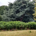
(3) Turn left and follow the West Sussex Literary Trail which is going through Parham House & Garden. There is some truly spectacular trees in the grounds and you may see deer and geese.
(4) Take the path on the right and keep following the West Sussex Literary Trail until you reach Rackham Street.
(5) Turn left on Rackham Street, pass some houses on your right and then, turn right at the car park. At the end of the small forest, turn left.
(6) Turn left through the fields and woods on Rackham Road.
(7) Turn left on Rackham Street, walk back to (5) and continue straight until you hit Greatham Lane. Cross it carefully to join the smaller path you see in front of you. It's tarmac for about a mile and a half to the footpath, but the route is through lovely woodland.
(8) From here, follow the path bearing left at the fork, which is heading to the RSPB Pulborough Brooks. After you pass it, head north and keep the river to your left until you will arrive in Pulborough (E).


