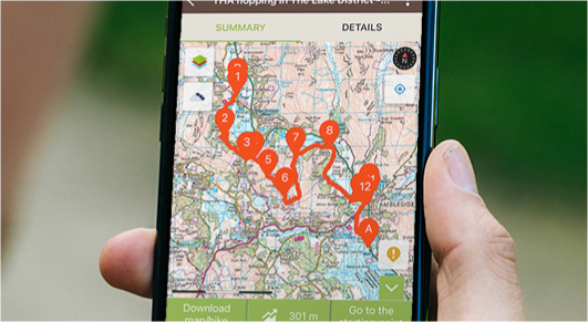
Topographic maps available on your mobile (even offline)
OS Explorer Great Britain
IGN France and overseas territories (topo & satellite maps)
 IGN Belgium
 IGN Spain
Swisstopo
USGS United States
High level of detail maps
Subscribing to OS Maps gives you access to unique levels of zoom and precise maps on your smartphone. Zoom levels goes up to 1:50 000 so it’s making it easier to find your way around.
Save money
1:25 000 OS Maps in paper costs at least £8.99 each covering a limited area. With Visorando Premium access the full set of OS Maps and overseas maps on your smartphone from £5.
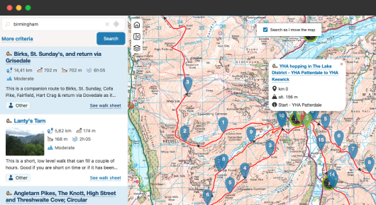
Easily change map layers while plotting a route or searching for a walk on visorando.com/en.
Walking route planner on your mobile phone
Plot your own routes and directly record it on smartphone using the Visorando mobile app. The route planner calculates the distance and elevation gain of your route simultaneously.
Advanced walking route planner on your desktop
Intuitive and ergonomic, it offers several possibilities:
- Full screen mode
- Automatically generate a return journey or reverse a route
- Import, export multiple GPX files
- Compoare and merge multiple routes
- Automatically center the map so it is easier to plot your route
No ads
There is nothing nicer than being able to smoothly and freely browse without being disturbed by advertisements. You will easily take the website in hand without having the risk to click on a link which does not interest you.
Detailed weather forecast
Easily consult 7 days of weather forecast (including 48h detailed hour per hour). You can also check the last 3 days weather forecast related to all the routes even for your private ones.
Real-time position sharing from the app
Your loved ones will be able to view your route, follow your progress minute by minute, locate you if necessary and know the battery level of your phone.
This feature available on the Visorando mobile app requires you to be connected to a mobile network.
Advanced search engine
The Visorando Premium subscription gives you access to several maps on the search engine on visorando.com (OpenStreetMap Hiking (Worldwide), OpenStreetMap (Worldwide), OpenStreetMap Cycling (Worldwide) and Topo IGN!).
Visualize easily the difficulties linked with the relief, the areas with a high drop, but also spot the remarkable sites and other natural curiosities such as waterfalls, caves, monuments…
Sort, classify and order your hikes on the app and on the Visorando website
You can now order all your hikes and classify them according to your preferences: by year, by theme, by region, by difficulty… In this way, you will more easily find the routes already taken and those to be done!
Hiking maps customizable according to your needs
Thanks to Visorando Premium, customize the PDFs of your hikes according to your needs. Choose the color and thickness of your plot, apply the scale and map layer of your choice (OSM, IGN, Satellite IGN, etc.), decide on the display mode (portrait or landscape) and the information to be included.
Do you love long-distance hiking? Frame the whole of your tour: place and overlap as many frames as necessary and no longer cut your hike in several pieces.
Export KML/Google Earth
By exporting your hikes on Google Earth, you have access to satellite images and relief of the entire globe in 3D. You can zoom in and out at any point of your hikes, get a better idea of the reality of the terrain and visualize your hikes from the sky.
Slope map layer of France
For those of you, who like to ski in the French Alps, the slope map makes it possible to visualize the inclination of slopes greater than 30° to understand risk areas and to anticipate the risk of avalanches.
 Offer the Visorando Premium experience to your loved ones
Discount code
Group offer
Are you a walking club wishing to subscribe to Visorando Premium?
Contact usYour online payment are entirely secure thanks to the plaform Stripe.
If you have any question related to your subscription or on how Visorando works, we engage ourselves to answer in a short delay.
It is always better to try before buying, that’s why Visorando offers 3 days free Visorando Premium trial period. The trial automatically starts as soon as your subscription on the mobile app is activated.
Your subscription is activated as soon as your payment is made without any delay.
Easily cancel automatic renewal of your Visorando Premium subscription by clicking in the menu “My Premium subscription”.
Go into the Menu “My account”, then “My Premium subscription” and then click on “See my invoices”.


