Country:

 City:
City:


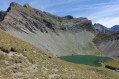
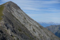
The car park is on the right-hand side before you enter the hamlet of Valsenestre
(S/E) From the car park, head north towards the hamlet, walk through it, then just after the chapel, turn left onto theGR®54B. The sign reads ‘4h00 Col de la Tomeïou’.
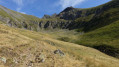
The path runs alongside the Béranger valley and climbs steeply very quickly, heading west.
It heads due north on the right into the Combe Guyon
(1) Ignore the small path branching off to the right and head slightly downhill towards the Fayolle stream
Cross it via a wooden footbridge; the path zigzags uphill through a mountain pasture and then continues along a ledge heading north.
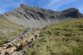
(2) Continue climbing, leaving the shepherd’s hut (Cabane de Combe Guyon) on your left.
TheGR® route has been diverted from the route shown on the map to go round the sheep pen.
You’ll reach a small clearing and then arrive at the Ruisseau de la Fayolle.
(3) Walk along the left bank before quickly heading up to the right, skirting the Combe and finally reaching Lac Labarre.
(4) Head left along the switchbacks towards a small pass, then finally reach the Col de Romeïou.
(5) Descend back to the small pass, then take a path to the right, staying on a contour line to go round the hillock. There are no markings until the Tête de Rame, but simply follow the track that runs along the ridge to the summit.
(6) Head back down the same path, heading towards the lake. Follow the same route as on the way up to the vicinity of the shepherd’s hut near the footbridge.
(2) Below the sheepfold, leave theGR® by turning right to follow the “Sentier de Martine” (1h 30min), skirting around the sheepfold. The path runs along a ridge with a beautiful view over the Combe Guyon and leads to another vantage point: the hamlet of Valsenestre, nestled in the upper Bérenger valley.
Continue southwards, crossing over to the other side of the valley along a grassy path, to begin the descent into the valley. Although not heavily used, the path is well maintained; there are no signposts, but they are not necessary.
Cross a beech forest, then a hazel grove where the descent becomes steeper. You’ll reach the upper Bérenger valley
(7) Cross the D117a road and follow it to the left for about 300 metres, until you reach the first bridge.
(8) Turn right onto a grassy, carriageable track.
Alternatively, you can take a shortcut by staying on the tarmac (a quiet little road) all the way to the car park.
(9) At a clearing, turn left onto theGR® path, which crosses a forest to rejoin the road and reach the car park (S/E)

 Visorando Member
 Moderate
 Difficult