Country:
 City:
City:


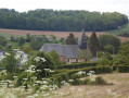
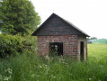
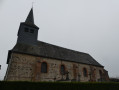
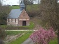
Start from the car park shared by the church and the village hall in Haudricourt.
(S/E) With your back to the village hall, leave the car park and turn right onto Rue des Écoles until you reach the junction with Route de l’Église. Turn right onto Route de l’Église. Continue along this road until you reach the junction with Route du Clos Bourdet.
(1) At the junction, turn right onto Route du Clos Bourdet. Leave the village of Haudricourt and continue along this uphill road until you reach a junction. At the junction, turn right and head towards the hamlet of Le Ménivier (Haudricourt).
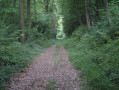
(2) Pass through the hamlet of Le Ménivier along this small road straight ahead, which turns into a track. Continue straight ahead along this descending track as it winds its way into the Bois de la Fontaine. Pass through the woods, staying on the same track, which at the bottom leads to the hamlet of Roupied (Haudricourt) and joins the D282.
(3) Turn right and follow the D282 until you reach the edge of Roupied. As you leave the hamlet, turn left onto the path that climbs and leads into the Bois de la Mare du Bois. Follow this ascending path, which turns left and then crosses two side paths.
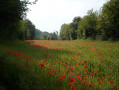
(4) At the top, as you emerge from the woods, continue straight on along the path across the plain, ignoring the path on the left, until you reach the crossroads by the wayside shrine.
(5) At the junction, take the path on your right, which initially crosses the Plaine de la Couture and then descends towards the hamlet of Villers (Haudricourt).
(6) At the bottom of the path, at the entrance to Villers, turn right onto Rue du Tortillard. Walk down this street and then take the second street on the left, Rue de l’Église. Follow this street to the junction with the D9 Route d’Aumale.
(7) Cross the junction with care and take the road opposite, Route de la Scierie. Continue along this road and take the first road on your right, Route de la Minette. Follow this road uphill; it runs alongside the Bois de Villers and leads to the La Minette and Monte à Peine farms.
(8) After the Monte à Peine farm, carry on along the same road until you reach the hamlet of Hardonseille (in the commune of Saint-Valéry, Oise department). Once you reach the hamlet of Hardonseille, continue to the junction.
(9) Take the road on your right. Follow this road, which curves slightly to the left and then turns into a grassy track. Continue straight on along this track until you reach the Bois de la Vergne.
(10) At the entrance to the woods, take the path on your right. Follow this path as it descends into the woods and, at the next Fork in the road, keep left, continuing downhill.
Continue through the woods, staying on the same path, which takes a sharp left-hand bend until you reach a crossroads. Turn right onto the path and continue your descent until you reach the junction with the Route d’Haudricourt au Bois.
(11) Take the Route d’Haudricourt au Bois on your right until you reach the junction with the D9. Cross the junction carefully and take the street opposite, Rue des Écoles. Follow this street until the junction with the Route de l’Église, where you will immediately come back to the car park where you started (S/E).


 Visorando Member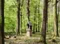
 Difficult
 Easy
Easy