The Massane Tower

A lovely heritage walk in the Massif des Albères, leading to the spectacular Tour de la Massane

Details

69795464
Creation:
Last update:
Last review:
  • Walking
    Activity: Walking
  • ↔
    Distance: 4.29 mi
  • ◔
    Average duration: 3h 30 
  • ▲
    Difficulty: Moderate

  • ⚐
    Back to start: Yes
  • ↗
    Ascent: + 1,768 ft
  • ↘
    Descent: - 1,785 ft

  • ▲
    Highest point: 2,717 ft
  • ▼
    Lowest point: 948 ft

Description of the walk

Park in the car park open in the low season situated on a forest track just past the hamlet of Lavail.

(S/E) From the car park, head along the forest track, below the coastal river the Massane, until you reach a junction.

(1) Leave the track and turn left onto the path that climbs through the woodland (yellow markings). This section features steep gradients (almost 300 m of elevation gain over approximately 1.2 km). You’ll reach the Roc del Grill junction.

(2) Turn right towards the Massane, following an almost straight path for about 500 m (a chance to give your legs a bit of a rest). The climbs gradually resume before you reach another junction of paths.

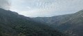
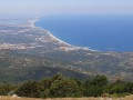
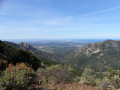
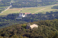
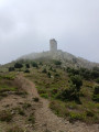
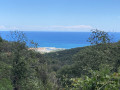
(3) Head up to the right towards La Massane (with a view of the ‘Grande Bleue’ behind you). There’s still a bit of effort required before reaching the spectacular Tour de la Massane, which offers a marvellous panorama of the Mediterranean and the coastal villages, such as Argelès and Collioure. 

(4) Head back along the same path you took on the way out, in the opposite direction, to finish this fairly challenging hike and return to the car park (S/E).


Waypoints

  1. S/E : mi 0 - alt. 981 ft - Lavail Gorges car park - Massane (fleuve)
  2. 1 : mi 0.19 - alt. 965 ft - Junction shared by the outbound and return routes
  3. 2 : mi 0.77 - alt. 1,850 ft - Junction - Col d’accès à la Tour de la Massane depuis La Vall, Lavall, Lavail
  4. 3 : mi 1.77 - alt. 2,306 ft - Trail junction
  5. 4 : mi 2.13 - alt. 2,687 ft - Tour de la Massane
  6. S/E : mi 4.29 - alt. 981 ft - Lavail Gorges car park - Massane (fleuve)

Notes

Three-quarters of the route is in the shade.
No water points.

Worth a visit

Reviews and comments

5 / 5
Based on 2 reviews

Reliability of the description
5 / 5
Ease of following the route
5 / 5
Route interest
5 / 5
Guillemette90
Guillemette90

Very pleasant hike, best avoided in hot weather. Spectacular views!

Machine-translated

User 25431923

Overall rating : 5 / 5

Date of your route : Jun 05, 2025
Reliability of the description : ★★★★★ Very good
Ease of following the route : ★★★★★ Very good
Route interest : ★★★★★ Very good
Very busy route : No

The trail is well marked and the walk is ideal, but it climbs steeply right from the start. Difficult for beginners. I find the medium difficulty rating a bit low.

Machine-translated

Isard63
Isard63

Overall rating : 5 / 5

Date of your route : Apr 30, 2025
Reliability of the description : Not used / Not applicable
Ease of following the route : ★★★★★ Very good
Route interest : ★★★★★ Very good
Very busy route : No

We hesitated for quite a while before parking the car in the final car park, as the signs giving directions to it were extremely contradictory: no entry except for residents, except from 15 July to 15 September, and so on. The town hall really ought to be clearer.
Otherwise, the walk is simply splendid, with a profusion of flowers at this time of year. There are beautiful views of the (snow-capped) Canigou massif and the coast. The panorama from the tower is magnificent. The cork oak forest features some truly remarkable trees, some of which are probably over a hundred years old.

Machine-translated

Other walks in the area

For more walks, use our search engine .

The GPS track and description are the property of this route's author. Please do not copy them without permission.