Country:

 City:
City:


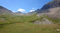
Park in the Arpettaz car park on the Route des Confins.
(S/E) Take theGR®® Tournette-Aravis trail towards Bombardellaz as far as the Chalet de Paccaly, keeping to the left.
(1) Just before the chalet, take the path on the right which climbs up to Paccaly d’en haut.
(2) Pass the path on your right leading to the Combe de Paccaly, then the Rochers de la Salla, and continue straight on towards the north-east until you reach a wide track. Follow it to the right for a few tens of metres until thefirst right-hand bend, at an elevation of 1,765 on the IGN map (Sous Tardevant).
(3) Turn left off the well-used track leading to Lac de Tardevant. Begin the traverse towards the Combe de la Grande Forclaz, following the sign for Rocher de Rô.
(4) From here, the route is unmarked but the path is easy to follow. You will soon reach a Fork in the road at the bottom of the valley, marked by a simple wooden arrow (Combe de la Grande Forclaz).
(5) Turn right towards the grassy ridge flanked by the Aiguilles Noires and the Mamule. At around 1,800 metres, the path splits in two: to climb this moraine mound, take the left-hand path if continuing straight on, or the right-hand path. Continue to the right along the slightly less well-marked track. The climb becomes a little steeper, crosses some sharp limestone pavements, then passes beneath the rocky ridges of the Aiguilles Noires to the foot of the scree slope (altitude around 2,000 m).
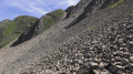
(6) Here, vegetation gives way to rock. There is still a 300-metre climb ahead on a very well-marked path through the scree slope (exposed to frequent rockfalls on both sides). The red markings (dots, dashes and occasionally arrows) along the scree slope, as well as a few cairns, prove useful only on the final, steeper slopes, before reaching the ridge with views of the Mont Blanc and Aiguilles Rouges massifs at the Passage de la Grande Forclaz.
(7) Panoramic view of the Combe des Fours; below on the left, the Col de Niard; the Petit Pâtre hut and the Croisse Baulet on the right. Once you reach the ridge, head right along the grassy terraces of the ridge itself (ignore the side path which continues towards the Ambrevetta).
(8) At the large cairn, head down to the left towards the east. The fairly obvious path, marked by a few cairns, descends through schist terrain (to be avoided in wet weather) to reach the Col de Portette.
(9) From the pass, head down to the right towards the Chalets de Cœur. The path crosses a few gullies that can be dangerous in wet weather and quickly loses altitude as it passes at the foot of the Miaz, swapping the rugged landscape you’ve just traversed for a world of peaceful mountain pastures. Pass the Torrent de la Miaz on the left, then reach the Chalet de Cœur.
(10) Follow the 4x4 track linking the chalets to Sallanches as far as the Pierre Fendue.
(11) Continue to the left, heading north towards Mayères/Le Tournieux, with the Quatre Têtes in your sights. You can hear the Torrent and the Waterfall des Fours from a distance. Cross a wooden bridge. The tree-lined track becomes a footpath and crosses another branch of the torrent before branching off.
(12) Leave the route towards Mayères and take the path that climbs to the left towards the Combe des Fours (unmarked route). The steep climb is equipped in places with a few cables and iron steps. After several hundred metres, the path turns westwards to reach the junction for Chombas.
(13) Near the 1874-metre mark (IGN map), ignore the path leading off to the right towards the foot of the Pointe de Chombas and continue up the grassy slopes towards the Combe des Fours. Passing through the hamlet of La Chombas (alt. 1956) and the Cabane Maury, this oasis is suspended between the cliffs and scree slopes on the eastern side of the Aravis, and the Arête de la Besse, which separates the Gouille des Fours from the mountain pastures to the west. You will reach a red and yellow marker post at a junction.
(14) The path continues southwards. Take the track heading east for a detour via Lac de la Gouille des Fours, which is well worth a visit.
(15) From the lake, head south and follow the valley all the way to the Col de Portette. Join the path that climbs to the Passage de la Grande Forclaz.
(16) Turn right, heading in the opposite direction to the way out. Return to the ridge and the Passage de la Grande Forclaz.
(7) Turn left, heading north-west, walk along the valley, descend the scree slope and reach the Fork in the road.
(6) Turn right to go round the grassy shoulder on the Mamule side this time, and rejoin the path you took on the way out at the bottom of the valley.
(5) From here, the return journey follows the same route as the outward journey (S/E).
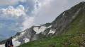

 Visorando Member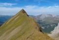
 Difficult
 Easy
Easy 
 Extremely difficult