Country:

 City:
City:



To get to the starting point, head towards Souchez and park in the car park of the ‘Memorial 14-18’ History Centre at Notre-Dame-de-Lorette, located on Chemin de Lens.
(S/E) From the car park, head back along Chemin de Lens, turn right and cross the D 937 at the pedestrian crossing to take the small path that runs between two houses.
(1) At the junction with Rue du Docteur Henri Wagnon, turn right heading north-west and cross the D 48E3.
Continue along the stony path marked by an information sign about walks and hikes. Keep going in this direction for about 1 km.
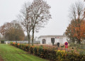
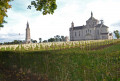
(2) At the junction with Chemin du Roi d’Angleterre, turn left to continue along a country lane that climbs gradually towards the top of the hill. At the T-junction, turn right onto the tree-lined path to reach the western entrance to the ‘Nécropole Nationale de Notre-Dame de Lorette’. Walk past the 14-18 Museum. (For those interested in the history of the site, this museum houses a wealth of artefacts and everyday items used by soldiers, as well as weapons and a section of reconstructed trenches based on actual German trenches. The display cases are well labelled and give a good insight into the conflict in the Artois sector). Continue along the tarmac road, where you can see, on your right, the remains of trenches in land scarred by shell craters and, on your left, the vast cemetery where the rows of White Crosses are a striking sight.
(3) Opposite the basilica, turn right onto theGRP® Bassin Minier Nord Pas de Calais trail. Walk north-west for 1.3 km.
(4) At the crossroads, head left to follow the path down into the Bois l’Abbé valley. At the bottom of the path, turn left to rejoin Rue Marcel Lancino, then turn left into Rue de la Vallée du Chauffour. On this street, after the right-hand bend, carry on straight ahead to rejoin a path at No. 12.
(5) Continue along this tree-lined path for 700 metres until you reach Rue Ponthiers. From the start of this street, head down a small path on the right and go round the football pitch on your left until you reach the Ruisseau le Saint-Nazaire.
(6) Continue along this path heading south-east for 600 metres. Take care when crossing Rue Ponthiers, Rue du 8 Mai and Rue du Flot in turn.
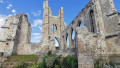
(7) On Rue Marcel Lancino, turn left, then left again after the bend onto Rue de la Blanche Voie. Walk past the ruins of the old church. At the end of the street, turn right and walk to the last houses on Rue de Lens.
(8) Continue along the path through open countryside and keep heading in this direction for just over a kilometre to reach the crossroads from the outward journey.
(1) Carry on straight ahead, following the route in the opposite direction to the outward journey, until you reach the car park where you started (S/E).

 Visorando Member


 Moderate
 Association / Club / Walk leader

 Difficult