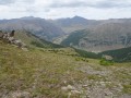
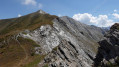
La Colette and the Crête de Gilly from Ristolas

A long circular walk which, above all, takes you along the Crête de Gilly and its viewpoints over two valleys – the Guil and the Bouchet – and across to Italy in the distance.

Details

26351445
Creation:
Last update:
Last review:
  • Walking
    Activity: Walking
  • ↔
    Distance: 8.65 mi
  • ◔
    Average duration: 6h 45 
  • ▲
    Difficulty: Difficult

  • ⚐
    Back to start: Yes
  • ↗
    Ascent: + 3,212 ft
  • ↘
    Descent: - 3,205 ft

  • ▲
    Highest point: 8,471 ft
  • ▼
    Lowest point: 5,259 ft

Description of the walk

Park in Ristolas, at the side of the road, opposite the wooden bridge (sign).

(S/E) Take the path leading uphill towards the Colette de Gilly, marked in white and red (a variant ofthe GR®58), ignoring all the paths on the left that lead to Abries or come from the ski lift terminus. Pass under various ski lifts and arrive at the Col de Gilly.

(1) At the pass, turn right onto the Crête de Gilly path, which climbs steeply before levelling out along the ridge.

(2) Begin the long descent into the valley, staying on theGR® 58 (variant) until you reach the hamlet of La Monta, where you join the D947.

(3) Follow the road to the left for about a hundred metres, then cross the bridge over the Guil.

(4) Turn right to follow the river towards Ristolas and its wooden bridge, which you cross to return to the starting point (S/E).

Waypoints

  1. S/E : mi 0 - alt. 5,259 ft - Wooden bridge - Guil (rivière)
  2. 1 : mi 2.75 - alt. 7,759 ft
  3. 2 : mi 3.89 - alt. 8,376 ft - Descent - La crête de Peyra Plata et de Gilly
  4. 3 : mi 6.72 - alt. 5,459 ft - La Monta, D947 - Refuge de la Monta
  5. 4 : mi 6.88 - alt. 5,463 ft - Turn right
  6. S/E : mi 8.65 - alt. 5,266 ft - Ristolas. Bridge

Notes

Water available in Ristolas and at the lodges.
Walking poles recommended.

Worth a visit

Queyras Park Nature Centre in Ristolas.

Always be cautious and plan ahead when you're outdoors. Visorando and the author of this route cannot be held responsible for any accidents occurring on this route.

The GR® and PR® markings are the intellectual property of the Fédération Française de Randonnée Pédestre.

Reviews and comments

5 / 5
Based on 2 reviews

Reliability of the description
5 / 5
Ease of following the route
5 / 5
Route interest
5 / 5
pdf06
pdf06

Overall rating : 5 / 5

Date of your route : Sep 19, 2025
Reliability of the description : ★★★★★ Very good
Ease of following the route : ★★★★★ Very good
Route interest : ★★★★★ Very good
Very busy route : No

A long and fairly challenging walk, but the view from the ridges makes it well worth the effort. Bring plenty of water in hot weather.

Machine-translated

marseille2
marseille2

Overall rating : 5 / 5

Date of your route : Jul 19, 2024
Reliability of the description : ★★★★★ Very good
Ease of following the route : ★★★★★ Very good
Route interest : ★★★★★ Very good
Very busy route : No

Significant elevation gain, stunning views of the ridges. Make sure you take enough water – it was very hot that day.

Machine-translated

Other walks in the area

For more walks, use our search engine .

The GPS track and description are the property of this route's author. Please do not copy them without permission.