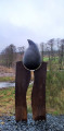
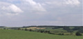
Rolley Pond and the water tower

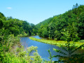
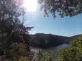
A walk through fields and woodland, taking in an old water tower and a magnificent pond.

Details

5553722
Creation:
Last update:
Last review:
  • Walking
    Activity: Walking
  • ↔
    Distance: 5.73 mi
  • ◔
    Average duration: 2h 55 
  • ▲
    Difficulty: Moderate

  • ⚐
    Back to start: Yes
  • ↗
    Ascent: + 318 ft
  • ↘
    Descent: - 305 ft

  • ▲
    Highest point: 1,686 ft
  • ▼
    Lowest point: 1,437 ft

Description of the walk

You can park on the lawn next to the church, which has not been in use for several years.

(S/E) With your back to the church, head left to walk back up through the village. At the next junction, take the road to the right – cross carefully! Carry on to the junction near the ‘Hemroulle’ exit sign.

(1) Turn left and carry on along the fields until you reach the junction, after a long left-hand bend.

Yellow markings

(2) Turn right. From this path, start following the yellow markings (triangle + 2 circles) along the track to the crossroads before the water tower.

(3) Carry on straight ahead, leaving the water tower on your left, and head down the path to the side. At the bottom of the field, turn right and continue for about a hundred metres until you reach the Fork in the road.

(4) Ignore the path on the right – this will be your return route – and keep to the left, heading north-east.

(5) Before you reach the road, turn left. At the Fork in the road between the two fields, take the path heading to the right. Walk down alongside the field to the next crossroads.

(6) At the crossroads, take the path directly ahead, which veers slightly to the left. You’ll reach the Étang de Grand Vivier; continue along the path as it curves to the right. Walk through the tree-lined avenue until you reach the main road (N854).

No signposting

(7) Taking care, walk up the road to the right for about 50 metres and turn immediately right. Continue straight on until you reach the edge of the field again.

(6) From there, retrace your steps until you reach the Fork in the road you passed on the way out.

(4) Head down the path on your left. Carry on straight ahead until you reach thefirst road, which you should cross carefully. Carry on straight ahead until you reach thesecond road to return to the starting point (S/E) – we hope you enjoyed the walk.

Waypoints

  1. S/E : mi 0 - alt. 1,575 ft - Car park - Église de Hemroulle
  2. 1 : mi 0.23 - alt. 1,611 ft - Crossroads – Hemroulle exit
  3. 2 : mi 0.81 - alt. 1,591 ft - Crossroads – Yellow markings
  4. 3 : mi 1.53 - alt. 1,673 ft - The water tower
  5. 4 : mi 1.85 - alt. 1,634 ft - Y-junction
  6. 5 : mi 2.28 - alt. 1,608 ft - Turn left at the fork
  7. 6 : mi 2.94 - alt. 1,483 ft - Junction of the circular loop
  8. 7 : mi 3.64 - alt. 1,463 ft - Road N854
  9. S/E : mi 5.73 - alt. 1,572 ft - Église de Hemroulle

Notes

There are no drinking water points along the route.
There are no benches along the path

Reviews and comments

5 / 5
Based on 2 reviews

Reliability of the description
5 / 5
Ease of following the route
5 / 5
Route interest
5 / 5
kami
kami

Overall rating : 5 / 5

Date of your route : Nov 16, 2022
Reliability of the description : ★★★★★ Very good
Ease of following the route : ★★★★★ Very good
Route interest : ★★★★★ Very good
Very busy route : No

A lovely walk with some stunning views, far from any houses. You really are out in the countryside. We did it in mid-November and didn’t come across a single soul. Absolute peace and quiet – highly recommended for anyone who appreciates that sort of thing.

Machine-translated

Christianne
Christianne

Overall rating : 5 / 5

Date of your route : Sep 27, 2021
Reliability of the description : ★★★★★ Very good
Ease of following the route : ★★★★★ Very good
Route interest : ★★★★★ Very good
Very busy route : No

A lovely walk. As mentioned, there are no benches, but near the pond you can sit on the parapet above the pond’s overflow weir. A clean and beautiful spot.
It’s not difficult, and there are some lovely countryside views and a bit of woodland.

Machine-translated

Other walks in the area

For more walks, use our search engine .

The GPS track and description are the property of this route's author. Please do not copy them without permission.