Country:
 City:
City:


Park at an angle (5 to 6 spaces) in a small car park on the side of the D20, known as the Route des Châteaux, near the Poulhoat P71 bus stop.
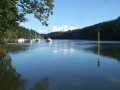
(S/E) Opposite the car park, cross the D20 with care to find, behind the embankment, a footpath closed to motorised vehicles (sign) and follow it to the right, running parallel to the road. At the crossroads, turn right to cross the D20 again with care and continue straight ahead on the road towards Meilh Kerdour (Kerdour Mill). Ignore the road continuing to the left (no entry except for residents) and take the one signposted as a dead end (a small sign for ‘L’Odet’, somewhat hidden amongst the foliage of a hedge). Continue along the path which leads out opposite the Anse de Kerdour, which you will follow along.
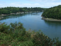
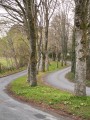
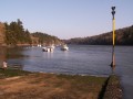
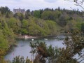
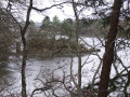
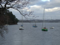
(1) At a gate, turn left and continue across a grassy area lined with old trees overlooking this branch of the Odet. On your right, you’ll see some modern houses and beautifully landscaped gardens. Pass a signpost marking an old route between two mills, continue along this path to the banks of the Odet (view of Kerdour Castle on the other side of the cove) and reach a metal gate.
(2) This section is closed from 1 October to 31 March to protect wintering birds (see the ‘Practical Information’ section). Retrace your steps to the signpost between the two mills, then head up to the left along the edge of a property to reach the road leading to the residential area of Porrajenn. Turn right onto this road and walk along a wide footpath to reach a junction.
(3) Turn left and follow the road which passes through several residential areas. Keep heading south-east and ignore the various streets on both the right and left.
(4) Pass a beautiful stone farmhouse with a bread oven and reach a Fork in the road. Ignore the road marked ‘no entry’ and continue along the one in the 30 km/h zone. After a small car park, follow the path to the left through a grassy area to reach the edge of the Étang de Kerbernez.
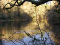
(5) Turn left to follow the path right alongside the pond, which is teeming with mallards. Continue until you reach the embankment separating the pond from the Odet.
(6) Turn right to cross the dyke for the first time, then take the steps on the left to continue along the path at the edge of the woods and reach the Trois Tourtes site. Cross the footbridge to reach this islet (see the description in the ‘Sights to see during the walk’ section).
(7) Retrace your steps and continue to the left along the edge of the woods. Pass an old, abandoned house – which may have been that of the woman mentioned in the legend (?) – and carry on straight ahead until you reach a gate on the right.
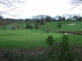
(8) Ignore, for now, this lovely lane – which you’ll take on the way back – and carry on with the Kerbernez Golf Course on your right. At the end of the path, turn right, then head down to the left to cross a small stream, before climbing back up the other side to reach a viewpoint overlooking the Anse de Saint-Cadou, where a tributary of the Odet flows into the sea. Continue along the path, which narrows. Pass three fallen trees blocking the path (easy to go round) and carry on to the end of the path, marked by a barrier of branches blocking the way (the IGN map is inaccurate).
(9) Turn back and follow the same route to return to the gate and the path you passed by on the way there (view of the rear of the Manoir de Lanroze on the opposite bank, formerly owned by the Marquise de Sévigné, though she never stayed there).
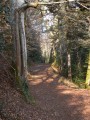
(8) Turn left, go through the gate and follow this lovely lane straight on, running alongside the golf course. At the end, turn right next to a small pond and then turn left to walk to and from the Manoir de Kerbernez, now the golf clubhouse (a sign indicates that access is permitted). A horticultural college is situated on this site (note the two rows of camellias with gnarled trunks as you arrive in front of the manor house). On the way back, turn left and, near an old brick water tower, turn right onto a wooden walkway which leads to a path overlooking the pond. Walk to the end and take the steps to cross the embankment for the second time.
(6) Turn left to walk as close as possible to the pond. When you reach a house on your right, leave the pond’s edge on the right and join a road leading to some houses. Carry on, then turn right at the corner of a thatched cottage and arrive at the Fork in the road with the ‘No Entry’ sign you saw on the way out. Head straight up this road to the farmhouse you spotted on the way out (there’s a large cypress tree on the right).
(4) Take a grassy path to the left at the corner of a house (pebbles on the ground); this leads onto a dead-end street. Continue straight on, still following the grassy path, which bends to the right and then to the left, leading onto another dead-end street (route visible on OSM). Carry on straight ahead, entering a wooded area. At the last house, turn left to follow a path along the edge of the woods. Turn right past a stream, with a stream below on your left, and arrive near a golf course.
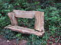
(10) Turn slightly right, skirting the golf course, and at the next junction (marked by a rustic bench), turn left and continue along the wooded path which runs alongside a marshy meadow area and leads to the car park on the edge of the D20 (S/E).



 Visorando Member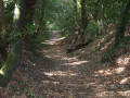

 Moderate