


Refine your search for walks in Claï Inférieur
Claï Inférieur walks


 Lower Claï from the Vens car park
 Visorando Member
 9.16 mi
 +3,540 ft
 -3,540 ft
 7h 20
7h 20
 Difficult
 Departure from Saint-Étienne-de-Tinée (Alpes-Maritimes)
A little-known viewpoint above the Lakes of Vens and Babarottes. A 360° panorama stretching from Mont Ténibre to Mont Mounier, as well as the Tête de l’Enchastraye and the Cime de Pal...
Walks near Claï Inférieur
Refuge de Vens - Camp des Fourches
 7.34 mi
+2,090 ft
-2,441 ft
5h 10
7.34 mi
+2,090 ft
-2,441 ft
5h 10
 Moderate
Departure from Saint-Étienne-de-Tinée (Alpes-Maritimes)
Moderate
Departure from Saint-Étienne-de-Tinée (Alpes-Maritimes)
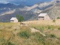
Thisthird and final stage of the Tour du Mont Aiga starts from the Refuge de Vens and crosses a balcony below the slopes of the Aiguilles de Tortisse to the north-east of the Lacs de Vens. After passing the Crête de la Côte and descending to the Maisons Forestières de Tortisse, you will walk along a balcony path beneath the slopes of the Tête des Mourres to reach the Morgon plateau and climb back up to Laussets and finally to the Lacs de Morgon. At the large Morgon lake, you will descend eastwards into Salso Moréno to rejoin the path of thefirst stage and Camp des Fourches. It is possible to see chamois early in the morning and, of course, marmots throughout the day.
From the Vens mountain hut to the hamlet of Le Pra via the Morgon Lakes
 6.18 mi
+1,178 ft
-3,455 ft
3h 50
Moderate
Departure from Saint-Étienne-de-Tinée (Alpes-Maritimes)
6.18 mi
+1,178 ft
-3,455 ft
3h 50
Moderate
Departure from Saint-Étienne-de-Tinée (Alpes-Maritimes)
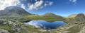
Second part of the circular route to explore the magnificent Lacs de Vens.
Starting from the Vens Lakes and Vens Refuge, the route leads to the hamlet of Le Pra via the small pass of Tortisse, the Col du Fer, the Pas de Morgon and the Morgon Lakes.
Small pass of Tortisse – Cime du Fer – Saint-Étienne-de-Tinée
 9.23 mi
+1,955 ft
-6,621 ft
5h 55
Difficult
Departure from Saint-Étienne-de-Tinée (Alpes-Maritimes)
9.23 mi
+1,955 ft
-6,621 ft
5h 55
Difficult
Departure from Saint-Étienne-de-Tinée (Alpes-Maritimes)
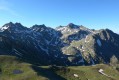
Before descending back to Saint-Etienne-de-Tinée, you climb to the Cime du Fer (2,700 m), which offers a superb 360° view, notably of the Tête de Moïse (3,104 m) and the magnificent Mont Viso (3,841 m).
Then we descend alongside the Tortisse torrent before heading back towards the Lacs de Vens and climbing up to the Lac des Babarottes.
We continue along a section of the Chemin de l’Énergie until we catch sight of Mont Ténibre.
We then finish with a long descent (-1,200 m) down to the village.
Le Pra – Vens Mountain Hut
4.69 mi
+2,792 ft
-417 ft
4h 35
Moderate
Departure from Saint-Dalmas-le-Selvage (Alpes-Maritimes)
A first day to stretch your legs and discover the magnificent natural setting of the Vens lakes.
Note: as this route ends in Saint-Étienne-de-Tinée, it is advisable, if possible, to park a second car in Saint-Étienne-de-Tinée to shuttle back to the starting point. Otherwise, allow around €25 for the taxi journey from Saint-Étienne-de-Tinée to Le Pra, but please note that booking is required a few hours in advance.
Saint-Etienne-de-Tinée - Lacs de Vens - Small Pass of Tortisse
 7.52 mi
+5,942 ft
-1,342 ft
7 hrs
7.52 mi
+5,942 ft
-1,342 ft
7 hrs
 Very difficult
Departure from Saint-Étienne-de-Tinée (Alpes-Maritimes)
Very difficult
Departure from Saint-Étienne-de-Tinée (Alpes-Maritimes)
First stage of a two-day hike in the Haute-Tinée.
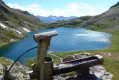
Ascent to the magnificent Lacs de Vens and the small pass of Tortisse via the Claï valley and Lac des Babarottes.
Plenty of marmots and chamois around the Lacs de Vens and below the small pass of Tortisse.
Saint-Étienne-de-Tinée - Rabuons Refuge
 4.55 mi
+4,951 ft
-423 ft
6h 25
Difficult
Departure from Saint-Étienne-de-Tinée (Alpes-Maritimes)
4.55 mi
+4,951 ft
-423 ft
6h 25
Difficult
Departure from Saint-Étienne-de-Tinée (Alpes-Maritimes)
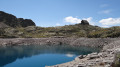
This first stage will take you to the Rabuons mountain hut, on the shores of the largest lake in the Alpes-Maritimes.The landscape is very rocky. You’ll come across plenty of Italians, as just across the border there are several mountain huts offering lovely routes via the nearby Pas de l’Ischiator.
⚠️ Allow around 4 hours for an average hiker in good physical condition to complete this walk.
Rabuons Mountain Hut – Saint-Étienne de Tinée
4.93 mi
+164 ft
-4,642 ft
2h 25
Moderate
Departure from Saint-Étienne-de-Tinée (Alpes-Maritimes)
The final day is less demanding than the previous one, consisting entirely of a descent. It’s a chance to walk the ‘Chemin de l’Énergie’ one last time before a long descent to Saint-Étienne-de-Tinée.
Camp des Fourches - Ferrere Refuge
 6.25 mi
+1,381 ft
-2,615 ft
4h 05
Moderate
Departure from Saint-Dalmas-le-Selvage (Alpes-Maritimes)
6.25 mi
+1,381 ft
-2,615 ft
4h 05
Moderate
Departure from Saint-Dalmas-le-Selvage (Alpes-Maritimes)
This first stage of the Tour du Mont Aiga starts from Camp des Fourches on the Bonette road and, via the Col des Fourches, descends into the large Salso Moreno valley, which you climb back up to the Col de Pouriac. From the Col de Pouriac, you quickly reach Bassa di Colombart and then, after a long descent through the mountain pastures, the charming village of Ferrere. You may encounter flocks of sheep in Salso Moreno and, at night, the wolves that prey on them.
Bacchi Rossi Refuge - Vens Lakes Refuge
 4.60 mi
+2,359 ft
-807 ft
4h 10
Moderate
Departure from Argentera (Cuneo)
4.60 mi
+2,359 ft
-807 ft
4h 10
Moderate
Departure from Argentera (Cuneo)
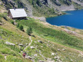
On thissecond day of the Tour of Mount Aiga from the Ferrere Refuge, you will pass through Plan de Belvédère, where there is a tin shelter overlooking the Rio Forneris valley and a fountain. You will also pass below Lake Emma, Monte Peiron at 2,796 m and Pointe Testa di Garbe at 2,749 m, to arrive, after a few hairpin bends, at Col de Fer at 2,584 m. You will then head towards Small Pass of Tortisse and the Vens Refuge, the end of this stage.
Auron – Longon dairy farm
 16.41 mi
+5,928 ft
-4,970 ft
10 hrs
Very difficult
Departure from Saint-Étienne-de-Tinée (Alpes-Maritimes)
16.41 mi
+5,928 ft
-4,970 ft
10 hrs
Very difficult
Departure from Saint-Étienne-de-Tinée (Alpes-Maritimes)
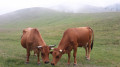
A long but beautiful stage combining the austere landscape of Mont Mounier with the green mountain pastures of Longon.Look up to watch the vultures.A gentle finish at the Vacherie de Longon, surrounded by animals.