Country:

 City:
City:


The route starts at marker 20, at the Vens car park, on the Route de la Bonette.
(S/E) Head towards Claï via the Piste de l’Eau (south-south-east then east). Reach the first valley floor and cross the torrent via a footbridge.
(1) Immediately afterwards, pass marker 21 and continue along the track, heading south-west.
(2) Pass the 1650 mark, ignoring a path coming from the right. Continue southwards, gradually climbing.
(3) At a junction (elevation 1799), continue uphill along the track on the left.
(4) At marker 115 (see an alternative starting point in the practical information), continue uphill (north-east) to marker 114.
(5) Leave the track and take the path leading uphill to the left (north-east).
(6) Shortly afterwards, cross the Riou de Claï and continue towards the Clot des Nières. Climb the winding path, heading generally north-north-east. Pass the Clot des Nières and continue north-east.
(7) About a hundred metres above the Clot des Nières, the route changes direction: follow an ascending traverse heading north-north-west to reach marker 113, which leads to the Chemin de l’Énergie.
(8) Follow the Chemin de l’Énergie to the left (north-west). Climb the winding path to reach the junction of the Crête des Babarottes and the Crête de Chanier.
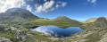
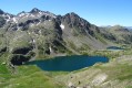
(9) On the ridge (with a direct view of Lac des Babarottes), turn left (due east). Continue as best you can in this direction to reach the summit of Claï Inférieur.
(10) The return journey follows the same route in the opposite direction, back to the Vens car park (S/E).


 Visorando Member

 Moderate