Bouffard route

Visit to an alpine hamlet at the foot of Roche Charnière on the outskirts of the Écrins National Park.

Details

89021
Creation:
Last update:
Last review:
  • Walking
    Activity: Walking
  • ↔
    Distance: 3.25 mi
  • ◔
    Average duration: 2h 30 
  • ▲
    Difficulty: Moderate

  • ⚐
    Back to start: Yes
  • ↗
    Ascent: + 1,181 ft
  • ↘
    Descent: - 1,184 ft

  • ▲
    Highest point: 5,712 ft
  • ▼
    Lowest point: 4,724 ft

Description of the walk

Park in the village of Le Ponteil; please note there are few spaces – if all are full, continue to the car park at the village exit.
(S/E) Head south on theGR®50, then leave it after 500m.

(1) Turn right onto the track leading to Tramouillon.

(2) After the first hairpin bend, turn left onto the poorly marked path that winds through the forest.
Initially gentle, it soon becomes very steep, leading out onto the mountain pasture just before the Bouffard chalets at the crossroads at an altitude of 1,724 metres.

(3) Continue on to the chalets.

(4) Then return to the junction at the 1724-metre mark.

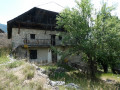
(3) Turn right onto the path and cross the Torrent de Bouffard. You will then come to a wide track rutted by timber hauling, before reaching the alpine hamlet of Les Preyts (marked ‘Spreyts’ on the sign).

(5) Join theGR®50, turn left and, on a level stretch, cross the Torrent de Bouffard again via a brand-new footbridge, and further on, the Torrent du Rivet. You’ll reach the first junction of the morning.

(1) Turn right to return to the car park (S/E).

Waypoints

  1. S/E : mi 0 - alt. 4,760 ft - Ponteil car park
  2. 1 : mi 0.23 - alt. 4,915 ft - Tramouillon crossroads
  3. 2 : mi 0.44 - alt. 5,079 ft - Bouffard crossroads
  4. 3 : mi 1.13 - alt. 5,584 ft - Elevation 1724
  5. 4 : mi 1.33 - alt. 5,712 ft - The hamlet of Bouffard
  6. 5 : mi 2.18 - alt. 4,724 ft - The hamlet of Preyts
  7. S/E : mi 3.25 - alt. 4,757 ft - Ponteil car park

Notes

Water is available in the streams and the springs that feed them, but must be used with care.
Springs near the chalets.

Worth a visit

The Freissinières Valley, a centre of Protestantism in the Hautes-Alpes.
Dormillouse, a secluded village accessible only on foot.
There are numerous hikes, notably the Tour de Roche Charnière, the peak overlooking Bouffard – a route to be described… soon.

Always be cautious and plan ahead when you're outdoors. Visorando and the author of this route cannot be held responsible for any accidents occurring on this route.

The GR® and PR® markings are the intellectual property of the Fédération Française de Randonnée Pédestre.

Reviews and comments

5 / 5
Based on 2 reviews

Reliability of the description
5 / 5
Ease of following the route
5 / 5
Route interest
5 / 5
jp11
jp11

Overall rating : 5 / 5

Date of your route : Oct 10, 2025
Reliability of the description : ★★★★★ Very good
Ease of following the route : ★★★★★ Very good
Route interest : ★★★★★ Very good
Very busy route : No

A beautiful route in glorious weather with the first colours of autumn. Really enjoyed the Bouffard site and the return along the balcony between (5) and (1). Two small points to note. Point (2) is a little higher than on the map (50 m from the hairpin bend) and there is a cairn at the entrance. Similarly, point (4) is lower than on the map. The logging track can be avoided by taking the hairpin bends that cross it several times.

Machine-translated

Other walks in the area

For more walks, use our search engine .

The GPS track and description are the property of this route's author. Please do not copy them without permission.