Belle-Île-en-Mer: Les Poulains – Donnant

Belle-Île-en-Mer is the largest and most majestic of Brittany’s islands.
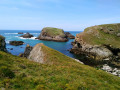
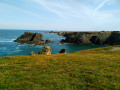
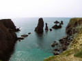
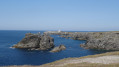
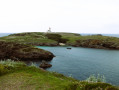
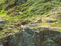
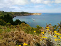
The coastal path allows us to walk all the way round the island and appreciate the beauty and variety of the landscapes. This walk is on the south coast (the ‘wild coast’), facing the Atlantic winds; the jagged cliffs, covered in sparse, colourful heathland, paint an incredible picture.

Details

390094
Creation:
Last update:
Last review:
  • Walking
    Activity: Walking
  • ↔
    Distance: 8.03 mi
  • ◔
    Average duration: 4h 20 
  • ▲
    Difficulty: Moderate

  • ⚐
    Back to start: No
  • ↗
    Ascent: + 722 ft
  • ↘
    Descent: - 692 ft

  • ▲
    Highest point: 138 ft
  • ▼
    Lowest point: 7 ft
  • ⚐ Country: France
  • ⚐
    Area: Belle-Ile
  • ⚐ City: Sauzon (56360)
  • ⚑
    Start: N 47.385365° / W 3.247325°
  • ⚑
    End: N 47.319969° / W 3.228165°
  • ❏
    IGN map(s): Ref. 0822OT
  • Hour-by-hour weather

Photos

Description of the walk

Pointe des Poulains car park (To get to the car park, we took the blue bus from Le Palais).

(S) Head towards Sarah Bernhardt’s house and continue left along theGR® 340, still following the coastline.
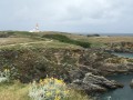
Cross the golf course. Magnificent view of Pointe des Poulains. Continue along the GR®.

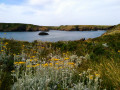
(1) Cross Stêr-Vraz beach. Take the path to the left of the beach, which is steep at first then flattens out, through dense heathland. Descend into the wild cove of Stêr-Ouen (a safe haven for boats during storms). At the top of the opposite slope, you’ll come across the Pointe du Vieux Château (now a bird sanctuary).

(2) Continue to the Grotte de l’Apothicairerie (a dirt track lined with heather leads to the Grotte de l’Apothicairerie, but access is prohibited). Head south; the coastline is particularly rugged, and the ground, battered by offshore winds, is covered in short, dense grass. Walk past the Er Hastelli Semaphore. Leave Er Hastellic Island on your right.

(3) Reach the impressive site of Port de Borderun (a17th-century walled cove). This landscape features all along the coast as far as Port-Donnant: a succession of deep coves and ‘ports’ – small, sheltered beaches, some enclosed by walls, such as Port de Kerlédan. Further on, you’ll come across Port des Sonnettes, Port-Puns and Port-Skeul.

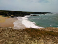
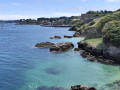
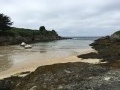
(4) From a promontory jutting out to the south of the hamlet of Anter, the superb beach of Port de Donnant comes into view, with its impressive waves. It is one of the island’s prettiest beaches. Cross the beach, following the GR® markings.

(5) Leave theGR® to join the small road leading to a large car park, then turn left towards Donnant village, the end of today’s walk.
For the return journey, continue along the small road, ignoring the turn-offs to the right, until you reach a Fork in the road and the bus stop which takes you back to Le Palais. (E).

Waypoints

  1. S : mi 0 - alt. 85 ft - Pointe des Poulains car park
  2. 1 : mi 1.57 - alt. 16 ft - Ster Vraz Beach
  3. 2 : mi 2.99 - alt. 108 ft - Apothicairerie Cave
  4. 3 : mi 4.25 - alt. 56 ft - Borderun Harbour
  5. 4 : mi 7.22 - alt. 33 ft - Donnant Beach
  6. 5 : mi 7.56 - alt. 16 ft - Chemin de Donnant Village
  7. E : mi 8.03 - alt. 121 ft - Donnant Village

Notes

There are no water points or refreshment stops on this walk.

We chose to walk around the island in a ‘star’ pattern, returning to the campsite every day using the ‘Cars Bleus’ bus service (the most sociable and economical way to explore Belle-Île on a day trip)
Bus timetables are available fromthe tourist office and on their website: https://www.lescarsbleus.com/

Always be cautious and plan ahead when you're outdoors. Visorando and the author of this route cannot be held responsible for any accidents occurring on this route.

The GR® and PR® markings are the intellectual property of the Fédération Française de Randonnée Pédestre.

Reviews and comments

5 / 5
Based on 2 reviews

Reliability of the description
5 / 5
Ease of following the route
5 / 5
Route interest
5 / 5
amostini
amostini
• Edited:

Overall rating : 5 / 5

Date of your route : May 22, 2024
Reliability of the description : ★★★★★ Very good
Ease of following the route : ★★★★★ Very good
Route interest : ★★★★★ Very good
Very busy route : Yes

A wonderful walk! Including photo stops, a picnic and a swim at Donnant beach, it took us 7 hours and 30 minutes. We felt it was the easiest and most interesting part of the island circuit, with less elevation gain than the others.

Machine-translated

MTBB
MTBB

Overall rating : 5 / 5

Date of your route : Oct 06, 2023
Reliability of the description : ★★★★★ Very good
Ease of following the route : ★★★★★ Very good
Route interest : ★★★★★ Very good
Very busy route : No

A lovely walk in brilliant weather. We had a lovely swim at Donnant beach. We had a bit of trouble finding our way back to Le Petit Cosquet to catch the bus.

Machine-translated

Other walks in the area

For more walks, use our search engine .

The GPS track and description are the property of this route's author. Please do not copy them without permission.