Pointe des Poulains – Aiguilles de Port Coton

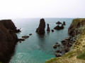
Stage2 of the GR®340, from Pointe des Poulains to the Aiguilles de Port Coton, famous for having been immortalised by Claude Monet in 1886.

This walk is part of a multi-day hike: Le tour de Belle Île en mer - GR®340

Details

34099274
Creation:
Last update:
Last review:
  • Walking
    Activity: Walking
  • ↔
    Distance: 11.72 mi
  • ◔
    Average duration: 6h 05 
  • ▲
    Difficulty: Moderate

  • ⚐
    Back to start: No
  • ↗
    Ascent: + 810 ft
  • ↘
    Descent: - 807 ft

  • ▲
    Highest point: 138 ft
  • ▼
    Lowest point: 7 ft
  • ⚐ Country: France
  • ⚐
    Area: Belle-Ile
  • ⚐ City: Sauzon (56360)
  • ⚑
    Start: N 47.384784° / W 3.247151°
  • ⚑
    End: N 47.305079° / W 3.237504°
  • ❏
    IGN map(s): Ref. 0822OT
  • Hour-by-hour weather

Photos

Description of the walk

You can reach Pointe des Poulains by bus on line 1, which departs from the coach station at Le Palais (please check carefully that the bus goes as far as Pointe des Poulains and not just to Sauzon).

The GR® is very well signposted. The markings are red and yellow or red and white.

(S) The route starts at the car park.

(1) Head towards the Maison du Littoral (check opening times) and take the path on the right. Follow the signposts towards Pointe des Poulains.

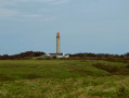
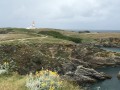
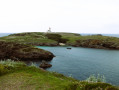
(2) The lighthouse overlooks the Pointe des Poulains, and you can walk all the way round it, in whichever direction you like, crossing the Plage des Poulains at low tide.
You’ll catch sight of the Villa des Cinq Parties du Monde and Sarah Bernhardt’s fort, which you’ll leave behind as you take the path that runs along the coast, with the sea on your right, to reach the golf course.

(3) You cross the island’s golf course at Petit Donnant. The walk continues to the port of Ster Vraz.

(4) We then arrive at the Koh-Kastell nature reserve, a site protected by the Conservatoire du Littoral, allowing us to explore a truly unspoilt stretch of coastline.
At Pointe du Vieux Château, birdwatchers should stop off to enjoy the bird sanctuary.

(5) The walk continues across the moorland to the Apothicairerie and its cave. However, entry is prohibited.

(6) We carry on to the ruins of the old Er Hastellic semaphore station. We go round it on the right to follow the coastline.

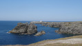
(7) We then find ourselves facing the small island of Er Hastellic. We carry on, staying on the path that runs along the coast. There is a succession of harbours, such as Port Kerlédan, Port Puns and Port Scheul.

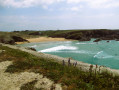
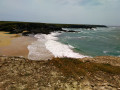
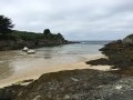
(8) You’ve now reached Donnant Beach, well known to surfers. Walk around it.

(9) Shortly afterwards, you reach Vazen Beach, which you also walk around. In the distance, inland, you can see the Goulphar lighthouse.

The finish is opposite the Aiguilles de Port Coton, by the car park (E).

Waypoints

  1. S : mi 0 - alt. 85 ft - Car park - Pointe des Poulains
  2. 1 : mi 0.01 - alt. 85 ft - Maison du Littoral - Fort Sarah Bernhardt
  3. 2 : mi 0.52 - alt. 69 ft - Pointe des Poulains Lighthouse
  4. 3 : mi 1.63 - alt. 102 ft - Belle Île en Mer Golf Club
  5. 4 : mi 3.34 - alt. 102 ft - Koh-Kastell Bird Sanctuary
  6. 5 : mi 3.83 - alt. 105 ft - L’Apothicairerie
  7. 6 : mi 4.82 - alt. 131 ft - Former Er Hastellic semaphore station
  8. 7 : mi 4.98 - alt. 125 ft - Er Hestellic Island
  9. 8 : mi 8.53 - alt. 39 ft - Donnant Beach
  10. 9 : mi 9.53 - alt. 13 ft - Vazen Beach
  11. E : mi 11.72 - alt. 98 ft - Car park - Les aiguilles de Port Coton

Notes

La Pointe des Poulains.
At the Maison du Littoral, toilets are accessible from outside but are not always open.
Wear walking shoes, high-top if necessary, as there are both uphill and downhill sections.
Walking poles are permitted, but must have protective caps.
This section of the route offers very little shade. Bring a hat or cap and sun cream and lip balm.
There are no drinking water points on this route.
No toilets.

Worth a visit

(E) On arrival, you can take bus route 2 to Le Palais, or continue along theGR®340to Locmaria.

Always be cautious and plan ahead when you're outdoors. Visorando and the author of this route cannot be held responsible for any accidents occurring on this route.

The GR® and PR® markings are the intellectual property of the Fédération Française de Randonnée Pédestre.

Reviews and comments

4.8 / 5
Based on 4 reviews

Reliability of the description
4.8 / 5
Ease of following the route
4.5 / 5
Route interest
5 / 5
alexandre.tomas
alexandre.tomas

Overall rating : 5 / 5

Date of your route : Jul 15, 2026
Reliability of the description : ★★★★★ Very good
Ease of following the route : ★★★★★ Very good
Route interest : ★★★★★ Very good
Very busy route : Yes

Brilliant! Make sure you take plenty of water with you, as there are no places to get supplies and VERY little shade!

Machine-translated

Saroumane
Saroumane

Overall rating : 4.3 / 5

Date of your route : Sep 12, 2024
Reliability of the description : ★★★★☆ Good
Ease of following the route : ★★★★☆ Good
Route interest : ★★★★★ Very good
Very busy route : No

Stage three for us
Lovely weather
No major difficulties – a long but fairly quick walk – the bus at the Aiguilles car park, which is in a magnificent setting

Machine-translated

patounet38
patounet38

Overall rating : 4.7 / 5

Date of your route : Aug 12, 2024
Reliability of the description : ★★★★★ Very good
Ease of following the route : ★★★★☆ Good
Route interest : ★★★★★ Very good
Very busy route : No

Classic but stunning! The walk to and from Port Donnant and its beach offers breathtaking views. On hot, sunny days, make sure you take plenty of water with you. There’s hardly any shade along the route.

Machine-translated

lntess
lntess

Overall rating : 5 / 5

Date of your route : Sep 10, 2023
Reliability of the description : ★★★★★ Very good
Ease of following the route : ★★★★★ Very good
Route interest : ★★★★★ Very good
Very busy route : No

Stunning scenery – a real treat!

Machine-translated

Other walks in the area

For more walks, use our search engine .

The GPS track and description are the property of this route's author. Please do not copy them without permission.