Walk to Vienne

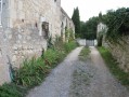
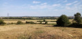
A hike for wet days with small roads and paths that are not too muddy. Part of the route runs along the banks of the Vienne river on the edge of a field (please respect the crops).

Details

52066
Creation:
Last update:
Last review:
  • Walking
    Activity: Walking
  • ↔
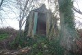
    Distance: 5.93 mi
  • ◔
    Average duration: 2h 55 
  • ▲
    Difficulty: Easy

  • ⚐
    Back to start: Yes
  • ↗
    Ascent: + 187 ft
  • ↘
    Descent: - 177 ft

  • ▲
    Highest point: 367 ft
  • ▼
    Lowest point: 171 ft

Photos

Description of the walk

No difficulty following the map; the village remains in sight for almost the entire hike.
To park at the start, use the stadium car park.

(S/E) Go up Rue de Chémery-les-Deux and opposite the bakery, take the square on the left until you reach the Coq Hardi bar.

(1) Turn left and, after about 100 metres, take the street on the right that leads into a small housing estate (Les Savignes). Continue to the end, then take the passage between two houses that leads to Rue d'Aunis.

(2) Take the alleyway almost opposite, Rue des Savignes. At the next crossroads, turn right and follow Rue de Saintonge then Rue de l'Huilerie.

(3) After the oil mill, turn left onto Rue du Magnou and continue to Rue du Plessis. Then turn right. After about 100 metres, turn left onto a path.

(4) Go up 200 metres and then take the path on the right that goes down towards some houses. At the first house, turn left into the small street. Then take the first path on the right and follow it. At the end of the path, turn left and then right 20 metres further on. You will arrive in the small village of Prinçay.

(5) Turn left and continue; it feels like you are passing through private property. Opposite two garages, turn left. Go down about 20 metres and turn right onto the path that descends. Follow the end of the road straight ahead and continue straight ahead on the path towards Château de la Cataudière.

(6) Turn left onto the path that runs alongside the property. Cross the D749 road (take care). Continue straight ahead, leaving the path on your right. Then turn right to reach the banks of the Vienne.

(7) Follow the path that branches off to the right. When the path turns right, continue straight ahead along the field (respect the crops). There is no path, so walk along the edge of the field. After passing the high-voltage power line, you will find a path.

(8) Turn right. Follow this path to a T-junction. Then turn left and continue to the Ternay farm.

(9) At the farm, take the small road on the right. When you reach the D749, turn left and then immediately right (entrance to the industrial estate). Follow the road for a short distance and continue straight ahead to the end of a grassy field. When you reach a path at the edge of the field, turn left and then right to reach the small road.

(10) Follow this small road back to the starting point. Pass by the Pigeonnier du Perron. At the next crossroads, continue straight ahead and at the small roundabout turn left towards the village centre.

(1) Instead, cross over to the bakery and turn right onto the street that leads down to the car park (S/E).

Waypoints

  1. S/E : mi 0 - alt. 243 ft - Stadium car park.
  2. 1 : mi 0.11 - alt. 249 ft - Crossroads of the circular loop
  3. 2 : mi 0.28 - alt. 259 ft - Rue d'Aunis
  4. 3 : mi 0.83 - alt. 292 ft - Rue du Magnou
  5. 4 : mi 1.51 - alt. 315 ft - Plessis-Bas
  6. 5 : mi 2.09 - alt. 325 ft - Prinçay
  7. 6 : mi 2.43 - alt. 243 ft - Château de la Cataudière
  8. 7 : mi 2.89 - alt. 177 ft - Bankside of the Vienne
  9. 8 : mi 3.37 - alt. 171 ft - Path after the high-voltage power line.
  10. 9 : mi 3.92 - alt. 180 ft - Ternay farm
  11. 10 : mi 4.61 - alt. 213 ft - Route to the starting point
  12. S/E : mi 5.93 - alt. 243 ft - Stadium car park.

Notes

No drinking water, bakery or bar/restaurant in the starting village.
Pharmacy, doctor.
Hotel/restaurant on the route.

Worth a visit

In the village of Prinçay, underground passages can be visited (inexpensive) – ask the villagers for information.
Church worth seeing; it is always open.

Reviews and comments

4.3 / 5
Based on 7 reviews

Reliability of the description
3.7 / 5
Ease of following the route
4.7 / 5
Route interest
4.3 / 5
LesBobolas
LesBobolas

Overall rating : 4 / 5

Date of your route : Jan 17, 2021
Reliability of the description : ★★★★☆ Good
Ease of following the route : ★★★★☆ Good
Route interest : ★★★★☆ Good
Very busy route : No

A real treasure hunt, don't trust any markings! Luckily we had the route map... a bit of spice for a fun and varied course! Maybe best avoided in the height of summer, as there are no more hedges along the crops.

Machine-translated

nadasaidi
nadasaidi

Overall rating : 2.5 / 5

Date of your route : Jul 05, 2019
Reliability of the description : ★☆☆☆☆ Very disappointing
Ease of following the route : ★★★★☆ Good
Route interest : Not used / Not applicable

We only did the part near the banks of the Vienne (from point 5 to point 7). The part along the crops was almost impossible to do, we found ourselves having to walk between nettles and thistles without being able to turn back. The result: lots of hives and little enjoyment...
This hike could perhaps be updated in light of the current state of the banks of the Vienne.

Machine-translated

Marierose
Marierose

Overall rating : 4.3 / 5

Date of your route : Nov 12, 2018
Reliability of the description : ★★★☆☆ Average
Ease of following the route : ★★★★★ Very good
Route interest : ★★★★★ Very good

The description of this hike says to turn left at the first house, but this is incorrect because there is a sheep park on the left.

And since I didn't have a map with me, it was difficult to find my way.

But I'll do it! No problem, this app is really great otherwise.

Machine-translated

AYRAULT DANIELLE
AYRAULT DANIELLE

Overall rating : 5 / 5

Date of your route : Apr 29, 2018
Reliability of the description : ★★★★★ Very good
Ease of following the route : ★★★★★ Very good
Route interest : ★★★★★ Very good

Between PRINCAY and the Château de la CATAUDIERE, the path has not been cleared. Walking along the banks of the VIENNE through cornfields is not pleasant.

Machine-translated

Gilles490
Gilles490

Overall rating : 4.3 / 5

Date of your route : Sep 18, 2017
Reliability of the description : ★★★★☆ Good
Ease of following the route : ★★★★★ Very good
Route interest : ★★★★☆ Good

A walk for those who enjoy orientation challenges: the few signposts you see point to routes you should not follow! I loved it; it reminded me of orienteering when I was a scout...
However, contrary to what is written, avoid wet days, especially the part through the fields!
One regret: the section along the Vienne river is not very pleasant. The Vienne is below, inaccessible, and you're left disappointed when you thought you could have a picnic on the banks.
But the route is interesting and there are some beautiful houses to admire.
For your information: the pigeon loft on the steps is a hotel in the former seigneury of Descartes (the philosopher, of course).

Machine-translated

17tatout36
17tatout36

Overall rating : 4.3 / 5

Date of your route : May 17, 2015
Reliability of the description : ★★★★☆ Good
Ease of following the route : ★★★★★ Very good
Route interest : ★★★★☆ Good

One small hiccup at the start: after Rue des Savignés, we couldn't find Rue de Saintonge on the right and ended up on Rue des Fombeurs. We quickly corrected our mistake thanks to the map. After point 4, we turned left at the first house but didn't see the path on the right (too much vegetation?) so we climbed up to the marked path and turned right then left to catch up with Prinçay. After that, no problems except for a big struggle with the tall, thick grass near La Cataudière. We particularly enjoyed arriving in Availles via the Nauds neighbourhood, which is full of beautifully preserved old buildings. A lovely walk as an alternative to the already marked paths.

Machine-translated

dp86
dp86

Overall rating : 4.7 / 5

Date of your route : May 06, 2015
Reliability of the description : ★★★★★ Very good
Ease of following the route : ★★★★★ Very good
Route interest : ★★★★☆ Good

Perfectly explained route.
Well done.

Machine-translated

Other walks in the area

For more walks, use our search engine .

The GPS track and description are the property of this route's author. Please do not copy them without permission.