Around Tarare and Joux

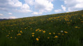
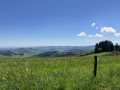
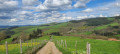
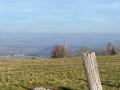
A hike of around ten kilometres ending with a walk around the Joux Dam. Suitable for mountain bikes. The start is an uphill stretch of just over 3 km, followed by a pleasant downhill path. Lovely views along the route.

Details

34004369
Creation:
Last update:
Last review:
  • Walking
    Activity: Walking
  • ↔
    Distance: 6.32 mi
  • ◔
    Average duration: 3h 50 
  • ▲
    Difficulty: Moderate

  • ⚐
    Back to start: Yes
  • ↗
    Ascent: + 1,063 ft
  • ↘
    Descent: - 1,066 ft

  • ▲
    Highest point: 2,539 ft
  • ▼
    Lowest point: 1,424 ft

Description of the walk

Park at the start of the Route Napoléon on the hard shoulder.

(S/E) Follow the Route Napoléon as it climbs for 3 km; it becomes tarmac-surfaced at a house on the left. Pass the house and continue uphill for a few hundred metres.

(1) Turn onto a path on the left with a hairpin bend. Follow this gently ascending path.

(2) At the end of the track, turn left and head due south until you reach a track on the left.

(3) Please note: leave the main track and turn left towards the north-east.

(4) Take the track that winds sharply to the right and follow it down to a road.

(5) Turn left and follow this road, passing through Arcy and continuing straight on to join the Tarare–Roanne road (N7). Please note: this is a busy road.

(6) Follow it for about a hundred metres and turn right onto the D79 towards Joux. Follow the road that runs alongside the reservoir.

(7) At the end, take the hairpin bend to the left and continue round the reservoir.

(8) At the dam, take the track on the right and follow it straight on until you reach a cross-track.

(9) Take the hairpin bend to the left, join a road and head down to the right until you reach a roundabout.

(10) Go round the roundabout on the right and join the Route Napoléon to reach the car park (S/E).

Waypoints

  1. S/E : mi 0 - alt. 1,476 ft - Car park at the start of the Route Napoléon
  2. 1 : mi 1.94 - alt. 2,480 ft - Hairpin bend – Track
  3. 2 : mi 2.23 - alt. 2,536 ft - Junction
  4. 3 : mi 2.74 - alt. 2,306 ft - Junction
  5. 4 : mi 3.26 - alt. 2,044 ft - Hairpin bend to the right
  6. 5 : mi 3.5 - alt. 1,919 ft - Road junction
  7. 6 : mi 4.19 - alt. 1,604 ft - Tarare–Roanne Road
  8. 7 : mi 4.94 - alt. 1,545 ft - Hairpin junction - Turdine (rivière)
  9. 8 : mi 5.62 - alt. 1,532 ft - Dam
  10. 9 : mi 5.88 - alt. 1,450 ft - Left-hand hairpin bend
  11. 10 : mi 6.14 - alt. 1,434 ft - Roundabout
  12. S/E : mi 6.32 - alt. 1,476 ft - Car park at the start of the Route Napoléon

Worth a visit

Reviews and comments

4.6 / 5
Based on 3 reviews

Reliability of the description
4.7 / 5
Ease of following the route
4.7 / 5
Route interest
4.3 / 5
Regis6971
Regis6971

Overall rating : 4 / 5

Date of your route : Aug 02, 2026
Reliability of the description : ★★★★★ Very good
Ease of following the route : ★★★★☆ Good
Route interest : ★★★☆☆ Average
Very busy route : No

The 3-kilometre climb in the heat is tough but, in the end, quite easy.
But reaching the summit only to head straight back down the 3 km is very disappointing!
We would have liked to make the most of our effort by continuing along the ridge, with its magnificent views.
And the final stretch, circling the lake on a tarmac road in the thick of the traffic…

Machine-translated

JoeAlex
JoeAlex

Overall rating : 4.7 / 5

Date of your route : May 21, 2024
Reliability of the description : ★★★★☆ Good
Ease of following the route : ★★★★★ Very good
Route interest : ★★★★★ Very good
Very busy route : Yes

A lovely walk, even if the first three kilometres are a bit of a slog.

Machine-translated

Michel69350
Michel69350
• Edited:

Overall rating : 5 / 5

Date of your route : Jul 31, 2023
Reliability of the description : ★★★★★ Very good
Ease of following the route : ★★★★★ Very good
Route interest : ★★★★★ Very good
Very busy route : No

A walk taken on a weekday in changeable weather, with a bit of rain at the start and end. A lovely, varied route alternating between scenic viewpoints and featuring some very interesting historical explanations. Suitable for the whole family, there are plenty of spots for a picnic, and the walk around the reservoir at the end is a lovely surprise.

Machine-translated

Other walks in the area

For more walks, use our search engine .

The GPS track and description are the property of this route's author. Please do not copy them without permission.