Country:
 City:
City:


Park at the Port de Frahier car park.
(S/E) Walk past the navigation services’ workshops and take the path running alongside the canal on your right. After the first small bridge, you’ll be treated to a bird’s-eye view of the Rouges Vis botanical garden. Continue straight on until you reach another bridge on your right (a bridge with a waterproof tarpaulin).
(1) Next to the bridge (with a tarpaulin), you’ll see an electricity pole on your left; behind this pole, take a ramp and a recently built flight of steps to reach Rue du Charme directly.
(2) This time, walk past the Rouge Vis Botanical Garden. After the last few houses, the street continues as a path that climbs into the woods. On emerging from the woods, follow the edge of the woodland to reach a more passable track.
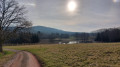
(3) Turn right and enjoy the view of Frahier. Continue to the end of the track and reach the road from Frahier to Errevet (D219a).
(4) Cross carefully and take the wide track almost directly opposite, which marks the start of the Chemin des Grands Hauts, also known as the ‘black track’ because of the colour of the materials that still partly cover it (black like Ronchamp coal).
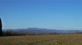
(5) At the T-junction, turn right and follow the path between the pastures as it descends gently. To the left, there are views of Évette-Salbert, the Ballon d’Alsace and Saint-Antoine. Continue to the bottom of the Chemin des Grands Hauts, where you’ll come to a bridge.
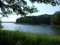
(6) Take the stony path on the right, before the bridge, to follow the canal on your left.
(7) Cross the Rue des Creuses, which climbs from the village centre on the left towards Errevet on the right. Take the path opposite to follow the canal, keeping it on your left, towards the harbour. You’ll reach the car park (S/E).

 Visorando Member
 Moderate