


Refine your search for walks in Zone de Recherche de Coutarse
Zone de Recherche de Coutarse walks


 Pointe de Chaurionde
 Visorando Member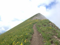
 8.83 mi
 +4,094 ft
 -4,072 ft
 7h 35
7h 35
 Difficult
 Departure from École (Savoie)
This hike will take you to the Pointe de Chaurionde via the Col du Haut du Four and the south-west ridge. Don't miss the chamois that inhabit the slopes. At the summit, you can admire Lake Annecy and Mont Blanc. You will cross the Vallon d'Orgeval (the valley of bears), which has now become a peaceful valley home to Tarine and Abondance cows and marmots.In June, the flora is magnificent and varied.
Chaurionde means "round summit".
(6) Access to the summit (or descent) via the Chalet de Coutarse is now prohibited (ZR zone of the PNR).
Arcalod-Mont de la Coche circular from Bellevaux
 10.29 mi
+5,381 ft
-5,364 ft
8 hrs
10.29 mi
+5,381 ft
-5,364 ft
8 hrs
 Very difficult
Departure from École (Savoie)
Very difficult
Departure from École (Savoie)
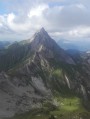
This is a beautiful circular that allows you to see three sides of Arcalod, climb to the summit via Orgeval and descend via a wilder route. It is a demanding but magnificent hike in good weather.
Please note that access to the Pointe d'Arcalod is not recommended with children or in wet weather.
Pointe d'Arcalod via the Chalets d'Orgeval
 7.21 mi
+3,999 ft
-3,999 ft
6 hrs
Very difficult
Departure from École (Savoie)
7.21 mi
+3,999 ft
-3,999 ft
6 hrs
Very difficult
Departure from École (Savoie)
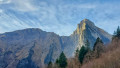
A beautiful, aerial and technical hike to climb to the highest point of the Bauges Massif (2,217 m).
Magnificent 360° panorama of the entire Bauges Massif and Mont Blanc.
Note on difficulty: following feedback from hikers, this hike has been classified as Very Difficult because the ascent and descent of the peak are quite technical.
Pointe de Chaurionde as seen from Tamié Abbey
 11.61 mi
+5,135 ft
-5,108 ft
9h 50
Difficult
Departure from Plancherine (Savoie)
11.61 mi
+5,135 ft
-5,108 ft
9h 50
Difficult
Departure from Plancherine (Savoie)
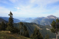
A very beautiful walk in the Bauges massif, with magnificent 360° views of Lake Annecy, Mont Blanc and the Bauges mountains such as L’Arcalod, La Sambuy, etc...
Mont de la Coche and Tré le Mollard
 7.17 mi
+3,409 ft
-3,389 ft
6h 15
Difficult
Departure from École (Savoie)
7.17 mi
+3,409 ft
-3,389 ft
6h 15
Difficult
Departure from École (Savoie)
This beautiful, wild circular hike starting from the Nant du Fourchu car park takes you to two peaks over 2,000 m in the Bauges massif in just a few kilometres, and can be completed with a climb to Pointe d'Arcalod. You may even see some marmots!
Tour de l’Arcalod
18.64 mi
+6,283 ft
-6,293 ft
2 days
Difficult
Departure from École (Savoie)
A two-day route around the Pointe d’Arcalod, the highest point in the Bauges, passing through unspoilt wilderness, valleys and rivers. The suggested route mainly follows the GR® de Pays Tour de l’Arcalod, marked in yellow and red. Spectacular views of the mountains and Lake Annecy. This wild and little-used route is mainly situated within a Regulated Sensitive Area.
Nant Fourchu stream car park – Chalets de l’Eau Froide
8.13 mi
+4,140 ft
-2,103 ft
7h 20
Very difficult
Departure from École (Savoie)
First day of a two-day route around the Pointe d’Arcalod, the highest point in the Bauges, crossing wild areas, valleys and rivers. The proposed route mainly follows the eastern section of the GR® de Pays Tour de l’Arcalod, marked in yellow and red. Spectacular views of the mountains and Lake Annecy. This wild and little-used route is situated mainly within a sensitive, regulated area.The terrain is good and presents no particular difficulties.