Country:
 City:
City:



Park in the Col d’Amos car park, near the cross.
(S/E) Two paths lead westwards: take either one; they join at the start of the trail, which is directly in front of you. You’ll reach a junction by an electricity pylon.
(1) Carry on straight ahead. This section has the steepest gradient, but after this initial climb the walk is generally very gentle. Please note that the path is not signposted at all; the route is generally quite visible, but it sometimes disappears into areas of scrub where vegetation is sparser and where it is possible to walk almost anywhere, meaning you can quickly lose the trail. Using a GPS track is a big help; I strongly recommend it.
(2) Cross the first small stream. It isn’t wide, but the vegetation almost completely covers the banks. You must therefore take great care to place your feet in the right places so as not to slip.
(3) Cross a second stream under the same conditions as the previous one and carry on.
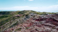
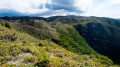
(4) Cross a third stream and carry on along the path, which slopes further to the right (north) before veering left. This path remains generally well-defined and offers a succession of magnificent views.
(5) From this point onwards, finding your way becomes more difficult without a GPS: the main path appears to head off to the right, but you must actually keep to the left on another path that seems less clearly marked and which may appear to disappear at times. You’ll reach the viewpoint overlooking the Diahot valley.
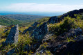
(6) It is theoretically possible to follow the ridges from here. Two paths are marked out, one heading west and the other east, but due to a lack of maintenance, both disappear after a few hundred metres into patches of dense forest, making them impassable. Follow the ridge on the left for a short while to reach the highest point of Xwa Naninégie.
(7) Turn back and return via the same path as on the way out to reach the Col d’Amos (S/E).
 Visorando Member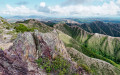

 Easy
Easy