Warneton and Deûlémont from Quesnoy-sur-Deûle

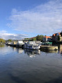
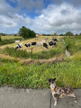
Circular route through the countryside to Warneton, then along the towpath via Deûlémont alongside the River Deûle.

Details

n°68700638
Creation:
Last update:
Last review:
  • Walking
    Activity: Walking
  • ↔
    Distance: 9.66 mi
  • ◔
    Average duration: 4h 30 
  • ▲
    Difficulty: Average

  • ⚐
    Back to start: Yes
  • ↗
    Ascent: + 26 ft
  • ↘
    Descent: - 26 ft

  • ▲
    Highest point: 69 ft
  • ▼
    Lowest point: 39 ft

Photos

Description of the walk

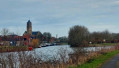
Park in Place du Général de Gaulle, between the Town Hall and Saint-Michel Church.

(S/E) Head towards the traffic lights and turn left onto Rue du Maréchal Foch (M36). Continue along Rue de Warneton (M108) and pass the schools.

(1) Turn right onto Chemin des Patards and carry on straight ahead until you reach a right-angled bend.

(2) Continue to the left, cross the old railway line and carry on to the junction by the Delannoy farm.

(3) Turn right onto Chemin de la Petite Hollande, then take the first road on the left until you reach the junction with Chemin Hors la Voie.

(4) Turn left, then right at the first junction to follow the Chemin de la Maigre Rue as far as L’Épinette.

(5) Turn left at a right angle, staying on Chemin de la Maigre Rue. Once at Les Villettes, turn right onto Chemin du Cœur Joyeux until you reach the junction with Chemin de la Fouine.

(6) Continue along Chemin du Cœur Joyeux to the left and take a 90° right-hand bend. Pass Chemin des Villettes on your left and take Chemin du Temple straight ahead.

(7) Cross the Comines/Armentières road (M945) with care and continue straight ahead along Chemin du Temple until you reach the T-junction.

(8) Turn left onto the Chemin du Fond de l’Eau towards Warneton. Cross the Route de Quesnoy/Warneton (M108) at the pedestrian crossing set back to the left. Once on the opposite side, follow the pavement to the right, then turn left towards a car park. Join the towpath: there’s a chance to take a break (picnic tables).

(9) Take the Lys towpath on the left towards Deûlémont.

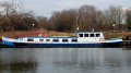
(10) After the beached barge, leave Rue Louis Flipo on your left and continue along the Lys towpath until you reach the junction with the Deûle Canal.

(11) Continue along the Deûle towpath, pass under the bridge on the Route de Comines and emerge onto the Impasse des Prairies at the Deûlémont locks.

(12) Turn right onto Rue des Trois Frères Fretin, then continue along Rue Virginie Ghesquière.

(13) Cross the footbridge and then the drawbridge over the Deûle. Then turn left onto Quai de la Marine.

(14) Pass the harbour master’s office and the Maxélo (brasserie) on your left and continue along the towpath to Quesnoy-sur-Deûle. Go under the bridge.

(15) Turn right to join Rue de Lille (D949). Turn right, then right again to cross the bridge and follow Rue Belle Croix. Then turn right onto Rue de l’Église and turn left onto Place Charles de Gaulle (S/E).

Waypoints

  1. S/E : mi 0 - alt. 66 ft - Place Général de Gaulle - Église Saint-Michel (Quesnoy-sur-Deûle)
  2. 1 : mi 0.32 - alt. 62 ft - Chemin des Patards
  3. 2 : mi 0.84 - alt. 62 ft - Right-angle bend
  4. 3 : mi 1.3 - alt. 66 ft - Delannoy Farm
  5. 4 : mi 1.65 - alt. 62 ft - Right-hand corner of Chemin Hors la Voie
  6. 5 : mi 2.17 - alt. 62 ft - L'Épinette
  7. 6 : mi 2.91 - alt. 62 ft - Right-hand corner of Chemin de la Fouine
  8. 7 : mi 3.49 - alt. 59 ft - Crossing the road
  9. 8 : mi 4.11 - alt. 46 ft - Chemin du Fond de l’Eau
  10. 9 : mi 4.62 - alt. 46 ft - Towpath - Lys (rivière canalisée)
  11. 10 : mi 5.97 - alt. 43 ft - Junction with Rue Louis Flipo
  12. 11 : mi 6.27 - alt. 49 ft - Deûlémont – Confluent
  13. 12 : mi 6.7 - alt. 49 ft - Écluses – Rue des Trois Frères Fretin
  14. 13 : mi 6.87 - alt. 43 ft - Footbridge over the - Deûle (rivière)
  15. 14 : mi 7.15 - alt. 49 ft - Harbour Master’s Office
  16. 15 : mi 9.38 - alt. 46 ft - Quesnoy Bridge
  17. S/E : mi 9.66 - alt. 66 ft - Place du Général de Gaulle. Near the - Cimetière militaire allemand (Qusnoy-sur-Deûle)

Notes

(15) A bar and grocery shop that has recently been awarded the “Café Rando” label, on the corner of Rue du Dr Calmette and Rue de Lille.

Reviews and comments

4.3 / 5
Based on 2 reviews

Reliability of the description
5 / 5
Ease of following the route
5 / 5
Route interest
3 / 5
Pierre59110
Pierre59110

Overall rating : 4 / 5

Date of your route : Feb 23, 2025
Reliability of the description : Not used / Not applicable
Ease of following the route : ★★★★★ Very good
Route interest : ★★★☆☆ Average
Very busy route : No

The first section up to Warneton is very pleasant, with quiet country lanes winding through the fields. From Warneton, the route follows a towpath to Quesnoy, which makes for a slightly more monotonous stretch.
On Sundays, the route is generally busy with walkers, joggers and cyclists, though this isn’t a problem.

Machine-translated

Clout59
Clout59

Overall rating : 4.3 / 5

Date of your route : Feb 21, 2025
Reliability of the description : ★★★★★ Very good
Ease of following the route : ★★★★★ Very good
Route interest : ★★★☆☆ Average
Very busy route : No

Hello,
A walk undertaken in overcast weather with no rain and a few sunny spells.
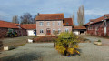
A few pretty farmhouses dotted along the route, which is mainly on tarmac or gravel.
The first section through the fields must be more pleasant and varied outside the winter months; at the moment, it’s rather monotonous.
For fans of towpaths, the seven kilometres along the Lys and the Deule will be a real treat.
One thing’s for sure: you won’t get your shoes dirty.
We enjoyed the picnic tables halfway along the route, just before reaching the banks of the Lys.

Machine-translated

Other walks in the area

For more walks, use our search engine .

The GPS track and description are the property of this route's author. Please do not copy them without permission.