


Refine your search for walks in Voinard (cours d'eau - affluent de la Loire)
Voinard (cours d'eau - affluent de la Loire) walks


 Overlook the Loire on a historical walk from Champtoceaux
 Visorando Member
 4.53 mi
 +348 ft
 -351 ft
 2h 25
2h 25
 Easy
Easy
 Departure from Champtoceaux (Maine-et-Loire)
Enjoy wild, surprising and charming landscapes on a historical walk starting at the foot of the medieval fortress, overlooking the Loire and passing through a forest steeped in legend.
Discover legends and medieval history from Champtoceaux
 Tourist office
 2.61 mi
+315 ft
-331 ft
1h 30
Easy
Departure from Champtoceaux (Maine-et-Loire)
2.61 mi
+315 ft
-331 ft
1h 30
Easy
Departure from Champtoceaux (Maine-et-Loire)
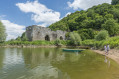
From the unmissable panorama of the Loire at Le Champalud to the ruins of the Citadel of Champtoceaux, via the Coulée de la Luce, a path steeped in legend, you will pass through unspoilt countryside.
Circular route between the Loire and Coteaux in Champtoceaux
 7.01 mi
+545 ft
-545 ft
3h 40
7.01 mi
+545 ft
-545 ft
3h 40
 Moderate
Departure from Champtoceaux (Maine-et-Loire)
Moderate
Departure from Champtoceaux (Maine-et-Loire)
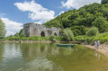
Climb to the top to enjoy one of the most beautiful views of the Loire.
Discover this lovely walk combining remarkable heritage with ancient ruins and beautiful panoramic views from the heights of the hillside. You will also walk along wooded paths and along the Loire via theGR®3.
Oudon-Ancenis circular route along the banks of the Loire
13.41 mi
+207 ft
-207 ft
6h 20
 Difficult
Departure from Oudon (Loire-Atlantique)
Difficult
Departure from Oudon (Loire-Atlantique)
A superb walk, with no difficulty other than the length, almost entirely along the water’s edge. Starting from Oudon, passing through Champtoceaux, crossing at the Ancenis bridge, picnic and return to Oudon. Follow theGR®3on the south bank and theGR®3Eon the north bank; red and white markings are clearly visible.
Of the 22 km, around 5 km is on country roads on the Ancenis-Oudon section. The rest is on paths or trails.
Walks near Voinard (cours d'eau - affluent de la Loire)
From Carquefou to La Haluchère along the Erdre
7.33 mi
+112 ft
-131 ft
3h 30
Moderate
Departure from Carquefou (Loire-Atlantique)
A very pleasant walk between the centre of Carquefou and La Haluchère, with a return journey by bus. Head down towards the Erdre in Carquefou, from the church car park via the Allée de la Renaudière, then follow the Erdre on the right-hand side as far as the Pont de la Jonelière. You then head back up to La Haluchère, alongside the tram line.
La Chauminette route
 4.98 mi
+112 ft
-69 ft
2h 25
Easy
Departure from Les Touches (Loire-Atlantique)
4.98 mi
+112 ft
-69 ft
2h 25
Easy
Departure from Les Touches (Loire-Atlantique)
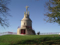
Set off to explore the Touchois bocage and its small sunken lanes. As soon as you set off, enjoy the 360° panorama from the Mont Juillet site. Its orientation table will help you to interpret the landscape around you.
Then set off to explore the surrounding countryside.
As you wander along the paths, you may come across an old building, a manor house, a calvary, a well or even a bread oven, each of which bears witness to a bygone era...
From Montrevault to Saint-Florent-le-Vieil
17.02 mi
+1,286 ft
-1,319 ft
8h 55
 Very difficult
Departure from Montrevault (Maine-et-Loire)
Very difficult
Departure from Montrevault (Maine-et-Loire)
This stop marks the end of an 80-kilometre journey along the River Èvre. Amidst rugged terrain, magnificent panoramas and sites steeped in history, the landscape gradually opens up and becomes more expansive. The journey then takes on a new dimension: the intimacy of the river gives way to the solemn grandeur of the Loire.
From Saint-Florent-le-Vieil to La Pommeraye
12.04 mi
+722 ft
-482 ft
6h 10
Difficult
Departure from Saint-Florent-le-Vieil (Maine-et-Loire)
Stage Seven. Setting off from Saint-Florent-le-Vieil, the route joins the legendary GR®3, the first signposted Grande Randonnée® trail in France. More unobtrusive here, sometimes set back from the river, the path invites you to explore the landscapes of the Loire from a more intimate perspective. Amidst hillsides, hamlets and sunken lanes, the river is more sensed than seen.