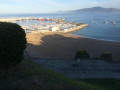
Txakoli vineyard in Getaria

A lovely walk through the Txakoli vineyards (sparkling white wine)
The vines are trained on tall trellises and harvested from below.

Details

2101637
Creation:
Last update:
Last review:
  • Walking
    Activity: Walking
  • ↔
    Distance: 4.16 mi
  • ◔
    Average duration: 2h 35 
  • ▲
    Difficulty: Easy

  • ⚐
    Back to start: Yes
  • ↗
    Ascent: + 728 ft
  • ↘
    Descent: - 728 ft

  • ▲
    Highest point: 620 ft
  • ▼
    Lowest point: 23 ft

Photos

Description of the walk

To get to the starting point: head to Getaria and park in the harbour car park.

(S/E) Walk up into the town along the main street.

(1) Cross the main road, the N-634, and head up the street heading west, Herrerieta kalea. As the bend begins, leave the street and keep to the right until you reach a roundabout near an inn on the Way of St James.

(2) Turn right onto the path, which then branches off to the left after a building. This is one of the routes to Santiago (Northern Way – Camino del Norte). Continue straight on, ignoring the streets on either side.

(3) Turn left onto the road that climbs through the vineyards and reach a Fork in the road.

(4) Follow the path that heads uphill to the right and leads to a complex junction.

(5) Turn right onto theGR®121-E03and follow it to a road junction.

(6) Take the road straight ahead heading north; this is the Camino del Norte again. Pass a street on your left.

(7) At the next junction, turn right down the street, then right again a little further on (Askizu auzoa) to rejoin the main road. Turn right.

(3) Carry on straight ahead and follow the same route you took on the way there to return to Getaria and the harbour car park (S/E).


Waypoints

  1. S/E : mi 0 - alt. 23 ft - Car park at the port of Getaria
  2. 1 : mi 0.17 - alt. 112 ft - N-634
  3. 2 : mi 0.45 - alt. 233 ft - The Way of St James on the right
  4. 3 : mi 1.07 - alt. 226 ft - Turn left
  5. 4 : mi 1.48 - alt. 387 ft - Fork in the road, take the path on the right
  6. 5 : mi 1.79 - alt. 594 ft - GR121 to the right
  7. 6 : mi 2.37 - alt. 394 ft - Road junction, opposite
  8. 7 : mi 2.6 - alt. 377 ft - Street on the right
  9. S/E : mi 4.16 - alt. 23 ft - Car park at the port of Getaria

Notes

Water and toilets are available in town.

Worth a visit

There are wine shops along the route for wine lovers, for example at (2).
If you’re buying some for the picnic afterwards, make sure to ask for it chilled.

A picnic on Mount Saint-Antoine (San Anton mendia) is a lovely way to round off this walk.
Mount Saint-Antoine is commonly known as ‘Ratón’ because of its silhouette.

Always be cautious and plan ahead when you're outdoors. Visorando and the author of this route cannot be held responsible for any accidents occurring on this route.

The GR® and PR® markings are the intellectual property of the Fédération Française de Randonnée Pédestre.

Reviews and comments

4.2 / 5
Based on 3 reviews

Reliability of the description
3.7 / 5
Ease of following the route
4.3 / 5
Route interest
4.7 / 5
Darrieu43
Darrieu43

Overall rating : 4.7 / 5

Date of your route : Jun 16, 2026
Reliability of the description : ★★★★★ Very good
Ease of following the route : ★★★★★ Very good
Route interest : ★★★★☆ Good
Very busy route : No

We completed this route from Getaria without any problems, in glorious sunshine with magnificent views of both the sea and the mountains. This route allowed us to explore this part of the Basque Country, with its vineyards and Getaria’s fishing harbour.

Machine-translated

22yves32
22yves32

Overall rating : 4.3 / 5

Date of your route : Apr 22, 2025
Reliability of the description : ★★★★☆ Good
Ease of following the route : ★★★★☆ Good
Route interest : ★★★★★ Very good
Very busy route : No

A pleasant walk, not very difficult and easy to follow (6 km in 2 hours). There are a few short climbs in the first part before the path gradually descends. It’s worth noting the superb views of the coast, amidst the vineyards.

Machine-translated

phmbtz
phmbtz

Overall rating : 3.7 / 5

Date of your route : Mar 06, 2023
Reliability of the description : ★★☆☆☆ Disappointing
Ease of following the route : ★★★★☆ Good
Route interest : ★★★★★ Very good
Very busy route : No

The route description is rather vague. Fortunately, this short walk is very well signposted with yellow arrows, which you can simply follow without worrying too much about the description. The start isn’t particularly interesting, but it gets better after about a quarter of an hour’s climb.

Machine-translated

Other walks in the area

For more walks, use our search engine .

The GPS track and description are the property of this route's author. Please do not copy them without permission.