Vineyards and châteaux in La Varenne, Orée-d’Anjou

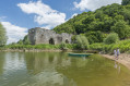
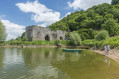
The route winds through the vineyards and offers lovely views of the surrounding private châteaux.

Details

n°7626005
Creation:
Last update:
Last review:
  • Walking
    Activity: Walking
  • ↔
    Distance: 3.79 mi
  • ◔
    Average duration: 2h 00 
  • ▲
    Difficulty: Easy

  • ⚐
    Back to start: Yes
  • ↗
    Ascent: + 253 ft
  • ↘
    Descent: - 249 ft

  • ▲
    Highest point: 220 ft
  • ▼
    Lowest point: 16 ft
  • ⚐ Country: France
  • ⚐ City: La Varenne (49270)
  • ⚑
    Start/End: N 47.32451° / W 1.292473°
  • ❏
    IGN map(s): Ref. 1322SB, 1323SB
  • Hour-by-hour weather

Description of the walk

Park in the small lay-by on the side of the D751, which can accommodate a maximum of two or three vehicles.

(S/E) At this junction, take the road running perpendicular to the D751 leading to the hamlet of La Babinière and take thefirst track on your right.

(1) In the hamlet of Gasselin, follow the road all the way to your right and, after 100 m, turn left.
At the end of the track, veer to the right. When you reach the road, turn right and then take the track immediately on the left.

(2) When you reach the hamlet of La Gulolière, carry on straight ahead and turn left at the end of the road. Continue until you reach the D751.

(3) Cross the road with care (there is no pedestrian crossing), turn left and then immediately right to follow the road to the hamlet of l’Écurie. On leaving the hamlet, continue for about 80 metres and turn right.

(4) Take the path on the left. Walk through the vineyards and turn right after the vineyard, continuing for about 40 metres. Turn left onto the path leading down towards the stream, cross the footbridge, then head into the woods. As you emerge from the woods, turn right, then left to walk alongside the field and continue until you reach the road.

(5) Turn right towards the hamlet of Le Tertre, then keep left at the three-way junction. Walk through the hamlet. At the three-way junction, continue to the right and keep right again at the last houses.

(6) Turn right towards Les Hautes Sauzaies. Carry on straight ahead for about 1.5 km. Here you’ll be walking alongside very damp meadows where the spotted snake’s head fritillary, a protected species, flowers in April.

(7) When you reach the junction with the road leading to Le Marais, turn left then immediately right, and follow the road until you return to your starting point at the junction with the D751 (S/E).

Waypoints

  1. S/E : mi 0 - alt. 171 ft - Crossroads on the D751
  2. 1 : mi 0.31 - alt. 220 ft - Gasselin
  3. 2 : mi 1 - alt. 174 ft - La Gulolière
  4. 3 : mi 1.29 - alt. 197 ft - D751
  5. 4 : mi 1.55 - alt. 151 ft - Vineyard Trail
  6. 5 : mi 1.98 - alt. 112 ft - Road junction, turn right
  7. 6 : mi 2.25 - alt. 30 ft - Le Tertre, turn right at the junction
  8. 7 : mi 3.29 - alt. 30 ft - On the road, turn left then right
  9. S/E : mi 3.79 - alt. 174 ft - Crossroads on the D751

Worth a visit

During the walk, you can see three châteaux:
- the Château de Clermont on the north bank (in the commune of Le Cellier), where Louis de Funès once lived.
- the Château d’Oudon.
- the Château de La Varenne.

The vineyards you’ll pass through produce Muscadet Coteau de la Loire (Melon de Bourgogne), Coteau d’Ancenis (red and rosé Gamay and the famous Malvoisie), and red Anjou… which I invite you to discover at Domaine Merceron Martin (La Coindassière – La Varenne) or at Romain Moreau’s organic estate (Le Fief de Bel-Air – La Varenne).

Reviews and comments

3.7 / 5
Based on 3 reviews

Reliability of the description
3 / 5
Ease of following the route
4 / 5
Route interest
4 / 5
Lady wraithy
Lady wraithy

Overall rating : 3.3 / 5

Date of your route : Mar 16, 2025
Reliability of the description : ★★★☆☆ Average
Ease of following the route : ★★★☆☆ Average
Route interest : ★★★★☆ Good
Very busy route : No

Please note: at point 2, it’s impossible to follow the marked path as it’s fenced off; we had to take a detour. At point 4, you need to be careful as the path is barely visible.
Otherwise, it’s a gentle walk with no particular difficulties.

Machine-translated

Claireandr
Claireandr
• Edited:

Overall rating : 3 / 5

Date of your route : Aug 09, 2022
Reliability of the description : ★★☆☆☆ Disappointing
Ease of following the route : ★★★★☆ Good
Route interest : Not used / Not applicable
Very busy route : No

The route isn’t signposted, but it’s quite easy to follow the directions. However, it’s impossible to turn left after 100 metres as indicated in point 1, as the field is fenced off.

Machine-translated

Brunette
Brunette

Overall rating : 4.3 / 5

Date of your route : Oct 01, 2021
Reliability of the description : ★★★★☆ Good
Ease of following the route : ★★★★★ Very good
Route interest : ★★★★☆ Good
Very busy route : No

On the map, at point 2, it says “carry on straight ahead and turn left at the end of the road.”
You need to turn right at the end of the road.
At point 4, the path on the left is barely visible.

Machine-translated

Other walks in the area

For more walks, use our search engine .

The GPS track and description are the property of this route's author. Please do not copy them without permission.