From the Citadel to the Loire, starting from Champalud

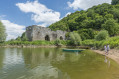
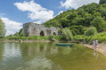
A superb walk with majestic views over the Loire! Discover the exceptional, listed site of the ‘Verrou du Val de Loire’, the little port of La Patache, and the shaded paths along the water’s edge. This walk, which involves a slight climb, will allow you to appreciate the rich landscape and heritage of this rock steeped in history!

Details

64825907
Creation:
Last update:
Last review:
  • Walking
    Activity: Walking
  • ↔
    Distance: 7.97 mi
  • ◔
    Average duration: 4h 15 
  • ▲
    Difficulty: Moderate

  • ⚐
    Back to start: Yes
  • ↗
    Ascent: + 650 ft
  • ↘
    Descent: - 659 ft

  • ▲
    Highest point: 269 ft
  • ▼
    Lowest point: 10 ft
  • ⚐ Country: France
  • ⚐ City: Champtoceaux (49270)
  • ⚑
    Start/End: N 47.338138° / W 1.265961°
  • ❏
    IGN map(s): Ref. 1322SB, 1323SB
  • Hour-by-hour weather

Description of the walk

Follow the white markings

Motorhome parking near the start of the walk.

Park in the car park at the Champtoceaux Tourist Office, located at Champalud.

(S/E) Head towards the viewpoint, then follow the signposted path running parallel to Rue de Bretagne, which branches off to the right, until you reach an underpass crossing the road.

(1) Follow the Coulée de la Luce path, making sure to close the gates behind you. At the exit of the Coulée de la Luce, turn right and head towards the village of La Patache. Keep left along the Loire on two occasions to reach the edge of the village. 

(2) Carry on until you reach La Marionnière.

(3) Turn left. Cross the bridge and carry on straight ahead until you reach some meadows. Follow the path, keeping to the right along the Loire, taking care not to open any gates and to keep your dogs on a lead. At the road, turn left towards La Rompure.

(4) When you reach La Boire de la Rompure, turn right to follow the poplar-lined avenue. At the crossroads, go straight on towards Les Greliers.

(5) Cross the county road with care. Follow the tarmac road to the Domaine des Galloires. Turn right and take the path through the vineyard until you reach a Fork in the road.

(6) Head down towards the woods, following the white markings. Cross the Ruisseau de la Champenière via the footbridge and continue along the path that runs alongside the stream and the meadows. You’ll arrive at La Gautellerie.

(7) Turn left, then immediately right, to reach Les Terrinières. Turn right, then left, and take the Chemin des Baudries on the left to reach Le Haut Quartron.

(8) Take the road on the left, then turn right onto the Chemin de la Bretèche. At the end of the path, turn right, then left to rejoin the Route de la Gagnerie.

(9) Head towards the Champ de Bataille playground, continuing straight on and crossing Avenue d’Anjou. Walk round the playground and head towards Rue du Champ de Bataille on your left.

(10) Then turn right and carry on straight ahead. Cross Avenue des Sept Moulins and continue along Rue du Petit Saint-Jean until it ends.

(11) At the end of the street, first turn right then left to cross Rue Jean V. Turn right onto Chemin du Voinard. After the secondary school, keep left, then immediately turn right until you reach the start of the climb to the citadel.

(12) Walk up to the ruins of the citadel. Go round to the right and return to the road.

(12) Continue to the right along Chemin du Voinard. At La Bonde, turn right towards the bridge and the sewage treatment works.

(13) At the sewage treatment works, take the path on the left. Follow it to the right-angled bend which takes you, on the right, under the bridge. Carry on straight ahead to reach the Moulin Pendu.                                                                 

(14) Follow the path through the woods, then turn right onto the county road.

(15) Cross the county road with care and take the path running alongside the embankment, slightly to your left (Chemin du Port Neuf). When you reach Place des Piliers, turn left onto Rue Hippolyte Maindron and continue to the restaurant La Citadelle. Then turn left. You have arrived at Le Champalud (S/E).

Waypoints

  1. S/E : mi 0 - alt. 243 ft - Tourist Office car park - Panorama du Champalud
  2. 1 : mi 0.26 - alt. 213 ft - Souterrain and the Coulée de la Luce
  3. 2 : mi 0.87 - alt. 46 ft - La Patache - La Loire
  4. 3 : mi 1.1 - alt. 30 ft - La Marionnière
  5. 4 : mi 2.26 - alt. 26 ft - Boire de la Rompure
  6. 5 : mi 2.74 - alt. 46 ft - Les Grelliers hamlet
  7. 6 : mi 3.13 - alt. 154 ft - Fork in the road and entrance to the woods
  8. 7 : mi 4.3 - alt. 233 ft - La Gautellerie
  9. 8 : mi 4.85 - alt. 249 ft - Le Haut Quartron
  10. 9 : mi 5.17 - alt. 266 ft - Route de la Gagnerie
  11. 10 : mi 5.5 - alt. 253 ft - Rue du Champ de Bataille
  12. 11 : mi 5.86 - alt. 233 ft - Chemin du Voinard
  13. 12 : mi 6.35 - alt. 105 ft - Climb up to the citadel
  14. 13 : mi 6.91 - alt. 49 ft - Wastewater treatment plant
  15. 14 : mi 7.16 - alt. 30 ft - The hamlet of Cul du Moulin - Le Moulin Pendu
  16. 15 : mi 7.64 - alt. 141 ft - Cross Rue de Bretagne
  17. S/E : mi 7.97 - alt. 243 ft - Tourist Office car park - Panorama du Champalud

Notes

(S/E) Tourist Office

Worth a visit

After (S/E): a promontory with panoramic views 70 metres above the Loire; the Champalud Gardens have been listed since 1937.
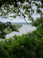
(1): Coulée de la Luce, offering a bird’s-eye view of the Loire.
(2): the village of the Patache boatmen; stroll through its narrow, old-world streets.
Above the (12): the ruins of the Citadel of Champtoceaux
(14): the hamlet of Cul du Moulin, home to a 12th-century hanging mill.

Reviews and comments

4.7 / 5
Based on 2 reviews

Reliability of the description
4.5 / 5
Ease of following the route
4.5 / 5
Route interest
5 / 5
daniel hautbois
daniel hautbois

Overall rating : 4.7 / 5

Date of your route : Nov 12, 2025
Reliability of the description : ★★★★☆ Good
Ease of following the route : ★★★★★ Very good
Route interest : ★★★★★ Very good
Very busy route : No

Very beautiful hike. I recommend it.

Machine-translated

MARIRAD
MARIRAD

Overall rating : 4.7 / 5

Date of your route : May 03, 2025
Reliability of the description : ★★★★★ Very good
Ease of following the route : ★★★★☆ Good
Route interest : ★★★★★ Very good
Very busy route : No

A magnificent walk with stunning panoramic views over the Loire and a wonderfully varied landscape (paths through woodland, flower-filled fields, hillsides). The route, which is a little steep in places, does not present any major difficulties but should only be undertaken in dry weather (stream banks, woodland). The signposting is excellent (apart from a right-hand turn near point 4, which you mustn’t miss). I highly recommend this ‘idyllic’ walk.

Machine-translated

Other walks in the area

For more walks, use our search engine .

The GPS track and description are the property of this route's author. Please do not copy them without permission.