Country:
 City:
City:


Quai de l’Orme de Sully car park.
(S/E) Head south with the Seine on your right.
(1) After 1.3 km along the banks of the Seine, you’ll come to a large gate on your left with ‘Private Road’ signs. ‘At the entrance to the passage, on your left, there is an old building, inaugurated on 19 August 1860 and founded by the Public and Private Water Services.’
Continue straight on along the Seine for 2 km.
(2) Take Rue de l’Écluse on your left and continue straight on for about 1.4 km until you reach Avenue de Saint-Germain. Cross the road with care.
Turn left, then immediately right onto Route du Domaine for about 300 metres.
Turn left onto Route de la Plaine for about 100 metres until you reach Avenue de la Princesse, then immediately turn right onto Boulevard du Président Roosevelt for about 300 metres.
(3) After passing Avenue Georges Clémenceau on your left and right, take care, as the start of the path running alongside the Les Petites Rivières stream is on your left, about 30 m away. Take the path on the left and follow the Les Petites Rivières stream for about 1 km, until you reach Allée d’Isly.
(4) Cross the bridge on your left, then take the path running alongside the stream on your right for about 500 metres, until you reach Allée de la Gare.
Cross the bridge on your right, then immediately turn left onto the Promenade d’Outremont. Cross the stream over the rock and continue to your right. Cross the stream again over the rocks and continue to your left. When you reach Avenue de la prise d’eau, turn right and continue for approximately 250 m.
(5) Turn left onto the path called “Promenade Villalueva de la Canada” until you reach another path.
Turn right and cross the large lawn until you reach the footbridge over the RER A railway line. Climb the 27 steps, cross the footbridge and Avenue Galliéni, then continue straight on to Boulevard Carnot. Cross the boulevard and go straight on along Allée des Fêtes to reach the lake at Île des Ibis.
(6) At this point, turn right and walk round the lake; leave the lake via Avenue du Grand Veneur until you reach Rue Alexandre Dumas, which runs alongside the railway line.
Turn right, pass the RER A station “Le Vésinet-Le Pecq”, and continue to Route de Montesson.
Cross the road and take Rue Watteau opposite, continuing until you reach Boulevard de Belgique.
(7) Turn left and continue to the RER footbridge. Climb the 36 steps to reach Rue de Seine. Turn right and continue to Route de Sartrouville.
Turn right, go under the railway line, then turn left immediately after the bus shelter.
Cross the Passage des Laurentides to reach the banks of the Seine. Continue to your left and follow the banks of the Seine to the car park. (S/E)


 Visorando Member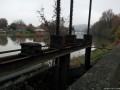

 Average