A variation on the ‘Eight Routes’ walk

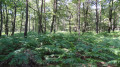
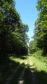
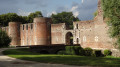
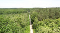
In the heart of the Ingrannes Forest, sometimes following wide, sun-drenched avenues and at other times narrower, shaded paths, this route is ideal for forest lovers wishing to spot large wild animals, listen to the birds, or simply breathe in the fresh air, far from roads and villages.

Details

n°3466144
Creation:
Last update:
Last review:
  • Walking
    Activity: Walking
  • ↔
    Distance: 7.05 mi
  • ◔
    Average duration: 3h 25 
  • ▲
    Difficulty: Moderate

  • ⚐
    Back to start: Yes
  • ↗
    Ascent: + 200 ft
  • ↘
    Descent: - 197 ft

  • ▲
    Highest point: 545 ft
  • ▼
    Lowest point: 404 ft
  • ⚐ Country: France
  • ⚐ City: Ingrannes (45450)
  • ⚑
    Start/End: N 48.02219° / E 2.258563°
  • ❏
    IGN map(s): Ref. 2319OT
  • Hour-by-hour weather

Photos

Description of the walk

The walk starts from the large car park at the Carrefour des Huit Routes. To get there from Ingrannes, with the town hall on your left, continue along the main road, ignoring the various turn-offs. Pass the church on your right, leave the village and continue in the same direction for 5 km, until you reach the car park signposted just before the Carrefour des Huit Routes.

Signposts for the “Promenade des Huit Routes”

(S/E) From the car park, make your way to the Carrefour des Huit Routes, which features a rose-shaped sign indicating the various directions in a rough star-shaped pattern.

(1) Coming from the car park, take the first path on the right, which is closed off by a barrier restricting access to “authorised persons”. A sign there marks the start of the walk: Route de Courcy to Sury, Chemin des Deux Gardes.

(2) After 800 m, turn left at the first junction onto theGR®3B, following the signposts, until you reach the next junction.

No signposting

(3) Leave the signposted path to the left and continue straight on along the Chemin des Deux Gardes (GR®3B). Cross the small tarmac road, then, after a first bend to the right followed by one to the left, cross the old Roman camp (few remains) until you reach a hard-surfaced track.

(4) Turn left, then left again at the next junction onto Route Saint-Charles. Pass the first junction and continue straight ahead along the shaded grassy path until you reach a crossroads.

(5) At the Marchais Plat crossroads, cross the hard-surfaced track and keep heading west, continuing straight ahead along the forest track; cross the small tarmac Forestière de Vitry-aux-Loges road, ignoring the ‘Promenade des Huit Routes’ sign on the left (unless you’re taking a shortcut).

(6) About 400 m after the small forest road, leave the main track and take the Maumaison path on the left, taking care as the entrance to the path is not very visible. Follow the path for over 600 m to rejoin the “Promenade des Huit Routes” route.

Signposted “Promenade des Huit Routes”

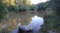
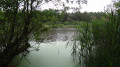
(7) At the crossroads, cross the small forest road. Opposite, the Maumaison path runs alongside a wetland known as the Fontaine de Maumaison, before joining a hard-surfaced track which you follow to the right.

(8) At the first crossroads, leave the hard-surfaced track and take a grassy path to the left, the Route de Doulchamp. This straight path leads to a crossroads. Turn sharply left onto the small road and follow it for a few dozen metres.

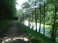
(9) Leave the tarmac and turn right onto the Chemin des Deux Gardes (GR®3B). Follow this lovely path, which crosses a small road and then intersects a gravel track, to rejoin the path you took on the way out.

(2) Turn left onto the gravel track signposted “Arrivée de la Promenade des Huit Routes” to return to the Carrefour des Huit Routes, just before the car park at the start of the walk (S/E)


Waypoints

  1. S/E : mi 0 - alt. 476 ft - Car park at the ‘Carrefour des 8 Routes’ junction
  2. 1 : mi 0.08 - alt. 476 ft - Crossroads of the Eight Roads
  3. 2 : mi 0.51 - alt. 472 ft - On the left: ‘Promenade des 8 Routes’
  4. 3 : mi 0.74 - alt. 495 ft - Straight on along the Chemin des Deux Gardes
  5. 4 : mi 1.61 - alt. 463 ft - Turn left, then left again
  6. 5 : mi 2.72 - alt. 512 ft - Carrefour du Marchais – Opposite
  7. 6 : mi 3.42 - alt. 476 ft - Maumaison path on the left (not very busy)
  8. 7 : mi 3.73 - alt. 459 ft - Opposite the Maumaison footpath
  9. 8 : mi 4.55 - alt. 436 ft - Grassy path on the left (Route des 2 Étangs)
  10. 9 : mi 5.4 - alt. 420 ft - Chemin des Deux Gardes on the right (GR3B)
  11. S/E : mi 7.05 - alt. 476 ft - Car park at the ‘Carrefour des 8 Routes’ junction

Notes

  • Unlike the original route (managed by the department) signposted ‘Promenade des Huit Routes’, which follows a few tarmac sections, the alternative route suggested here is virtually free of tarmac. It follows the magnificentGR®3Cfor nearly 4 km through the Ingrannes Forest (where signposting is virtually non-existent).
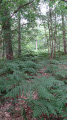
  • It is best to go hiking in April–May before the ferns grow over the Maumaison path.
  • Good walking shoes are recommended, with trousers that cover your shoes. Ticks may be present in the tall grass and ferns, as they are carried by deer.
  • Although the route never leaves the forest, it is exposed to the summer sun along its wide paths.

Worth a visit

Always be cautious and plan ahead when you're outdoors. Visorando and the author of this route cannot be held responsible for any accidents occurring on this route.

The GR® and PR® markings are the intellectual property of the Fédération Française de Randonnée Pédestre.

Reviews and comments

4.2 / 5
Based on 2 reviews

Reliability of the description
4 / 5
Ease of following the route
4.5 / 5
Route interest
4 / 5
Jean-Louis Pinault
Jean-Louis Pinault

Thank you for the information.
Jean-Louis

Machine-translated

Vero45
Vero45

Overall rating : 4 / 5

Date of your route : Jul 14, 2023
Reliability of the description : ★★★★☆ Good
Ease of following the route : ★★★★☆ Good
Route interest : ★★★★☆ Good
Very busy route : No

Part of the forest path is not maintained (tall ferns)

Machine-translated

Jean-Louis Pinault
Jean-Louis Pinault

Thank you for your comments,
Jean-Louis Pinault

Machine-translated

The user account associated with this content has been deleted.

Other walks in the area

For more walks, use our search engine .

The GPS track and description are the property of this route's author. Please do not copy them without permission.