Valmy – the cistern – Argelès-sur-Mer Proposed changes

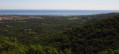
Wide tracks with lovely views of the coast and the Corbières.

Details

180738
Creation:
Last update:
Last review:
  • Mountain biking
    Activity: Mountain biking
  • ↔
    Distance: 11.76 mi
  • ◔
    Duration according to the author: 2 hrs 
  • ▲
    Difficulty: Moderate

  • ⚐
    Back to start: Yes
  • ↗
    Ascent: + 1,585 ft
  • ↘
    Descent: - 1,604 ft

  • ▲
    Highest point: 1,207 ft
  • ▼
    Lowest point: 46 ft
  • ⚐ Country: France
  • ⚐
  • ⚐ City: Argelès-sur-Mer (66700)
  • ⚑
    Start/End: N 42.531968° / E 3.029382°
  • ❏
    IGN map(s): Ref. 2549OT

  • ◶
    Type of surface:
  •  
     
     
     10% Road  84% Byway  6% Path
  • ⇧
    Bike carrying: Not specified
  • ▲
    Difficulty: Moderate
  • Hour-by-hour weather

Photos

Description of the route

Coming from Perpignan via the motorway: take exit 12 towards Valmy, and park at the Valmy car park.

(S/E) Follow the tarmac road you arrived on until you reach the Stop sign, then turn left.

(1) At the Stop sign, turn left towards the Camping des Mimosas.

(2) At the campsite, carry straight on towards Le Mas Blanc.

(3) Turn left onto the DFCI AL 40 track, heading south-east (end of the tarmac). Pass a water tank on your left, then a hunters’ lodge on your right. Carry on straight ahead, ignoring a track on your right, and descend towards the Rec de l’Abat stream. From here, the climb really begins.

(4) After two hairpin bends, ignore the track on the left and, further on, the access path to the Mas d’en Reda. Carry on to the next junction.

(5) Pass the access to Mas Consol and turn left.

(6) At the hairpin bend, head up to the right.

(7) Pass through the section with large animal-proof pipes and turn right. Join the main track leading up to La Massane and the signposted route No. 8.

(8) At the Fork in the road, ignore the access to Mas Consol once again and continue climbing along this firebreak. Carry on climbing straight ahead to the fire brigade’s water reservoir.

(9) Leave the main track and turn right, following No. 8.

(10) Pass the track on the left leading to Mas de l’Ours, take the right-hand Fork in the road at the next junction and carry on straight ahead, leaving Mas Cadena on your right. Join the junction of the path leading to the Chapelle Saint-Laurent.

(11) Continue down the track to the right, heading east, along a path with several hairpin bends, passing the ruins of Mas de Sant-Lorenç (on the right).
Continue along the track, leaving the access path to Mas de Monja on your left, pass two hairpin bends and reach a junction.

(12) Turn left (north-west) onto track DFCI AL28 – marked with MTB sign No. 8. Pass a graffiti-covered water tank on your right and reach a Fork in the road (if you turn right, you’ll reach the start of the route at track DFCI AL 40, 1 km away).

(13) Ignore the track leading down to the right (DFCI AL38). At this point, you’ll cross a technical MTB track. Continue along the main track, ignoring the numerous turn-offs to the left and right.

(14) Pass the next track which climbs up to the left towards Mas d’Amunt and, immediately after, the private track on the right. There’s a lovely view of the Corbières before a good descent.

(15) The track joins a tarmac road. Turn right for a fairly short descent (350m) before the El Rancho campsite.

(16) At the junction, turn right onto the DFCI AL36 track, which takes you back to Argelès-sur-mer.

(17) Turn left onto the tarmac and coast down to Argelès (the small, fairly technical single track on the left joins the Massane route).

(18) Before passing under the four-lane road, turn right and follow the tarmac alongside the four-lane road until you reach the Les Mimosas campsite.

(2) Turn left.

(1) Turn right to reach the Valmy car park (S/E).

Waypoints

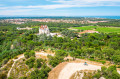
  1. S/E : mi 0 - alt. 197 ft - Valmy car park - Château de Valmy
  2. 1 : mi 0.1 - alt. 167 ft - Turn left at the Stop sign
  3. 2 : mi 0.2 - alt. 171 ft - Go straight on
  4. 3 : mi 0.36 - alt. 233 ft - Turn left onto the DFCI 325
  5. 4 : mi 0.96 - alt. 404 ft - Carry on straight ahead
  6. 5 : mi 1.58 - alt. 696 ft - At the junction, turn left uphill
  7. 6 : mi 1.73 - alt. 738 ft - Sharp right-hand bend on the climb
  8. 7 : mi 2.02 - alt. 892 ft - Main track to La Massane, turn right
  9. 8 : mi 2.19 - alt. 978 ft - Pass Mas Consol on your left and carry straight on
  10. 9 : mi 2.72 - alt. 1,188 ft - Fire brigade water tank, turn right
  11. 10 : mi 3.45 - alt. 1,125 ft - Leave Mas de l’Ours on your left and carry straight on
  12. 11 : mi 4.13 - alt. 994 ft - Continue down the slope to the right
  13. 12 : mi 5.3 - alt. 538 ft - At the junction, turn left following mountain bike signpost no. 8
  14. 13 : mi 5.63 - alt. 554 ft - Ignore DFCI AL38, turn left
  15. 14 : mi 7.44 - alt. 735 ft - Leave the track on your left and carry straight on
  16. 15 : mi 8.39 - alt. 364 ft - Tarmac road, turn right
  17. 16 : mi 8.52 - alt. 272 ft - At the junction, turn right onto DFCI AL36
  18. 17 : mi 9.42 - alt. 266 ft - At the start of the tarmac road, turn left
  19. 18 : mi 10.53 - alt. 52 ft - Turn right before the four-lane road
  20. S/E : mi 11.76 - alt. 197 ft - Valmy car park

Notes

No water along the route.

Worth a visit

Reviews and comments

4.7 / 5
Based on 3 reviews

Reliability of the description
4.7 / 5
Ease of following the route
5 / 5
Route interest
4.3 / 5
polo66
polo66

Good for electric vehicles...

Machine-translated

Papadeltalima
Papadeltalima

Overall rating : 4.7 / 5

Date of your route : Aug 12, 2022
Reliability of the description : ★★★★★ Very good
Ease of following the route : ★★★★★ Very good
Route interest : ★★★★☆ Good
Very busy route : Yes

It’s fine, but a bit stiff for me

Machine-translated

leptitarico
leptitarico

Overall rating : 4.3 / 5

Date of your route : Jul 15, 2018
Reliability of the description : ★★★★☆ Good
Ease of following the route : ★★★★★ Very good
Route interest : ★★★★☆ Good

A walk along wide, well-maintained paths. Stunning views of Argelès and the sea.
The climb is particularly challenging over the first 6 kilometres. The descents are all the more enjoyable afterwards!
Well worth doing, time and time again!

Machine-translated

le dd
le dd

Overall rating : 5 / 5

Date of your route : May 08, 2018
Reliability of the description : ★★★★★ Very good
Ease of following the route : ★★★★★ Very good
Route interest : ★★★★★ Very good

A lovely mountain bike route, with magnificent views along much of the route. The climb up to point 8 is challenging.
A superb route

Machine-translated

Bernard59213
Bernard59213

Good evening.

We’re going to try out these walks at the end of May.

Thank you.

Machine-translated

For more walks, use our search engine .

The GPS track and description are the property of this route's author. Please do not copy them without permission.