Country:

 City:


Travel to Saint-Genis-les-Ollières (a town west of Lyon) via Tassin-la-Demi-Lune. Park in the cemetery car park on Rue des Mourrons.
(S/E) Leave the car park by turning right onto Rue des Mourrons. Continue to the dead end and follow a downhill path with steps to reach the road (Rue Louis Pradel). Follow the pavement to the left for about sixty metres.
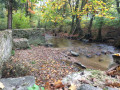
(1) Cross the road carefully: there is a bend and limited visibility. Turn into Impasse des Aiguas de Ribes, then follow the nature trail to the left which runs alongside the Ribes stream. Further on, the path turns left between two hedges and climbs, running alongside a meadow on your right.
(2) Halfway up the slope, just before the first houses, turn right onto a small track lined with hedges which runs alongside and crosses meadows that may be occupied by a herd of cows. You’ll come out onto a road (Rue Georges Mayser).
(3) Continue to the right, following this road for about sixty metres, then cross it carefully and turn left onto the path that forms part of the GR®169: marked with red and white signs. When you reach the “Ruisseau de Ménigand” marker, take the path on the right towards Le Chapoly, cross the stream and, when you reach the road, head uphill to the left.
(4) Once you reach the flat stretch, take the Chemin du Bois Ponard on the right, cross a road and continue straight ahead, passing the “Méginand” signpost. Carry on along the small road, which becomes a track after the last houses and passes through woodland. Ignore all the paths on the right and follow the information signposts for the “Jeu de regards sur Méginand” trail.
(5) At the “Ribes” signpost, head left towards Clape-Loup, following the edge of the woods. At the “Clape-Loup” signpost, turn left towards Saint-Genis-les-Ollières, come out onto a small road and follow it for about a hundred metres.
(6) At the model aeroplane field, turn left onto the track that runs alongside cultivated fields, crosses the Méginand Stream and then climbs up to a road (Rue des Monts d’Or), which you should follow until you reach the “Monts d’Or” signpost.
(7) Carry on straight ahead, staying on Rue des Monts d’Or and heading towards La Vuldy. You’ll come to a junction with traffic lights.
(8) Turn right onto Avenue Marcel Mériaux, then left onto Rue Louis Gayet. Stay on this street until you reach the“Chemin de la Rize” signpost.
(9) Take the steps on the right and head towards the Ruisseau du Ratier: signpost “La Ponterle”.
(10) Take the GR®169 on the left, following the sign for “Jeu de regards – Ruisseau du Ratier”. Go through a tunnel and continue to the “Ruisseau du Ratier” marker.
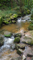
(11) Ignore the path leading uphill to the left and continue along the stream, following the path that climbs above the gorges.
(12) Halfway up the slope, leave this path and take the one on the right which descends to join a road (Allée du Taragnon). At the next junction, head up to the left onto Rue de la Vallée.
(13) Once on the level stretch, take Rue des Mourrons on the right and return to the cemetery car park (S/E).
 Visorando Member

 Moderate