Country:
 City:


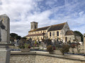
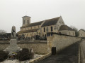
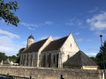
Park in the car park at Saint-Martin Church, Rue de Verdrie in Rouvres.
(S/E) Facing the church, head right, walking alongside the building, then walk up Rue de Verdrie to the junction, then turn right onto Rue des Canadiens (D91) towards the river and the bridge. Cross the Laizon, go across Rue du Moulin and carry on to Route d’Olendon (D91). Carefully cross Rue des Canadiens (D91) opposite the town hall (former school), turn left onto Chemin de Saint-Pierre and carry on for about 350 m until you reach the first junction.
(1) Continue straight ahead across the plain for about 2 km until you reach the fourth crossroads, right in the middle of the plain.
(2) Turn left onto Chemin de Fossard (formerly Chemin “de Jort à Caen”) then, 250 metres further on and just before a hedge, turn left again onto Chemin du Bout à Capron. Follow this track; note the long stone wall on the right, negotiate the right-hand bend, then head down towards the wall. Walk alongside the wall; note the beautiful building opposite at the bend, negotiate the left-hand bend and continue for just over 200 metres.
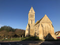
(3) After the house marked number 1 on the road (on the left), at the corner of the field on the right and before a stone wall, turn onto the small path on the right. Pass between the hedge (on the right) and the wall (on the left), cross the Laizon via the footbridge, then head up towards the church. Pass to the left of the church and the cemetery, go downhill to the next junction, then, at L’Escargotière, turn left. Cross the Laizon and carry on to the next crossroads.
(4) Turn right onto Chemin de la Croix Nicolas, walk for just under 100 metres, then, at the Fork in the road, continue to the right of the farm along Chemin du Bout au Roi. After just over 400 metres, negotiate the right-hand bend, cross the Laizon and follow it on your left until you reach the wash house. Turn right and head up Chemin de la Fosse Bodel until you reach the D91. Turn left and follow Rue Major Édouard Grieg Styffe along the left-hand pavement until you reach the bus shelter and the tree-lined path on the left at the corner of the football pitch.
(5) Turn left into Allée du Val Hébert, walk alongside the football pitch and then, at the gate, turn right into Rue Berthe. At the end of this street, turn left into Rue du Bout du Haut, then, about fifty metres further on, turn onto Chemin du Laizon. Follow this path for about 300 metres until you reach the Bastide du Laizon, turn left onto Chemin de la Cour de Maizières and cross the Laizon again.
(6) Before you reach the farm buildings, turn left onto Chemin du Moulin Blanchard, pass between the old mill and its outbuildings, then follow the old, dry branch of the River Laizon until you reach Route de Sassy. Turn right and follow this road for just over 300 metres to reach the crossroads near the Cour de Maizières farm.
(1) Turn right, follow Chemin de Saint-Pierre for about 350 m and you’ll reach the town hall. Cross Rue des Canadiens (D91) with care, turn right and, using the left-hand pavement, head down towards the river and the bridge. Cross Rue du Moulin, cross the Laizon and continue on to Rue de Verdrie. Turn left onto this street, then head for the church car park and the parking area (S/E).

 Visorando Member


 Association / Club / Walk leader
 Moderate