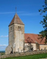
Park in the car park at the Pont Supérieur de Pierre-Perthuis.
(S) Follow the road towards Précy-le-Moult. Continue to the Roche Percée crossroads.
(1) Turn left to head towards La Roche Percée (natural arch, viewpoint).
(2) Return via the same route to the previous crossroads.
(1) Turn left back onto the road and head for the village of Précy-le-Moult.
(3) Turn left onto thePR®® trail. Follow it. Cross the D53. Head towards the River Cure and follow it to the Saint-Père campsite (canoe launch). Join the D36, turn left onto it and continue to the bridge.
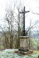
(4) Cross the Cure via the bridge, then turn into thefirst street on the right, Rue du Colombier. Come out onto the Vézelay road near a wayside cross; continue straight ahead to reach the Fontaine Sainte-Madeleine.
(5) Take the path on the left uphill. Cross the Vézelay–Asquins road. Continue along the steep path. Turn into thefirst street on the left, Chemin de la Corderie. Carry on to reach the Porte de Vézelay car park (E).
4 : mi 3.57 - alt. 486 ft - Bridge over the - Cure (la)
5 : mi 4.17 - alt. 535 ft - Sainte Madeleine Fountain
E : mi 4.91 - alt. 830 ft - Finish at the Porte de Vézelay car park
Notes
Please note: access to the start is by road or on foot only (not served by public transport); as the route is linear, if you are travelling by car, you will need to arrange for a vehicle at each end.
Restaurant in Pierre Perthuis. All shops, services and the Tourist Office in Vézelay. Steep slope at the end of the route. Campsite in Saint-Père-sous-Vézelay. Hotels, lodges and a youth hostel in Vézelay. SNCF railway station in Sermizelles.
This route passes through a protected area, which may be subject to special regulations:
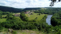
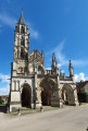
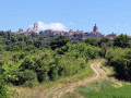
(S) Bridge over the Cure. Stunning view of the river below and the medieval bridge; you can walk down to it. The Cure Valley and the two stone bridges at Perthuis (river fishing). (4) Canoeing and kayaking on the Cure. Excavations at Les Fontaines Salées. (4) In Saint-Père-sous-Vézelay: museum, a beautiful Gothic church, and a remarkable garden. (E) In Vézelay: the Basilica (UNESCO World Heritage Site), pilgrimages, concerts. Terrace with a view, old town, Romain Rolland’s house, the Zervos Foundation. 10 km away: the Arcy Caves
Reviews and comments
5 / 5
Based on 1 review
Reliability of the description 5 / 5
Ease of following the route 5 / 5
Route interest 5 / 5
mamie.jac21
Overall rating :
5 / 5
Date of your route : May 12, 2024 Reliability of the description : ★★★★★ Very good Ease of following the route : ★★★★★ Very good Route interest : ★★★★★ Very good Very busy route : No
To open this route on your smartphone, you must have the Visorando app installed. If not, got to the Apple Store (iPhone) or Google Play Store (Android) to download the app.



 Country:

 City:



 Visorando Member
 Easy
 Tourist office