Country:
 City:
City:


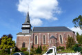
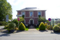
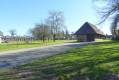
(S/E) Parking and start point: the car park opposite the town hall, Place du Village. Leave the car park opposite the town hall, turn right towards the church and continue to the first stop sign.
(1) Turn left onto Rue du Mont Blanc. Ignore Rue du Four à Chaud on your left and head down the dead-end road. At the end, take the path leading into the woods and follow it straight on for about 1.4 metres. When you reach the post with the blue markings, ignore the path that bends and climbs to the right. Take the path that leads into the field and joins the Route Départementale 151 a few metres further on.
(2) Cross the road carefully and continue along the path opposite to reach the hamlet known as “Le Pimon”. At the road, turn onto the first road on the left. At the T-junction that follows, turn left again onto the D87, until you reach the stop sign.
(3) Cross the D151 road with care and carry on straight ahead. Follow the road for about 700 m, until you reach the signpost just before a left-hand bend on the straight stretch.
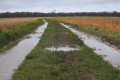
(4) Ignore the road leading off to the left towards the village of Coqueréaumont and head straight on along the path that crosses the fields. Follow this path for approximately 1,860 metres, ignoring a turn-off to the right, and at the two Y-junctions, take the left-hand branch each time.
(5) Cross the D53 and continue along the path opposite.
(6) You’ll come out onto a small road (sign for “Quincampoix” on the right); follow it to the left.
(7) At the next junction, turn left onto the D87 (Rue du Bout d’Amont). Follow this road for about 1.3 km to return to the starting point (S/E).
 Visorando Member
 Easy
Easy