Country:
 City:
City:


Park in the car park at the Leclerc in Allonnes.
(S/E) Before setting off, take a moment to admire the Maison de la Raterie, the Exelsior barge, the Rainbow Bridge and the social housing blocks. Continue along Rue de la Raterie. At the roundabout, turn left onto Route des Fondus. At the junction where the gendarmerie is located, carry on straight ahead along Rue du Breil.
Stop at the junction of Rue Claude Chappe and Boulevard Pasteur to see the 1937 wayside cross. As you continue along Boulevard Pasteur towards Rue des Termes, you’ll pass an old main road. Turn right onto Rue des Coquelicots, then left onto Rue Louis Desprès to reach Place du Mail, where the Étoile Tower and Allonnes Town Hall (the former tram station from 1897 to 1944) are located.
(1) During the most recent redevelopment of the Mail, traces of ancient times (a Carolingian artefact, a Roman-era pit and possibly a forum) were also discovered there.
To get to the town centre at Place de la Paix (St Martin’s Church and the shops), walk along Rue Pierre Curie.
(2) In the village centre, don’t forget to stop off at number 51 (the first hairdresser’s) and number 61 (the first optician’s) on Rue Pierre Curie, as well as in front of the ‘Mancelle’ house at 31 Rue Claude Chappe.
Start heading down Rue d’Argenton, then take Ruelle du Vieux-Bourg and Boulevard Pasteur; turn left onto Rue Hélène Boucher, then take Rue St Exupéry, Rue des Tonneliers, Rue Savetier and Rue Auguste Renoir in that order.
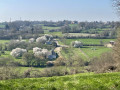
(3) You are now in front of the sign for Perrières, the name of this neighbourhood. Walk up Allée Verte to the residential area overlooking it, on the site of the former Château des Perrières. As you pass, don’t forget to take a good look at the field on your left, where a Gallo-Roman temple lies buried. In the distance, you’ll spot a house. This is the Perrières farm. Return to the ‘Perrières’ sign by taking Rue Pablo Picasso.
(3) Continue your walk along Rue des Boisseliers and then Rue des Tisserands, which form a circular route, and cross the Plaine des Sports (Ferme du Marin, then Collège Le Marin / swimming pool) via Rue de la Dentellière.
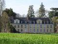
(4) Take the footbridge over the Route de Spay (CD51) (Château de la Foresterie, known as Château Brûlé, at the end of the private road) and continue along Boulevard d’Anjou towards Collège Kennedy. Walk alongside it, turning right onto the path leading to the water towers. Carry on by turning left onto the other path at the crossroads towards the Tour aux Fées (Gallo-Roman temple).
(5) You are now in front of the Tour aux Fées (Gallo-Roman temple). Leave the Marshain woods via Rue Charles Gounod. Immediately, at the circular section, head towards the CAPRA, formerly known as Foyer le Petit Cloteau. Carry on straight ahead at the first junction, then turn left at the next junction. With a view over the River Sarthe and the Boulevard Nature, head downhill towards the Leisure Centre and the Chaoué mill, following a wall. Make your way to the Chaoué footbridge.
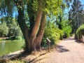
(6) Walk alongside the River Sarthe, turning left to take a short detour to the Raterie lock.
(7) Return to the footbridge via the same route.
(6) Turn right onto Rue du Moulin de Chaoué. At the junction, pass Rue Léo Delibes on your right and continue straight on along Rue Charles Gounod. When you reach the steps leading up to the Chaoué Theatre, go past them and head for No. 10 Rue Charles Gounod.
This used to be Building G (social housing); it is now the Yvon Luby Intercultural Community Centre.
(8) Carry on straight ahead along Rue Georges Bizet as far as the post office, then turn right onto Rue Léo Delibes.
(9) Just before the roundabout on Avenue Charles de Gaulle (formerly Avenue du Maine), turn right onto Rue Claude Debussy; this is the car park for the Stade Claude Voisin. Return to Avenue Charles de Gaulle via Allée André Legendre. Turn right and continue straight on until you reach the Leclerc supermarket, ending up back at the starting car park (S/E).

 Visorando Member
 Tourism professional
 Moderate