Around Boulevard Nature and the Château de la Forêterie

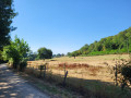
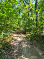
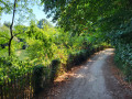
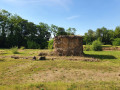
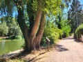
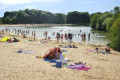
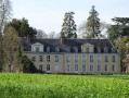
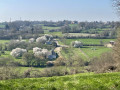
Along this walking route, discover the Mars Mullo sanctuary and the Château de la Forêterie thanks to the information panels installed along the way. You’ll wind your way through the fields whilst following the River Sarthe, enjoying beautiful views of the countryside and the water. Why not take the opportunity to stop for a break in the heart of the Chaoué woods, which feature picnic tables, benches and a fitness trail?

Details

35028372
Creation:
Last update:
Last review:
  • Walking
    Activity: Walking
  • ↔
    Distance: 6.59 mi
  • ◔
    Average duration: 3h 15 
  • ▲
    Difficulty: Moderate

  • ⚐
    Back to start: Yes
  • ↗
    Ascent: + 253 ft
  • ↘
    Descent: - 230 ft

  • ▲
    Highest point: 308 ft
  • ▼
    Lowest point: 125 ft

Photos

Description of the walk

(S/E) Walk up Rue Charles Gounod for 100 metres. Turn right onto Rue des Romarins, then enter the park on the left. You’ll arrive in the Chaoué Forest and pass by the Mars Mullo archaeological site. Head down the path on the right towards the Espace Chaoué Port Belle Eau building. Enter the park with the playground.

(1) Take the path running alongside the River Sarthe. Note the Chaoué Mill and then the lock. Join Boulevard Nature. 1 km further on, a viewing point for the Château de la Forêterie has been set up along the river. Continue for 1 km.

(2) Take the path on the right.

(3) At the end of the path, turn left, then left again. The route is marked in blue.

(4) Cross the bridge over the River Sarthe.

(5) Walk round the La Gémerie lake on the left-hand side.

(5) When you rejoin the path, turn left and cross the bridge over the River Sarthe.

(4) Then keep to the left to walk alongside the River Sarthe again. Turn left, then right.

(3) Carry on straight ahead, passing through the barrier. Follow the orange markings along the Chemin des Basses Métairies for 1 km.

(6) Turn right onto Boulevard d’Anjou and follow it for 400 m. Take the path on the right just before the IME L’Hardangère. Continue to the right through the woods until you reach the water towers.

(7) Head downhill and leave the woods via thefirst path on the left. Cross the park and turn right onto Rue du Bois Marshain. Return to the starting point by first turning right then left along Rue des Acacias (S/E).


Waypoints

  1. S/E : mi 0 - alt. 187 ft - Town Hall
  2. 1 : mi 0.58 - alt. 144 ft - Espace Chaoué Port Belle Eau
  3. 2 : mi 1.87 - alt. 131 ft - Path
  4. 3 : mi 2.1 - alt. 184 ft - Bois de Chaoué junction
  5. 4 : mi 2.89 - alt. 141 ft - Bridge towards La Gémerie - Sarthe (rivière)
  6. 5 : mi 3.03 - alt. 135 ft - Crossroads - Lac de la Gèmerie
  7. 6 : mi 5.68 - alt. 210 ft - Boulevard d’Anjou
  8. 7 : mi 6.15 - alt. 308 ft - Water towers
  9. S/E : mi 6.59 - alt. 187 ft - Town Hall

Notes

Start at the town hall.

Public transport: Le Mans T3 (Tempo) line, Mairie Allonnes stop.

Marked with yellow signs, then blue signs, then orange signs on the return journey.
The route follows the Vélobuissonnière cycle route (V44) as far as the bridge before La Gémerie.

Worth a visit

Places to see along the way:

  • Mars Mullo Sanctuary.
  • Allotment gardens.
  • Chaoué mill, lock and theatre.
  • Lac de la Gèmerie leisure centre.
  • Chaoué Wood.

Places to visit in the town:

  • Saint-Martin Church

Other walks in the area

For more walks, use our search engine .

The GPS track and description are the property of this route's author. Please do not copy them without permission.