


 Country:
 City:
City:


To start the route, return to Plaza de la Diputación and begin at the memorial stone.
(S) With your back to the memorial stone, head north up Plaza de la Diputación, then turn left onto the gently sloping road to reach a Stop sign. Cross the LU-633 with care, then first turn right then left to follow the signs for San Xil. Begin the climb, pass a farm shed and continue left to reach a fork in the road.
(1) Continue straight on (north) along this small road through woodland and meadows to reach the small village of A Balsa, near the Albergue Ecológico El Beso.
(2) Walk through the village, past an art gallery, and continue north-west along a narrow track that soon becomes stony as it crosses the forest. Carry on until you reach the Os Lameiros Fountain.
(3) Continue westwards until you reach a junction. Turn left and carry on until you reach the junction at the entrance to the village of San Xil.
(4) Carry on straight ahead (south-west), without entering the village. Continue uphill, then after a wide bend heading north, you will reach the Riocabo Stream.
(5) Continue along the tarmac road heading west. At the fork, stay on the left-hand track and carry on to the open plateau, the highest point of the stage. Continue to the fork.
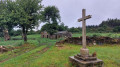
(6) Leave the tarmac road and turn right onto the stony path, then begin a gradual descent that takes you through woodland to the church and cemetery at Montán.
(7) Turn right onto the LU-P-5602, then at the sign indicating you are entering the village of Montán, veer right onto the small, slightly uphill path. Cross through and leave the village at the Terra de Luz pilgrims’ centre: a rest area with a vending machine for drinks and snacks.
(8) Continue north-west until you reach a junction.
(9) Carry on straight ahead to the hamlet of Fontearcuda. At the fork, turn right to pass by a large blue and white sphere atop a concrete post. Continue to the junction with the LU-P-5602.
(10) Turn right and continue to a marker at the start of a track on the left.
(11) At a hairpin bend, turn left onto the descending track. At the junction, turn right, cross the Rio de Navares de Barxelas and continue until you rejoin the LU-P-5602.
(12) Turn left, pass a junction and continue to the entrance to the village of Furela.
(13) Head left along the reconstituted stone road to cross the village, pass the Chapel of San Roque, then turn right at the fork to rejoin the LU-P-5602.
(14) Cross this road and continue left onto the footpath running parallel to the road. Carry on until you reach the fork.
(15) Turn right onto the small road, moving away from the LU-P-5602, to reach the small village of Pintin.
(16) Walk through the village heading north-west, then leave it quickly to continue amongst cows and cucurbits. Following the signposts, continue to the fork, just before the Stop sign at the junction with the LU-P-5602.
(17) Turn right onto a small path. Cross the LU-P-5602: stone markings on the road. Continue along the path opposite which leads into the woods and proceed to a Stop sign at the roundabout in front of the Albergue de Calvor.
(18) Continue westwards, keeping the LU-P-5602 on your right, and carry on until you have to cross it via a path made of reconstituted stone.
(19) Continue straight ahead on the tarmac road, following the signs for Aquida. You will arrive in this small village at the Chapelle Pequeña.
(20) Cross the village and leave it behind to find yourself a little further on the LU-P-5602.
(21) Continue westwards along the footpath that runs alongside the road. Pass the Albergue Paloma y Leña before reaching a farm by the roadside.
(22) Continue along the path, which runs slightly above the road and alternates between shaded and open areas. Carry on until you reach a pine forest, then continue to a junction where signs point right towards Ferreiros.
(23) Keep heading west and walk to the Vila de Sarria Campsite. Please note: if you need to recharge your batteries, do some laundry or anything else, you can stop here, bearing in mind that you will have covered only 16 km and there are no other campsites on this stage.
(24) Continue along the outskirts of the town to reach a picnic area located by the sign marking the entrance to Sarria.
(25) Enter the town, then at the junction, go to the right of the restaurant to continue along the small street. Carry on to the Stop sign, at the junction with Rúa Calvo Sotelo.
(26) Cross this road carefully and continue straight ahead along Rúa Mestre Saavedra: refreshments available. Following the yellow arrows on the ground, continue to the roundabout at Plaza de Galicia.
(27) Continue straight ahead along Rúa Peregrino, stay on this street and cross the bridge over the River Sarria, before reaching a junction: to the right of the junction stands a large bronze sculpture.
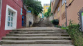
(28) Continue along the street until you reach the Stop sign at the junction with Rúa Benigno Quiroga. Walk a few metres further and turn left into the pedestrian street, then climb the steps of the Escaleira da Fonte, a beautiful 19th-century staircase, before reaching Rúa Maior.
(29) Turn left then right onto the gently sloping street, passing in front of Santa Mariña Church. Continue straight on, passing between the courthouse and Casa Don Alvaro, then carry on along the one-way street until you reach San Salvador Church.
(30) Turn right onto Rúa do Castelo, walk past the Xulgado prison and continue to the Church, the Convent of La Merced and the cemetery. Turn left just before the cemetery to head towards Baradelo, along Rúa Corga do Asno, then continue to the Stop sign. Turn right and continue to the small Áspera bridge spanning the Rio Celeiro.
(31) Cross this bridge and continue along this tree-lined path which runs alongside a farm track on your right, before turning away from it with a left/right turn. Continue south-west across vast maize fields, with the viaduct supporting the CG-2.2 in your sights. Pass under this viaduct then cross the railway line.
(32) Turn left to follow the track to the left, then take a 90° bend (west) and continue right into the woods. Stay on this path which leads you, after the forest, across fields and meadows to a farm.
(33) Turn right at a 90° bend and continue north-west, then south-west, to the village of Vilei. You will arrive at the car park of the Albergue Casa Barbadelo.
(34) Turn left and walk along the meadow to cross the village. At the fork, veer right twice to follow the direction of Casa de Carmen, walking alongside a dry stone wall with a hundred-year-old tree embedded in it. Continue straight on (south-west) alongside a meadow on your right, then at the fork, keep heading towards Casa de Carmen. Carry on to the next fork.
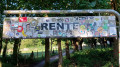
(35) Turn right, still heading towards Casa de Carmen. At the junction, leave the path for Casa de Carmen and continue straight ahead (north-west). Carry on until you reach the marker indicating the start of a path on the left. There is a sign pointing to Rente, covered in stickers.
(36) Turn left, following the direction of Casa Nova de Rente. Cross the small hamlet of Rente, staying on the main road, then leave it behind and continue north-west. Carry on through fields, meadows and woods until you reach the LU-P-5709 to the left of Bar da Serra.
(37) First turn right then left to continue along the small road bordered on the left by a low wall made of large stones. At the fork, turn right onto the cobbled path and continue to the Fontaine Del peregrino.
(38) Turn left (south-west) and continue to the entrance of the Albergue Molino de Marzan.
(39) Turn right (north) and continue to the junction with the LU-633.
(40) Cross carefully and follow the signs for Peruscallo/Domiz. Pass to the right of the hamlet of Leiman before reaching a fork.
(41) Stay on the road, which follows a wide bend to the left. Pass the Peruscallo bakery and continue to the village of Peruscallo (E) to find a place to camp (food available but no accommodation here).
 Visorando Member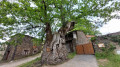
 Association / Club / Walk leader
 Moderate
